


KANSAS CITY, Mo. — The Kansas City region is experiencing yet another rainfall event this month, leading to flash flooding in parts of the area.
LINK | KSHB 41 Weather Radar
LINK | KSHB 41 Weather Alerts
LINK | KSHB 41 Weather
LINK | KSHB 41 Traffic conditions
Scroll down for the latest updates.
—
UPDATE, 7:20 A.M.| KSHB 41's Marlon Martinez says KC police still have I-435 & 23rd Street blocked due to high water.
UPDATE, 6:42 a.m. | KSHB's Claire Bradshaw says multiple vehicles stranded at N. Chouteau and Belmont
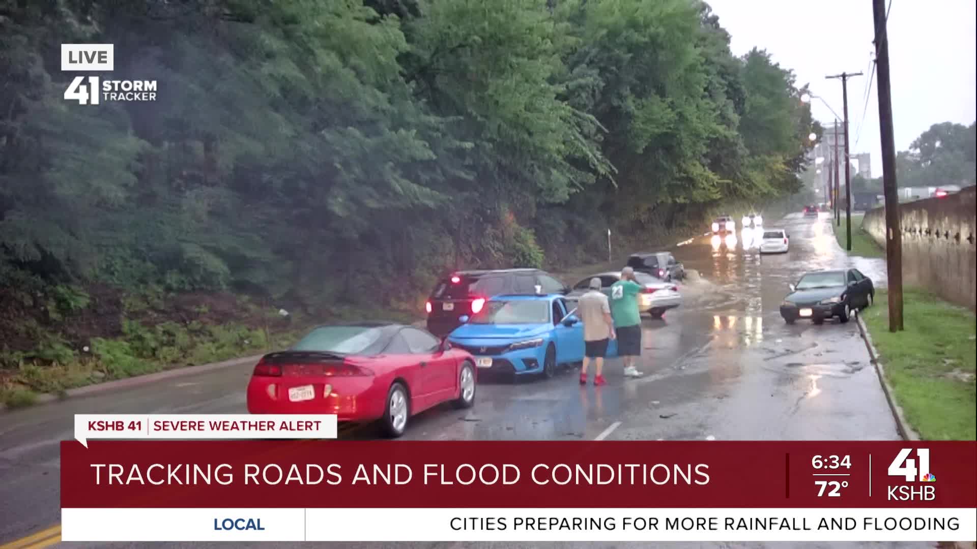
UPDATE, 6:35 a.m. | The Kansas City Fire Department reports 10 water rescues since 2:46 a.m. No reports of injuries or transports due to the rescues.
UPDATE, 6:22 a.m. |Belton police report high water and flooding in multiple locations.
UPDATE: 5:45.A.M. | KSHB's Claire Bradshaw says several vehicles towed from high water at I-435 & 23rd Street.
UPDATE, 4:45 a.m. | KCFD says they've responded to 8 water rescues early this morning since 2:46 a.m. Each of the rescues involved vehicles stuck in high water at various locations throughout the city. Each vehicle occupant was able to get out safely and no injuries were reported.
UPDATE, 2:07 a.m. | The National Weather Service says Kansas City tied its rainfall record for July 24, matching the record set in 1900.
***Record***...Kansas City tied it's rainfall record for the date yesterday (7/24) at 2.35" matching the record set in 1900.#RecordBreakingKC
— NWS Kansas City (@NWSKansasCity) July 25, 2025
UPDATE, 10:15 p.m. | Here's the latest weather forecast update from KSHB 41's Wes Peery.
UPDATE, 9:30 p.m. | While rainfall has been spotty tonight in Kansas City, it's been enough to cause problems in Lenexa.
Due to high water, Santa Fe Trail Drive is closed between Lackman Rd. and 107th St.
— City of Lenexa (@cityoflenexa) July 25, 2025
Closure is from flooding caused by rain and a failed stormwater pipe beneath the railroad tracks. The City is in communication with BNSF Railway and will work with them on necessary repairs. pic.twitter.com/JLz4S1C7T1
UPDATE, 8:30 p.m. | KSHB 41's Wes Peery has been monitoring tonight's storms, which have dropped nearly five inches of rain so far tonight.
8:40pm--Johnson County MO has received a lot of rain the last couple of hours...nearly 5" in some spots!
— Wes Peery (@WesWeather) July 25, 2025
Flash Flood Warning for Bates, Cass, Henry, Johnson, Pettis [MO]#mowx #kswx #kcwx pic.twitter.com/qS5KeNIMOY
—
If KSHB 41 News needs to break into programming with weather updates, you'll be able to watch our coverage in the video player below:
