


KANSAS CITY, Mo. — Parts of the Kansas City area and points to the east are included in a severe thunderstorm watch through 10 p.m. Wednesday.
RELATED | KSHB 41 weather alerts
RELATED | KSHB 41 interactive radar
RELATED | KSHB 41 Weather
Should KSHB 41 break into regular coverage for important weather information, you can also watch in the video player below.
—
UPDATE, 4:33 p.m. | The National Weather Service has issued a tornado warning until 5:15 p.m. for parts of Cass, Henry and Johnson counties in Missouri.
UPDATE, 4:05 p.m. | A severe thunderstorm warning has been issued until 4:45 p.m. for parts of Cass, Henry and Johnson counties in Missouri, per the National Weather Service.
KSHB 41 Weather's Wes Peery shared an update on storms.
4:05pm WED--Storms have started to develop near a cold front that is moving through.
— Wes Peery (@WesWeather) June 17, 2026
Storms, capable of mainly wind and hail, will continue to develop and push south and east for the next 2-3 hours#mowx #kswx #kcwx pic.twitter.com/0kmNDtoYEE
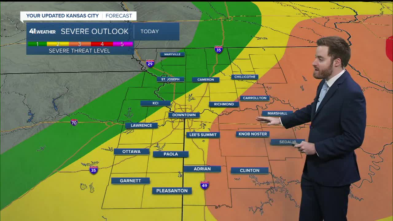
UPDATE, 2:40 p.m. | Here's a look at the watch area form KSHB 41 Weather's Wes Peery:
2:35pm WED-- A severe thunderstorm watch that includes the Kansas City metro is in effect until 10pm
— Wes Peery (@WesWeather) June 17, 2026
Storms will move through between now and 7pm capable of large hail and damaging wind. A tornado or two isn't out of the question.#mowx #kswx #kcwx pic.twitter.com/unPNu8qR41
—
