


KANSAS CITY, Mo. — The greater Kansas City area is included in a tornado watch through 1 a.m. Thursday, March 14, 2024.
The National Weather Service is monitoring conditions that are favorable for the formation of supercell thunderstorms.
LINK | Latest forecast update
LINK | Weather radar
LINK | Cassie Wilson details storm chances in latest weather blog
In addition to the tornado threat, the Kansas City area is also under threat of potentially large and damaging hail.
Follow along for updates.
8:45 p.m. | Earlier Wednesday night, some drivers on Interstate 70 before K-7 took cover under bridges amid the hail.
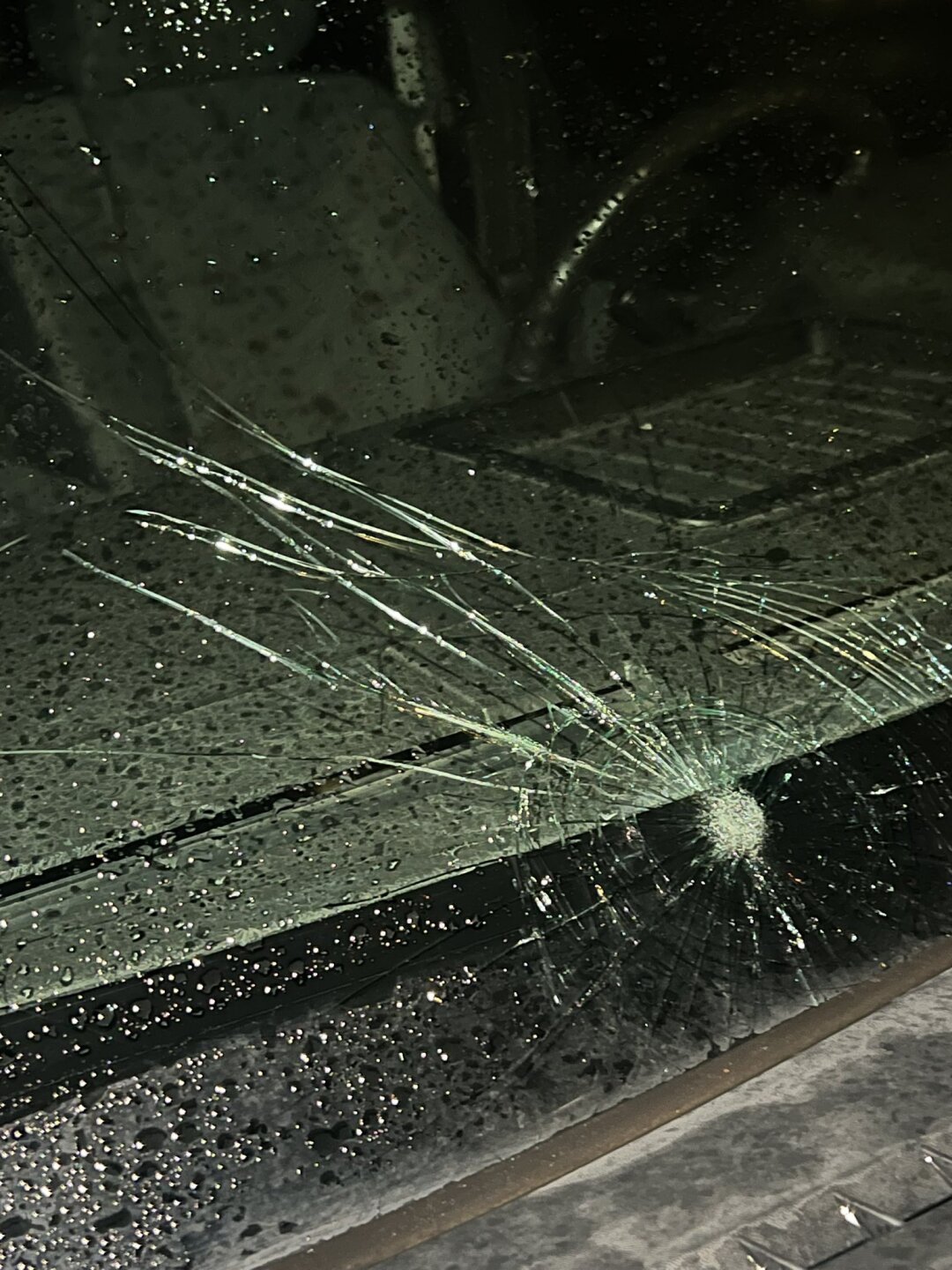
8:44 p.m. | A Shawnee resident reported taking damage to their windshield in western Shawnee.
8:14 p.m. | KSHB 41 Meteorologist Lindsey Anderson captured some large hail in Western Shawnee.
Very large hail in western Shawnee just moments ago! Close to baseball size here. 📸 from @PaytonMJensen. @KSHB41 @MikeNiccoKSHB41 @WesWeather @JeffPennerKSHB @CassieKSHB pic.twitter.com/89utZIWwBs
— Lindsey Anderson (@lnanderson) March 14, 2024
8:13 p.m. | The National Weather Service said baseball-sized hail is possible in the Kansas City area through 8:45.
The damage of the hail could be destructive, the NWS said.
7:58 p.m. | KSHB 41 Meteorologist Jeff Penner captured dime-sized hail near the Country Club Plaza.
Lots of dime sized hail on the Plaza at @kshb41 pic.twitter.com/hDNu8GOkuu
— Jeff Penner (@JeffPennerKSHB) March 14, 2024
—
