

WEATHER HEADLINES
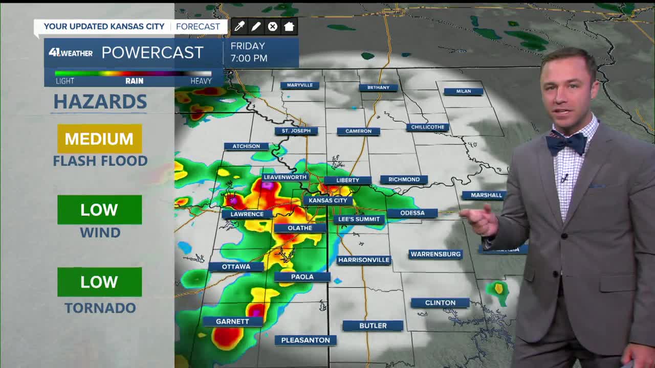
- Showers and storms overnight likely lead to more flash flooding
- Back to hot and humid over the weekend into early next week, heat index near 105 Sunday-Tuesday
- Much cooler end of July to early August
KANSAS CITY'S FORECAST
Tonight: Another round of rain and storms expected into early Saturday. Flooding is likely in low-lying and flood-prone locations in Kansas City and north.
Wind: E 5-10 mph
Low: 73º
Saturday: Scattered showers and thunderstorms possible during the early morning, then again in the afternoon. Some storms could cause flash flooding and damaging wind.
Wind: S-SE 5-15 mph
High: 89º
Heat Index: 100º
Sunday: Very hot and humid under a mostly sunny sky
Wind: S 10-15 mph
Low: 75º
High: 93º
Heat Index: 105º
Get more updates from our weather team:
View our interactive radar
Read our Weather Blog
Check out the current conditions in our area
The KSHB 41 Weather Storm Shield is a life-saving app that acts like an NOAA Emergency Weather Radio on your iPhone or Android phone. You will receive critical alerts via voice and push notification regarding major, potentially life-threatening weather events.
