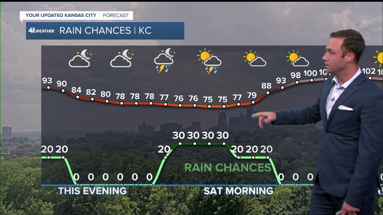


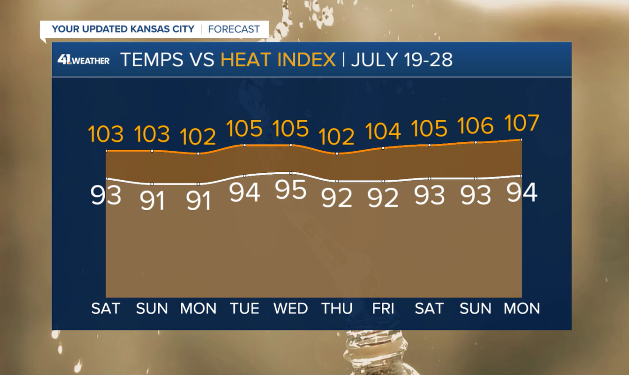
KANSAS CITY, Mo. — Just one day after storms led to flooding and dangerous road conditions across both Kansas and Missouri, an extreme heat warning has been issued for the immediate Kansas City region from noon Saturday through 7 p.m. Wednesday.
Dangerously hot conditions with heat index values up to 105 to 110 degrees are expected. Additionally, overnight lows may reside in the mid to upper 70s at times, reducing the ability to recover from daytime heat.
LINK | Latest forecast update
LINK | Latest watches, warnings
LINK | Interactive Radar
The National Weather Service said heat-related illnesses increase significantly during extreme heat and high humidity events.
NWS recommends drinking plenty of fluids, staying in an air-conditioned room, staying out of the sun, and checking on relatives and neighbors.
If you do go outside, wear lightweight and loose-fitting clothing, and try to limit strenuous activities to early morning or evening.
An extreme heat watch has also been issued for parts of northeast Kansas and north central, northeast, and northwest Missouri from Monday afternoon to Wednesday evening.
—
