

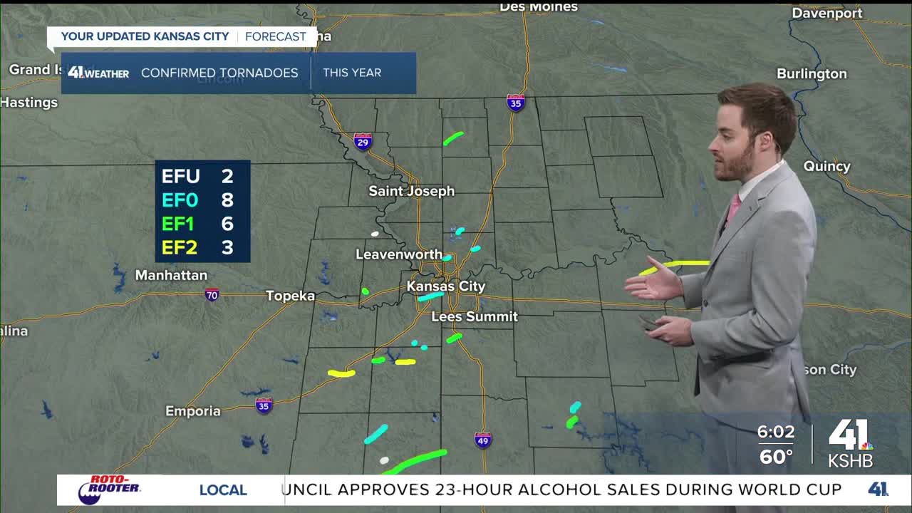



KANSAS CITY, Mo. — The National Weather Service says six tornadoes were confirmed across eastern Kansas and west-central Missouri from Sunday afternoon into early Monday morning, with no injuries or fatalities reported.
The first tornado touched down at 4:20 p.m. Sunday in northwest Miami County, where an EF1 produced estimated peak winds of 93 mph and tracked nearly 2 miles before lifting five minutes later.
A second tornado followed at 4:38 p.m. in northwest Linn County. That EF0 tornado produced estimated winds of 80 mph, traveled 6.81 miles, and caused damage mainly to trees and some outbuildings as it moved northeast toward Parker.

Early Monday morning, a supercell thunderstorm moving across Leavenworth County produced an EF1 tornado. It touched down at 3:31 a.m. south of Tonganoxie, just west of U.S. 24 between Honey Creek Road and north of Hemphill Road. Some trees and an outbuilding sustained damage.

The fourth tornado, an EF0, developed just northeast of Spring Hill in southeast Johnson County at 5:38 a.m. It lasted about one minute, with damage mainly to trees.
Shortly after, at 5:45 a.m., a second Johnson County tornado formed near Bucyrus. That EF1 tornado produced estimated winds of 90 mph and damaged a manufactured home near the Johnson County/Miami County line.
The sixth tornado struck Saline County in Missouri. The EF2 touched down at 6:52 a.m. in Slater and moved through Gilliam, Glasgow and Higbee, ending at 7:28 a.m. Maximum winds reached 115 mph. Residential properties, vehicles, grain bins, hog barns, outbuildings and more were damaged in the storm.
There have been 19 tornadoes in the KSHB 41 viewing area so far this severe weather season.
KSHB 41 meteorologist Wes Peery says this has been one of the most active periods of severe weather in the area since at least 1986.
—
![020626_KSHB_Image_NXA_Web_Standard Cube[88].jpg](https://ewscripps.brightspotcdn.com/dims4/default/0ead409/2147483647/strip/true/crop/300x225+0+13/resize/960x720!/format/webp/quality/90/?url=http%3A%2F%2Fewscripps-brightspot.s3.amazonaws.com%2F8f%2F6c%2Ffad8bd2346c5a4d4ead793017d4a%2F020626-kshb-image-nxa-web-standard-cube88.jpg)