


KANSAS CITY, Mo. — Several rounds of storms targeted the Kansas City area Tuesday night, bringing significant hail, tornado warnings and heavy rain.
LINK | KSHB 41 Weather Radar
LINK | KSHB 41 Traffic
LINK | KSHB 41 Weather forecast
LINK | KSHB 41 Severe Alerts
Should conditions develop, watch the video player below for live breaking news weather coverage.
Check back for storm updates.
—
UPDATE, 11:30 p.m. | Evergy reports 2,954 customers without power. Most of the outages were in the Wichita and Johnson County areas. The Board of Public Utilities and Independence Power and Light reported no outages as of 11:15 p.m. Tuesday.
UPDATE, 11:20 p.m. | KSHB 41 Weather's Wes Peery is offering a night-shift check on the weather:
UPDATE, 10:30 p.m. | Storms have formed a line and are moving repeatedly across the southern half of the Kansas City, prompting flash flooding concerns.
9:30pm--A stormy, flooding mess is developing on the south side of KC.
— Wes Peery (@WesWeather) March 11, 2026
Multiple severe storm warnings are in effect.
The large hail threat has decreased, but we’re still monitoring: Strong winds, tornado potentia', flash flooding
Stay weather aware.#mowx #kswx #kcwx pic.twitter.com/TmizbhmAKn
UPDATE, 8:23 p.m. | The tornado warning for Carroll County has been expired, per the National Weather Service.
UPDATE, 8:17 p.m. | The warning has been expired for Ray County but continues for Carroll County.
UPDATE, 8 p.m. | The National Weather Service has issued a tornado warning for a storm northeast of Richmond. Parts of Carroll and Ray counties are included.
Tornado Warning including Carroll County, MO, Ray County, MO until 8:30 PM CDT pic.twitter.com/mErGo9WpaZ
— NWS Kansas City (@NWSKansasCity) March 11, 2026
UPDATE, 7:35 p.m. | While all tornado warnings have been expired, KSHB 41 meteorologist Wes Peery says the potential for additional severe weather later remains. The Kansas City area remains under a tornado watch until midnight.
UPDATE, 7:25 p.m. | The National Weather Service has canceled the tornado warning for northwestern Ray County, southwestern Caldwell County and north central Jackson County.
The warning remains in effect for southeastern Clay County and west central Ray County.
UPDATE, 7:19 p.m. | A second tornado warning has been issued for areas of Clay, Jackson and Ray counties.
Tornado Warning including Liberty MO, Excelsior Springs MO and Glenaire MO until 7:45 PM CDT pic.twitter.com/WTLW6iHD3q
— NWS Kansas City (@NWSKansasCity) March 11, 2026
UPDATE, 7:15 p.m. | Parts of Ray and Caldwell counties in Missouri are under a tornado warning through 7:45 p.m.
Tornado Warning including Polo MO, Cowgill MO and Elmira MO until 7:45 PM CDT pic.twitter.com/heHxBeMn0h
— NWS Kansas City (@NWSKansasCity) March 11, 2026
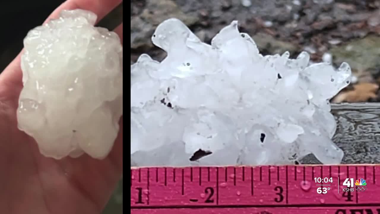
UPDATE, 7:05 p.m. | More images from Parkville showed large, spikey hail.

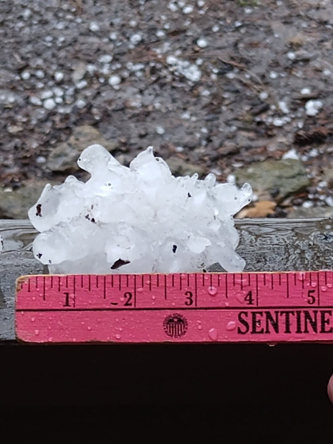

UPDATE, 6:50 p.m. | Several images of varying sizes of hail were sent to the KSHB 41 newsroom as strong thunderstorms moved through the metro.
Lindsay Monroe reported baseball-sized hail near Highway 9 about one mile north of Parkville.

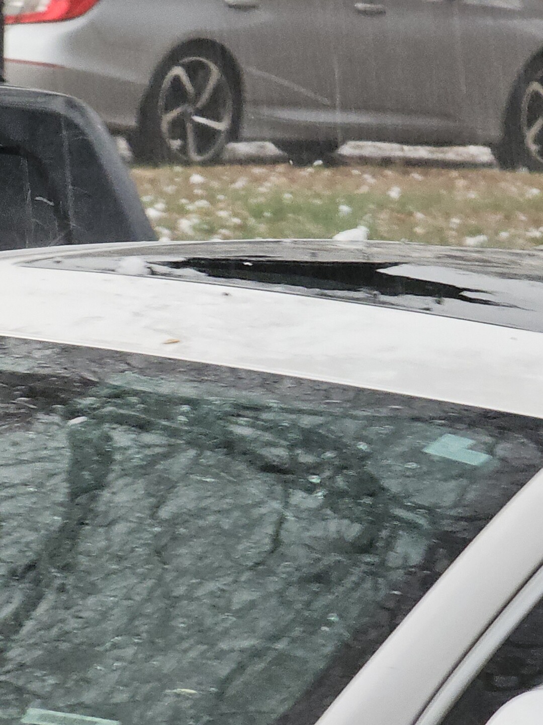
KSHB 41's own Lindsay Shively reported smaller hail north of Gladstone. However, she said the size seemed to be increasing.

One car appeared to suffer hail damage near NW Plaza Drive.
UPDATE, 6:05 p.m. | Here's the latest from KSHB 41's Jeff Penner:
Tornado Watch until midnight as thunderstorms are starting to form in western Johnson County. Since the front is in the KC area it puts the potential axis of severe weather & flash flooding through the city. Things are evolving fast. @KSHB41 pic.twitter.com/3hjwZqpoFw
— Jeff Penner (@JeffPennerKSHB) March 10, 2026
—
