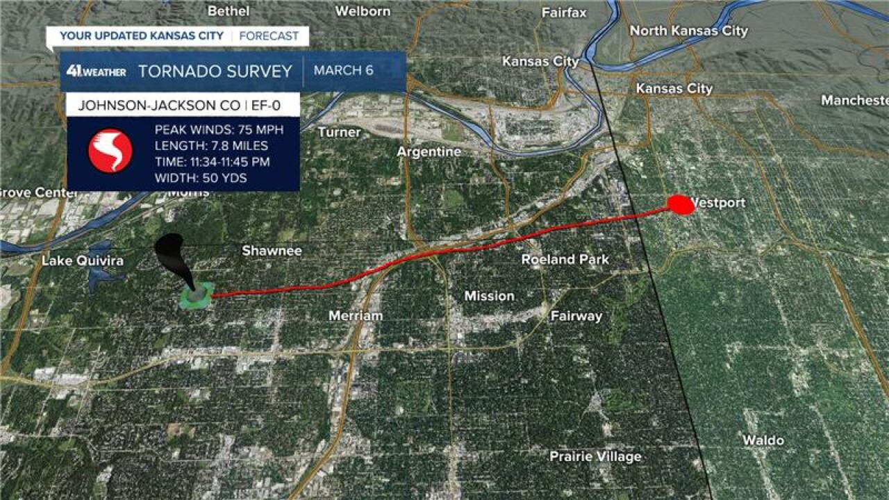

KANSAS CITY, Mo. — The National Weather Service revealed Saturday that an EF-0 tornado developed in northern Shawnee before crossing into Kansas City, Missouri, during a storm system late Friday night.
The NWS said the tornado started shortly after 11:30 p.m. Friday in northern Shawnee.
It then moved east into portions of Merriam and along and near the I-35 corridor into southern Wyandotte County.
The tornado then crossed the state line into KCMO shortly after 11:40 p.m.
About five minutes later, the tornado ended shortly before Westport near Southwest Trafficway.
According to the NWS, the majority of damage was to trees with peak wind speed estimated around 75 MPH.
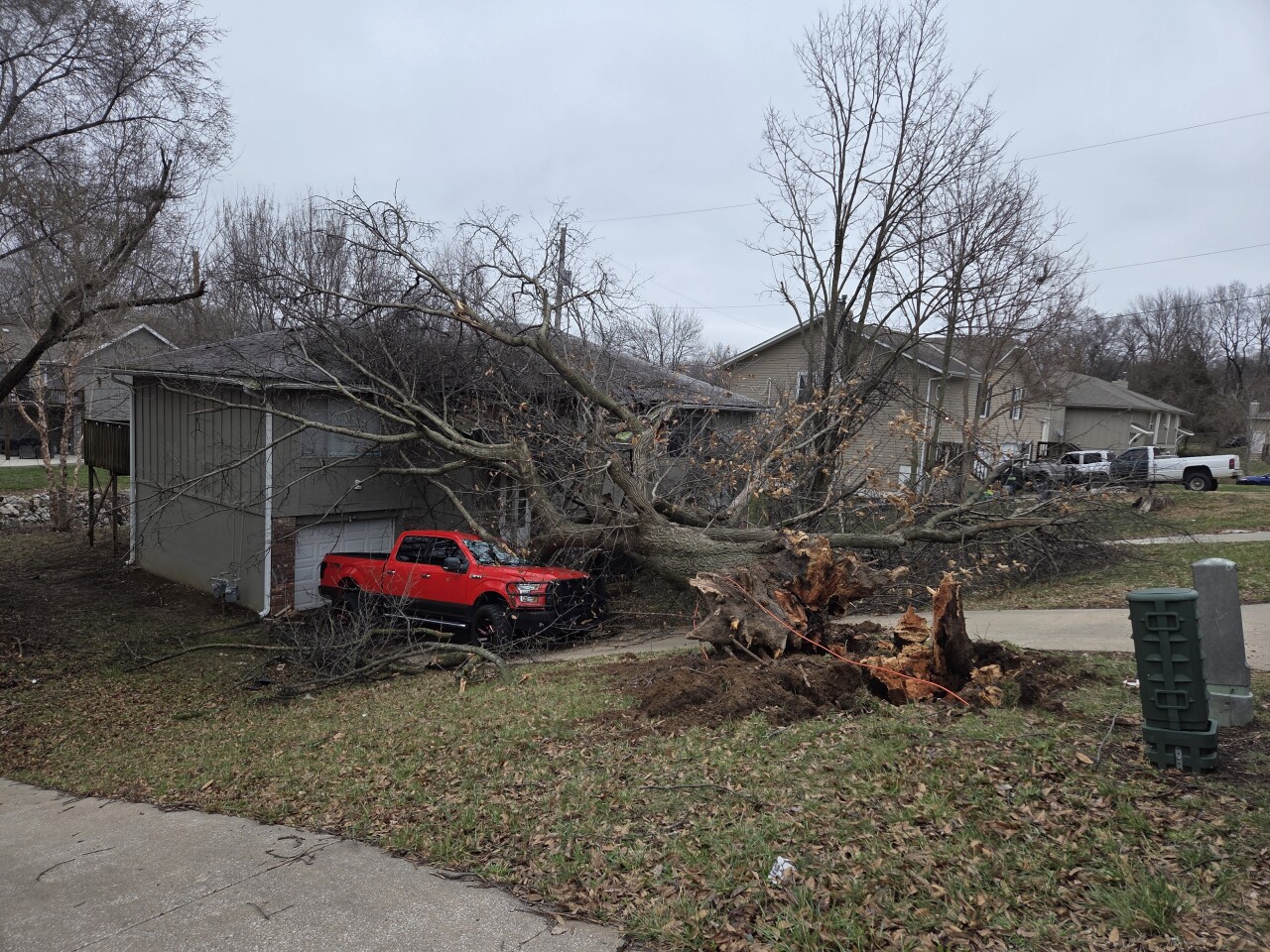
A tree fell onto the front of a duplex and a pickup truck in Merriam as a tornado warning was active in Johnson County. No injuries were reported.
—
