

WEATHER HEADLINES
- Chilly weather again tonight with lows near freezing
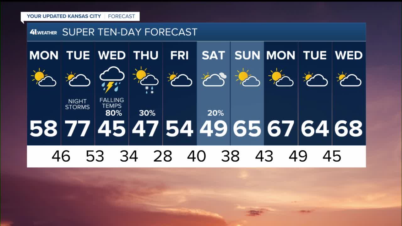
- A big warm up Monday and Tuesday
- Periods of showers and thunderstorms likely Tuesday night, Wednesday into Thursday
KANSAS CITY'S FORECAST
Tonight: Partly cloudy and cold. Wind: E 5-10 mph. Low: 32°
Monday: Partly cloudy, breezy and warmer. Wind: E-SE 10-20 mph. High: 58°
Tuesday: Partly to mostly cloudy with warm, windy conditions. Wind: S 15-35 mph. Low: 46° High: 77°
Tuesday Night: Showers and storms arrive late evening with the threat of mainly damaging wind gusts, hail, but a very low chance of a tornado too. Wind: SE 15-25 G45 mph. Temperatures in the 60s and 50s overnight.
Get more updates from our weather team:
View our interactive radar
Read our Weather Blog
Check out the current conditions in our area
The KSHB 41 Weather Storm Shield is a life-saving app that acts like an NOAA Emergency Weather Radio on your iPhone or Android phone. You will receive critical alerts via voice and push notification regarding major, potentially life-threatening weather events.
