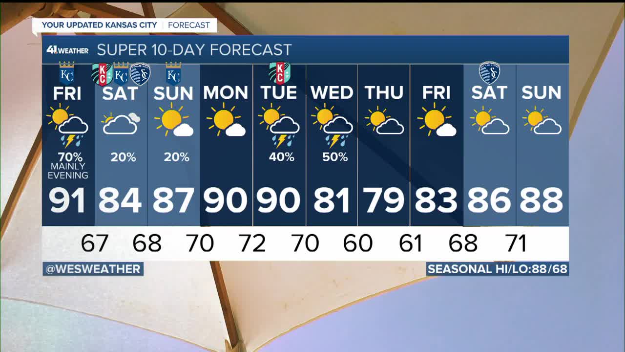


WEATHER HEADLINES
- Strong to severe storms possible Friday afternoon and evening as a cold front passes through
- A little cooler for the weekend with lower storm chances
- Back near 90 early next week followed by another strong cold front
KANSAS CITY'S FORECAST
Tonight: Increasing clouds and warm overnight. Slight chance for a shower or storm in eastern KS and NW Missouri
Wind: S 10-20 mph
Low: 75º
Friday: A few showers may develop in the late morning while the main area of storms develops after 2pm. Some storms could be strong to severe with damaging wind gusts and very low tornado risk.
Wind: S 10-20 mph
High: 91º Heat Index: 100°
Saturday: Shower possible in the morning. Mostly cloudy and cooler. Still humid.
Wind: S 10-20 mph
High: 84º
Get more updates from our weather team:
View our interactive radar
Read our Weather Blog
Check out the current conditions in our area
The KSHB 41 Weather Storm Shield is a life-saving app that acts like an NOAA Emergency Weather Radio on your iPhone or Android phone. You will receive critical alerts via voice and push notification regarding major, potentially life-threatening weather events.
