

WEATHER HEADLINES
- Very comfortable weather today as showers end north of KC
- Highs warm to the 80s Wednesday ahead of a strong cold front
- The strong front will bring thunderstorms, some severe
- Following the strong cold front, we will see temperatures remain unseasonably cool
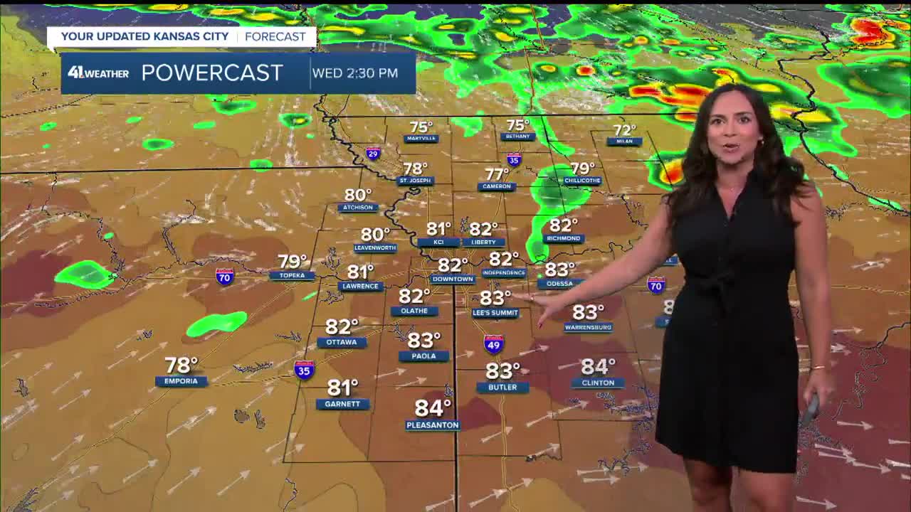
KANSAS CITY FORECAST
Tuesday: Showers will end north. Then, it becomes partly cloudy and pleasant.
Wind: NE 5-10 mph
High: 77º
Tonight: A few clouds, calm and comfortable.
Wind: SW 5-10 mph
Low: 58º
Wednesday: Partly cloudy and warming fast into the early afternoon. Then, a cold front arrives bringing scattered showers and thunderstorms during the rest of the afternoon and evening. Some storms could have damaging wind and hail.
Wind: SW 5-15 mph shift to N 15-25 mph
High: 82º
Thursday: Partly cloudy and cooler.
Wind: NE 5-15
Low: 50º
High: 76º
Get more updates from our weather team:
View our interactive radar
Read our Weather Blog
Check out the current conditions in our area
—
