

WEATHER HEADLINES
- Showers with some rumbles rolling into Kansas City early tomorrow morning
- Sunnier and pleasant for Friday afternoon
- Temperatures will stay warm this weekend, and more rain is possible early next week
KANSAS CITY'S FORECAST
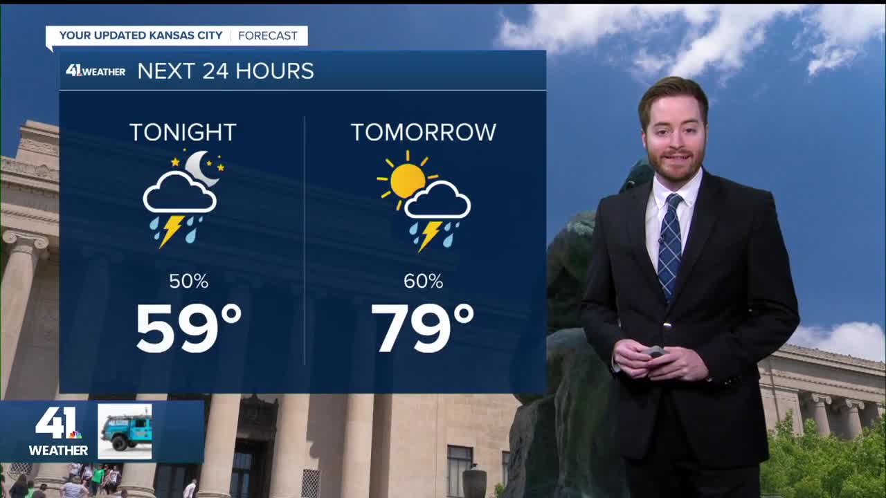
Tonight: Starting out clear, but clouds increase after midnight with some showers and storms after 4am.
Wind: S 10-20 mph
Low: 59º
Friday: Scattered showers and storms early in the morning, then a partly cloudy afternoon.
Wind: S to N 10-15 mph
High: 80º
Saturday: Partly cloudy skies and warm still.
Wind: E-SE 10-15 mph
Low: 57º High: 79º
Get more updates from our weather team:
View our interactive radar
Read our Weather Blog
Check out the current conditions in our area
—
