

WEATHER HEADLINES
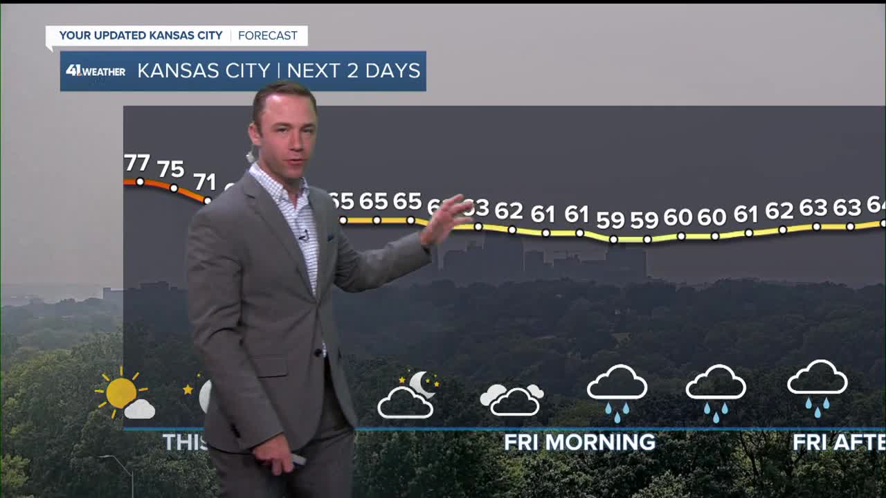
- A 2nd cold front arrives later tonight, bringing some light rain and much cooler air
- Record cold temperatures possible Friday
- The weekend looks nice, highs in the middle 70s
KANSAS CITY FORECAST
Tonight: Increasing clouds with a chance of rain showers after midnight as a 2nd cold front arrives.
Wind: SW 5-15 to N 10-20 mph
Low: 57º
Friday: A 2nd cold front sweeps through, bringing a mostly cloudy sky and areas of rain showers. If it rains most of the day we may set a record cold high temperature.
Wind: N 10-15 mph
High: 66º (Record cold high temperature: 66° set in 1905)
Saturday: Super Saturday! Sunshine and comfortable after a chilly start.
Wind: W 5-10 mph
Low: 46º
High: 74º
Sunday: Super Sunday! Sunshine and comfortable after a cool start.
Wind: NE 5-15 mph
Low: 51º
High: 77º
Get more updates from our weather team:
View our interactive radar
Read our Weather Blog
Check out the current conditions in our area
—
