

WEATHER HEADLINES
- Typical summer heat and humidity for the 4th of July weekend
- Isolated thunderstorms are possible Friday afternoon and Sunday
- A better chance of showers and thunderstorms is Saturday, but some may not see much rain
KANSAS CITY'S FORECAST
Tonight: A litte hazy overnight. Mostly clear and warm.
Wind: S 5-10 mph
Low: 74º
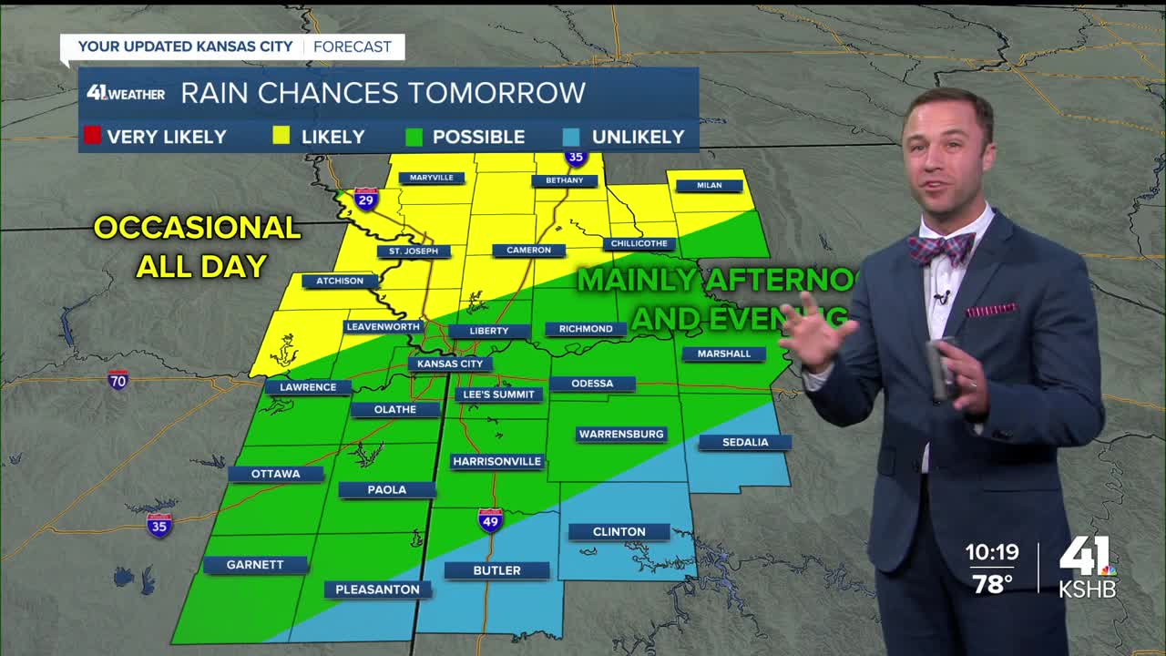
Saturday: Partly cloudy with a 60% chance of thunderstorms. Breezy. More rain and storms possible overnight.
Wind: S 10-20 mph
High: 87º
Sunday: Partly cloudy and very humid with a 30% chance of isolated thunderstorms during the day.
Wind: S-SW 5-10 mph
Low: 71º High: 86º
Get more updates from our weather team:
View our interactive radar
Read our Weather Blog
Check out the current conditions in our area
The KSHB 41 Weather Storm Shield is a life-saving app that acts like an NOAA Emergency Weather Radio on your iPhone or Android phone. You will receive critical alerts via voice and push notification regarding major, potentially life-threatening weather events.
