


Hope you're having a great Tuesday, weather blog readers!
We're going through three straight days of warmth. Don’t worry — winter isn’t canceled. It will get colder again, and yes, it will snow again.
This evening is a beautiful one across the metro. High temperatures on Tuesday climbed close to 60 degrees again, with many spots sitting in the upper 50s as the sun went down.
It’s one of those nights where a light sweater or jacket is perfect for an evening walk.
Tomorrow morning starts a little chilly, with temperatures near 35 degrees and a bit of fog possible, especially across northern Missouri.
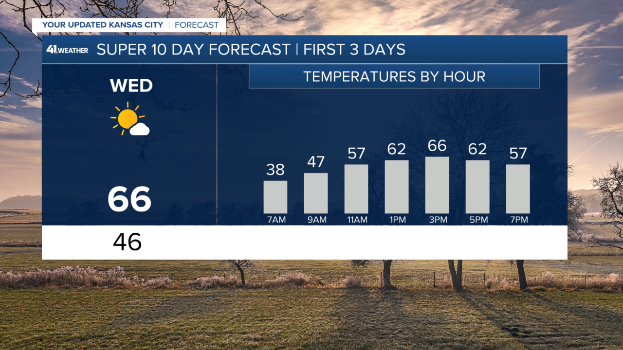
It’s not a harsh cold by any means, and once the sun comes up, temperatures warm quickly. By lunchtime, we’ll be near 60 degrees, and by the afternoon, many spots south of Kansas City will push into the mid-60s.
Northern areas will stay closer to 60. We’ll fall just short of the record high of 70 degrees, but it’ll still feel unusually warm for this time of year.
Expect mostly sunny skies, a breezy south wind and some high clouds drifting in later in the day.
Changes arrive midweek. Rain moves in on Wednesday night and continues into Thursday, with the heaviest rain likely from late morning through midday, tapering off in the evening. Some areas could pick up close to an inch of rain by the time this system moves out.
Then comes the tricky part — and the part that always raises eyebrows. As colder air pushes in late Friday, rain may mix with snow, even though temperatures could still be above freezing.
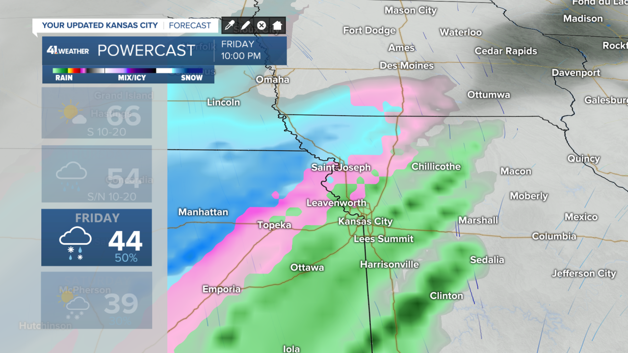
Yes, snow can fall at temperatures as warm as 36 degrees, and that’s exactly what we may see Friday evening. This looks like initially a rain-to-snow mix, especially across northern Kansas, northern Missouri and into parts of the Kansas City metro, before changing to snow overnight.
By late Friday night into early Saturday morning, some snow could stick around, and another narrow band of snow may move through later Saturday afternoon and evening.

Accumulating snow is possible, especially north of Kansas City.
A few inches can’t be ruled out for places like Maryville, Bethany, St. Joseph and Atchison, with a medium chance of at least an inch, even in the northern parts of the metro.
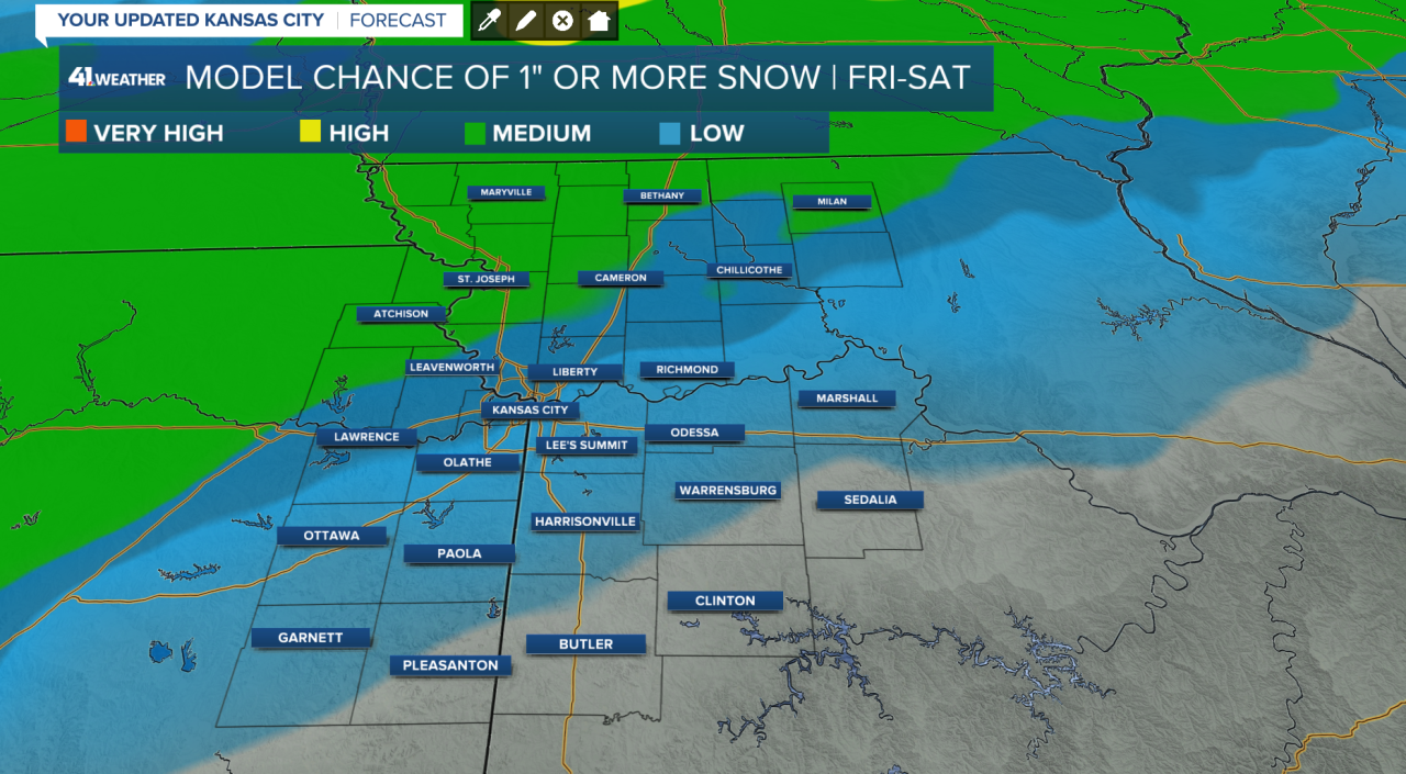
Road impacts in terms of slushy to covered conditions are possible Friday night into Saturday morning and again Saturday evening.
However, relatively warm air during snowfall may limit higher accumulation amounts to elevated surfaces.
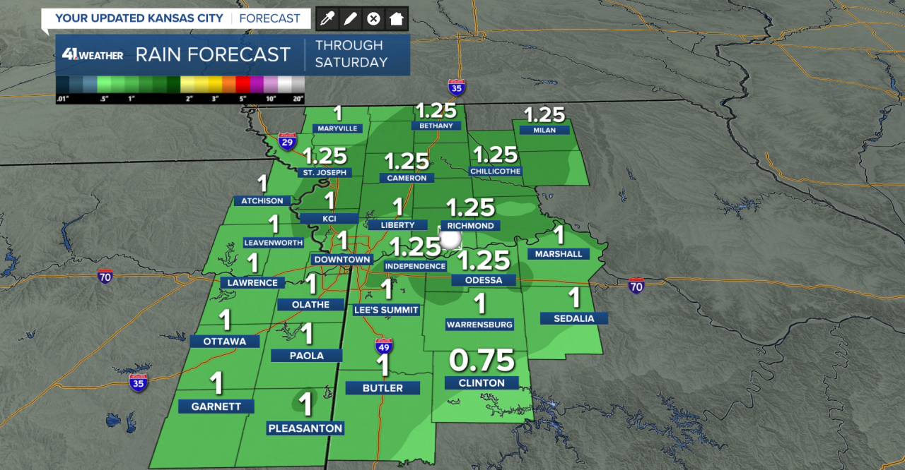
Snow or not, this should bring a very beneficial amount of rain, about an inch.
After all of that, temperatures rebound once again, with 50s returning as we head into the second half of next week.
So there you go — a little bit of everything. Spring-like 60s for now, snow chances for those who’ve been waiting all month, and more changes ahead.
A true Midwest forecast … and kind of a win-win.
Follow Wes on social media and listen to his podcast "The Kansas City Weather Report."
—
