


Good evening, weather blog readers!
We've got action brewing across western Missouri and eastern Kansas over the next few days, starting with some punchy storms tonight and building a bigger severe weather setup by Friday.
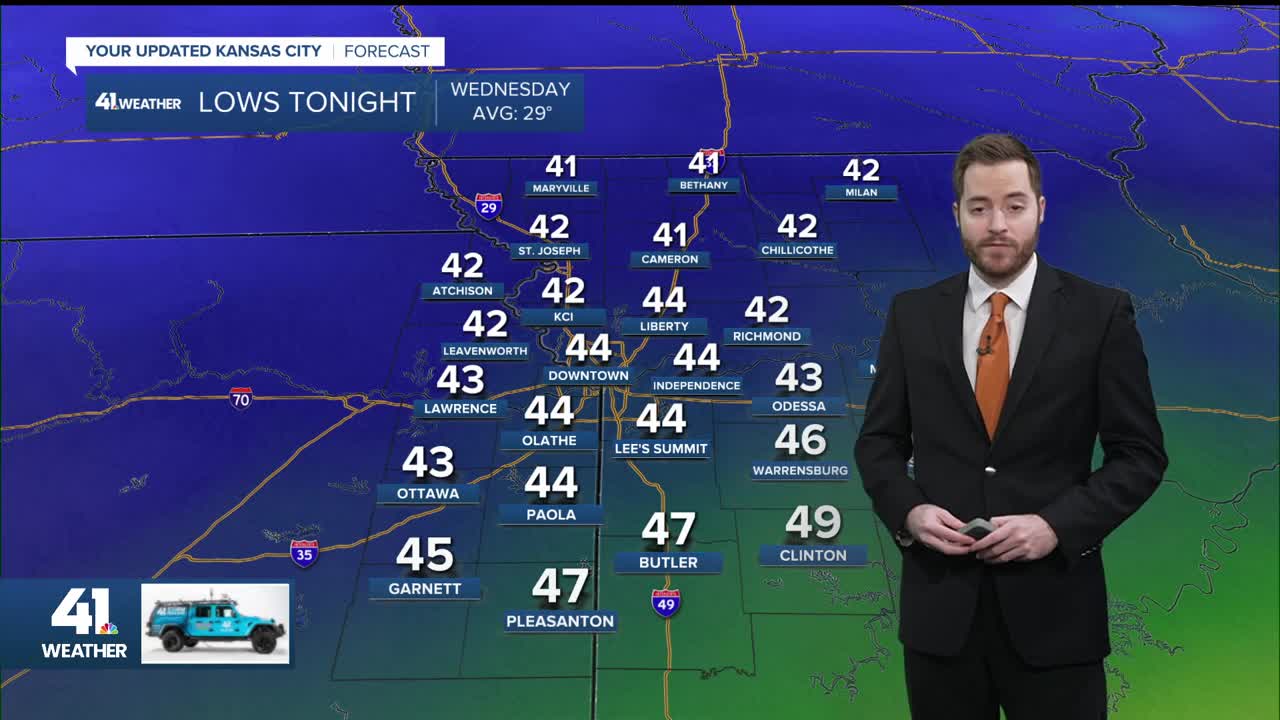
Tuesday night strong storms southward
Strong storms could fire up this evening into Wednesday morning, mainly south of a line from Ottawa, Kansas, to Marshall, Missouri.
Quarter-sized hail is the primary concern in those storms.

Shower and storm coverage increases overnight, but the worst stays south of our main metro area.
Wednesday: lingering showers, low threat
Showers and storms hang around much of Wednesday, with dry time possible around midday. No strong or severe action is expected in the afternoon or evening.
Thursday looks drier, giving us a brief reset before the next system ramps up.
Friday's severe threat builds
The real headliner arrives late Friday afternoon into the evening. Severe thunderstorms are possible across the region as a stronger system moves in.
Timing looks to be after 5 p.m. for storms to fire up in northeast Kansas and northwest Missouri.
Damaging winds are the top hazard with a front nearby in eastern Kansas, though a few tornadoes and large hail can't be ruled out.

After any supercell formation, a line of storms could sweep through the region with damaging winds and brief tornadoes.
The Storm Prediction Center highlights far eastern Kansas into northwest Missouri, with supercell potential the greatest risk.
But overall, all of western Missouri and eastern Kansas are already under a Level 3 of 5 severe risk. It is unusual for us to be under such a high risk this far out in early March.
Let’s not put it in stone yet, though.
Showers and storms will move through in the morning, and a later arrival could lower our severe threat.
It will be that classic case: Can the atmosphere recover with some afternoon sunshine to help the storms? Even if the sun doesn't shine much, the chances of severe storms exist.

If storms arrive after dark, that could limit severe potential, or if the cold front moves fast and that cold air gets ahead of the storms, the threat will be lower.
More storms next week
After a cooler Saturday with highs in the 40s, temperatures Sunday through Tuesday get back into the 70s. With sunshine, warm temperatures and strong southerly winds, there is another setup for severe storms on Tuesday.
We may be in for a long severe weather season, the way it's starting.
Have a safe evening, everyone!
For more updates on social media or via podcast from me, click here.
—
