


Good Monday, bloggers,
We saw highs of 95° Friday-Sunday at KCI. So we officially had our first heat wave of the summer.
Fortunately, it was a minimal heat wave, as we barely met the criteria of three straight days of 95° or higher.
On average, we see 39 days 90° or higher from May through September; 16 of those days are 95° or higher. This year, we are on an average pace of 90° or higher temps as we sit at 28 days.
But 95° or higher, we are below average. We have seen five days at 95° or higher, and three of them occurred during the last three days.

Our streak of 95° or higher may continue today and end Tuesday. Our streak of 90° or higher may end Tuesday, but for sure Wednesday.
Let's go through this.
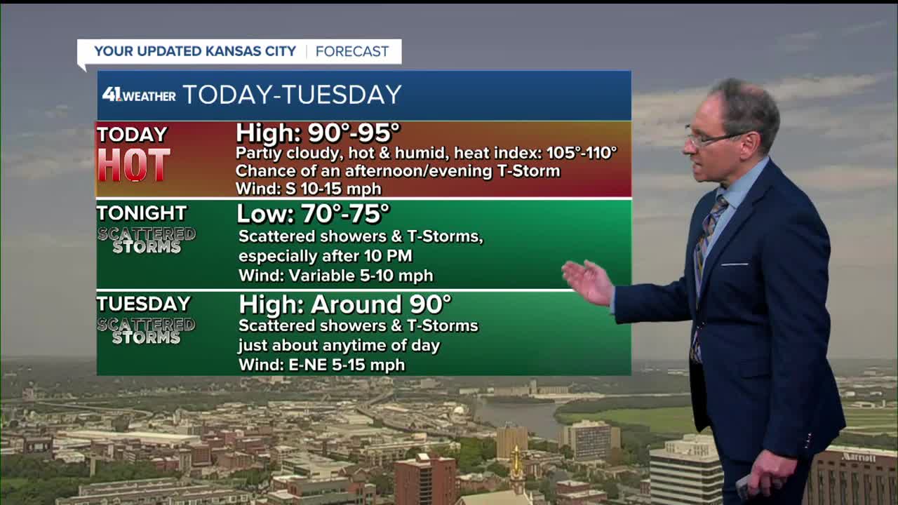
TODAY:
It will be another day with highs around 95° as the cold front we are tracking gets to I-80.

A few thunderstorms are possible after 5-7 p.m. as we track not only the front but a weak disturbance or two from the northwest.

TONIGHT:
A few thunderstorms will be around with lows 70°-75°.

TUESDAY:
A few showers and thunderstorms are possible during the morning. The coverage of the showers and thunderstorms will increase some during the afternoon and evening.
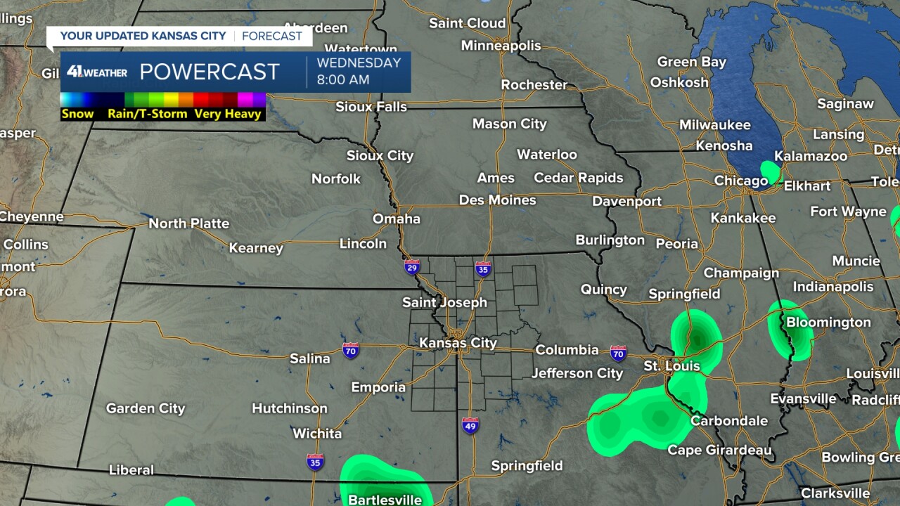
Any thunderstorms today through early Wednesday could produce a brief 30-50 mph wind gust and brief flash flooding. But we do not expect widespread severe weather and flash flooding.


Highs Tuesday will be around 90° with still high humidity as the cold front approaches.
Notice, the cold front is tracking from northeast to southwest and not the usual northwest/west to southeast/east. This is called a backdoor cold front as it is arriving from an unusual direction.

WEDNESDAY:
Any showers and thunderstorms will exit to the south as lows drop to around 70°.
Wednesday afternoon will see the wind pick up some from the northeast. This will not only bring in cooler air, but also less humid air as the backdoor cold front sweeps through.

The cold front will be tracking southwest as highs will be in the mid-80s. The humidity will be decreasing, but it is Thursday when we will see the full effect of the lower humidity.

RAINFALL FORECAST:
Some locations will see none to .10" while some see .10"-.50". A few locations will see 1"-2".
We know we will be in a zone of a few to scattered showers and thunderstorms this evening through early Wednesday. We will not know where the heaviest sets up until it starts developing.
This is due to the disorganized nature of the thunderstorm setup as we see weak disturbances and a backdoor cold front.
If your yard or farm does not get the rain it needs over the next two to three days, you will need the sprinkler, as we do not see much rain over the next 7-10 days.

If you are heading to The K this week for the big four-game series with the Rangers, there will be a chance to see a few thunderstorms for Games 1 and 2. But, if it rains, it should not last long enough to cause a rainout, just a delay.
Games 3 and 4 will see some great weather. The Thursday game will be warm, but not ridiculously hot like the game Sunday.

Have a great week.
Stay healthy.
—
