


KANSAS CITY, Mo. — Good Wednesday, bloggers,
We are tracking three main weather issues: nice weather, a few days of summer weather and a few chances of thunderstorm weather.
Before we get to the weather issues, let's look at the growing drought issues.
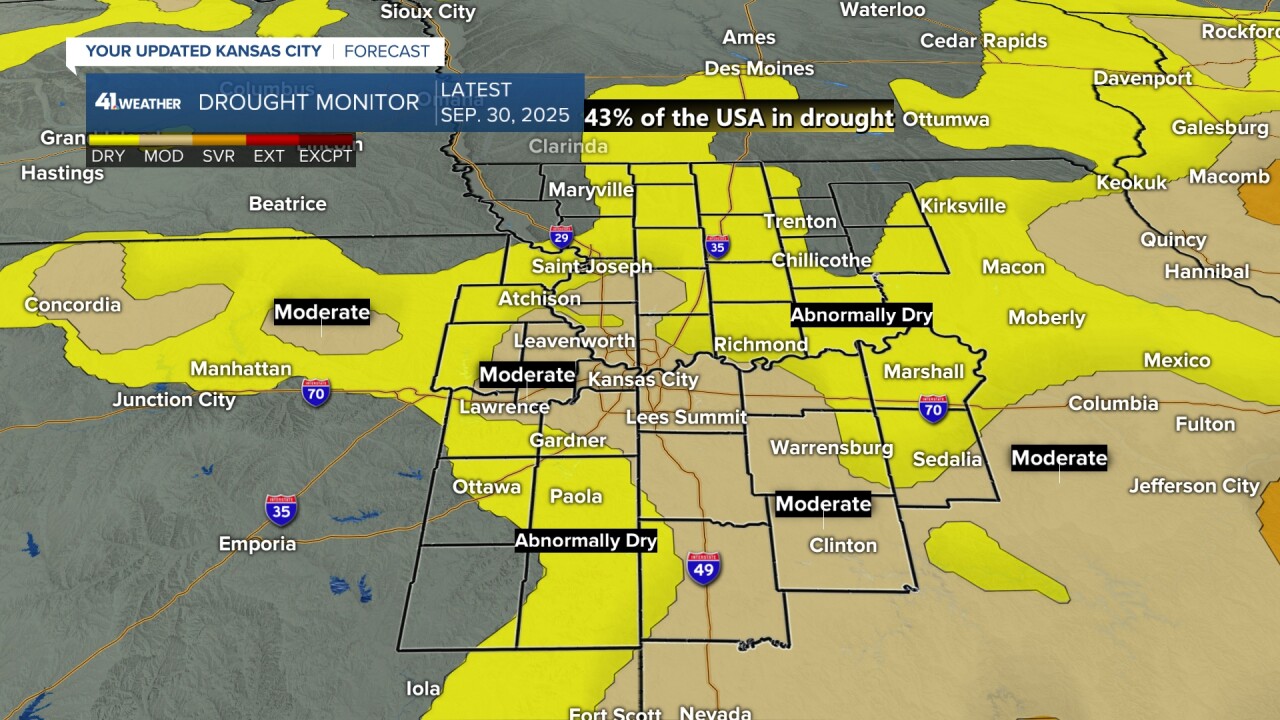
Kansas City and locations to the south and southeast are in a growing Level 1 of 4 drought, also known as a moderate drought. The yellow is one rung below a Level 1 drought, also known as "abnormally dry."
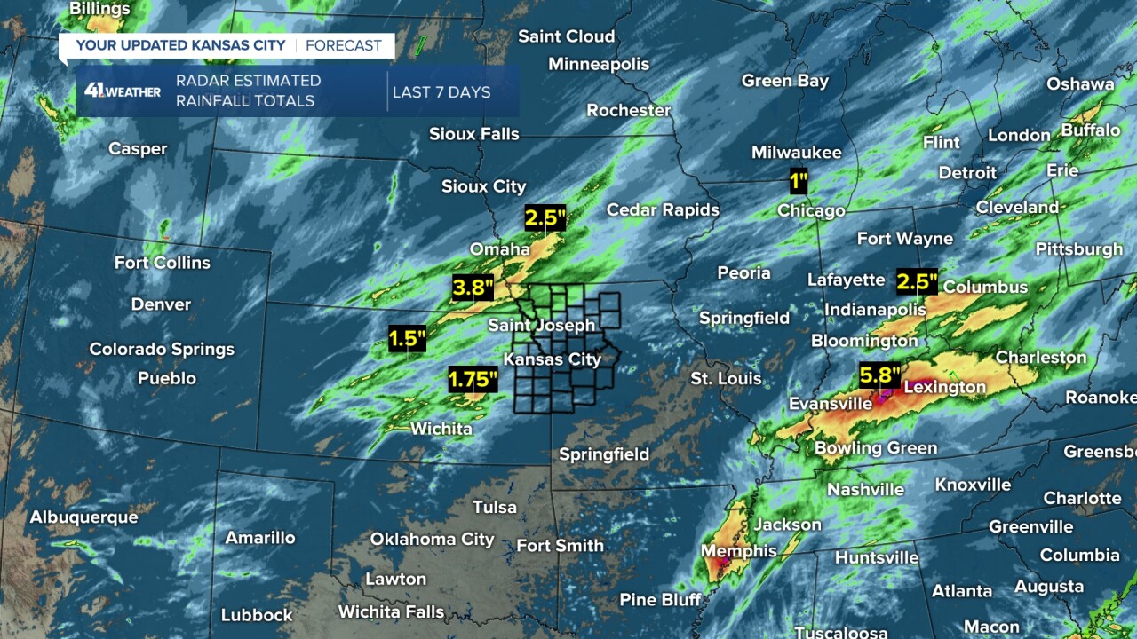
This does not count the rain over the last 5-7 days. But when you look at the radar-estimated rainfall totals over the last week, you can see locations that needed the rain did not get much.
The locations that really didn't need rain saw 0.50"-2". So some Level 1 drought areas may be nudged to a Level 2, which is the severe category, on the next drought monitor issued Thursday.

Drought conditions across the region are still in check from western Oklahoma to Nebraska and Iowa. Missouri is seeing quite a bit of Level 1 and 2 drought.
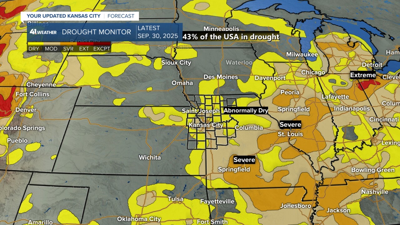
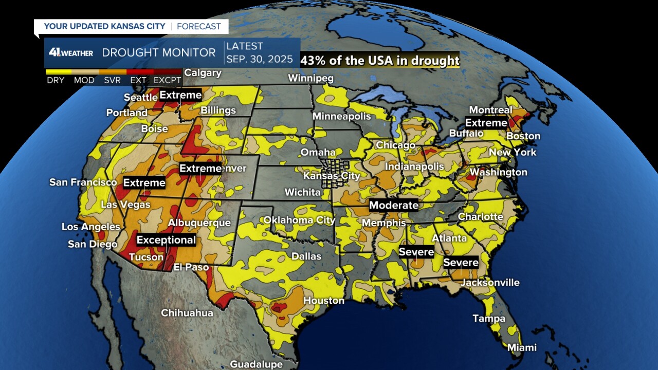
When we look at the U.S., the worst drought conditions are west of the Continental Divide and from Missouri, Arkansas to the Midwest and New England.
Rainfall around the region saw the heaviest rain from southern Kansas to southwest Iowa. These locations were already doing pretty good as far as not needing rainfall.
There was a second zone of heavy rain from eastern Arkansas to southern Ohio. They needed the rain, but amounts were 2"-6".
Some locations had too much of a good thing too quickly, and there was flooding in some locations.
Rainfall potential for the next 7 days shows some rain in areas that need it.
There is rain west of the Continental Divide and on the East Coast. And yes, there is a zone from New Mexico to Missouri.
The rain west of the Continental Divide is not monsoon rain; it is rain from storm systems, a sign of the changes in the weather pattern.
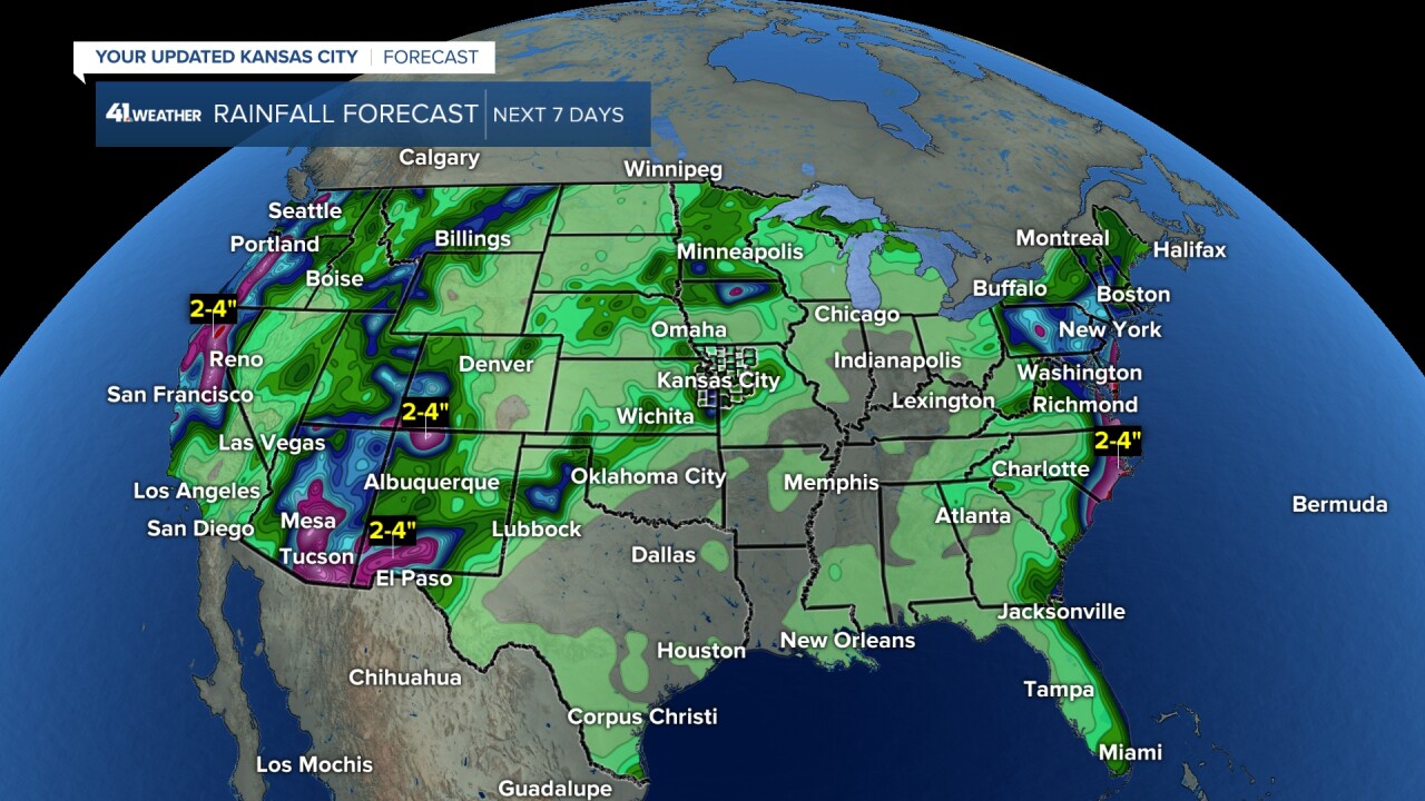
When we zoom in, you can see amounts in our area the next 7 days may be in the 0.50"-1" category with some locations seeing 1"-4".
So when are the best rain chances the next 7 days? Let's go through the forecast day by day.

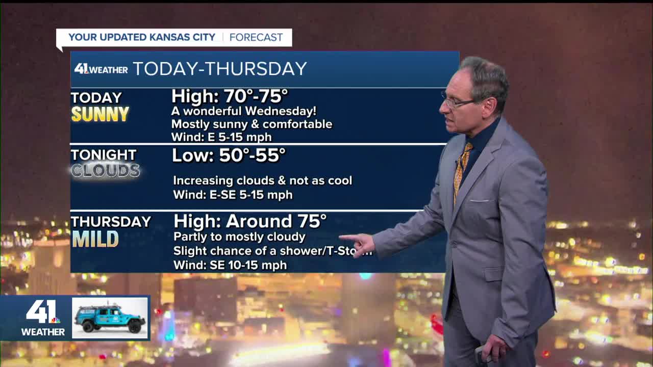
TODAY:
There will be no chance of rain today, and there will barely be a cloud. Highs will be in the low 70s with a light east breeze at 5-15 mph.
Clouds will increase across central sections of Kansas and Nebraska.

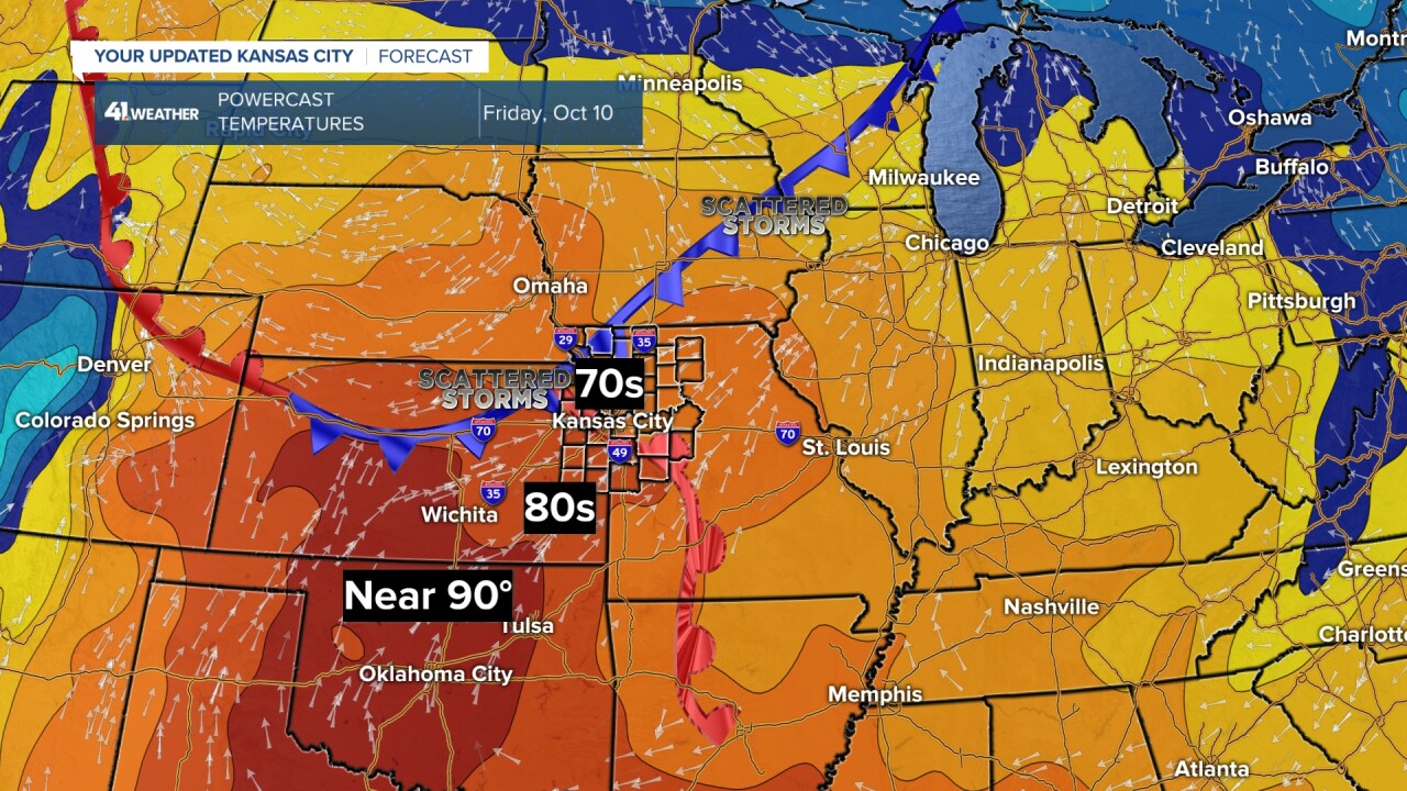
THURSDAY:
We will see a partly to mostly cloudy sky as scattered showers and thunderstorms form across central sections of Kansas and Nebraska.
A few showers and thunderstorms may wander in here by evening. This is being caused by a weak weather system tracking in from the northwest as a warm front approaches from the west.
Highs tomorrow will be in the 70s with a southeast breeze of 10-15 mph.

THURSDAY NIGHT-FRIDAY:
This is when we have our next best chance of thunderstorms as the system moves in from the northwest, the warm front moves in from the west and a weak cold front arrives from the northwest.
This puts eastern Kansas and western Missouri in a zone where showers and thunderstorms will form. The best chance of thunderstorms is basically from midnight Thursday night to noon Friday.
Highs will be in the 70s after lows 55°-60°.
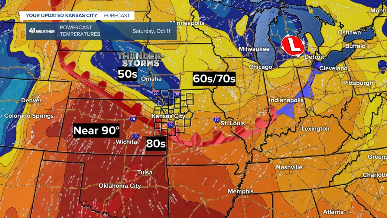
SATURDAY:
The assortment of fronts will become a warm front as the best chance of thunderstorms shifts to Nebraska and Iowa.
We will see a lot of clouds with highs in the low 70s if we are north of the warm front and fewer clouds with highs in the low 80s if we are south of the front.
There is a trend to being north of the front.
CHIEFS SUNDAY:
The warm front will surge north, so Sunday has the best chance to feel like summer as highs make a run at 90°.
The last record high of 90° or higher is on Oct. 30, where the record high is 91° set in 1950. So a few days near 90° can happen in October.
A new cold front will approach from the west, increasing the chance of thunderstorms Monday. This front may linger into the middle of next week as systems track along it.
This would be good news as it means we have some chance to see widespread beneficial rain and thunderstorms.
There is still uncertainty about how next week will evolve. We will update through this week.
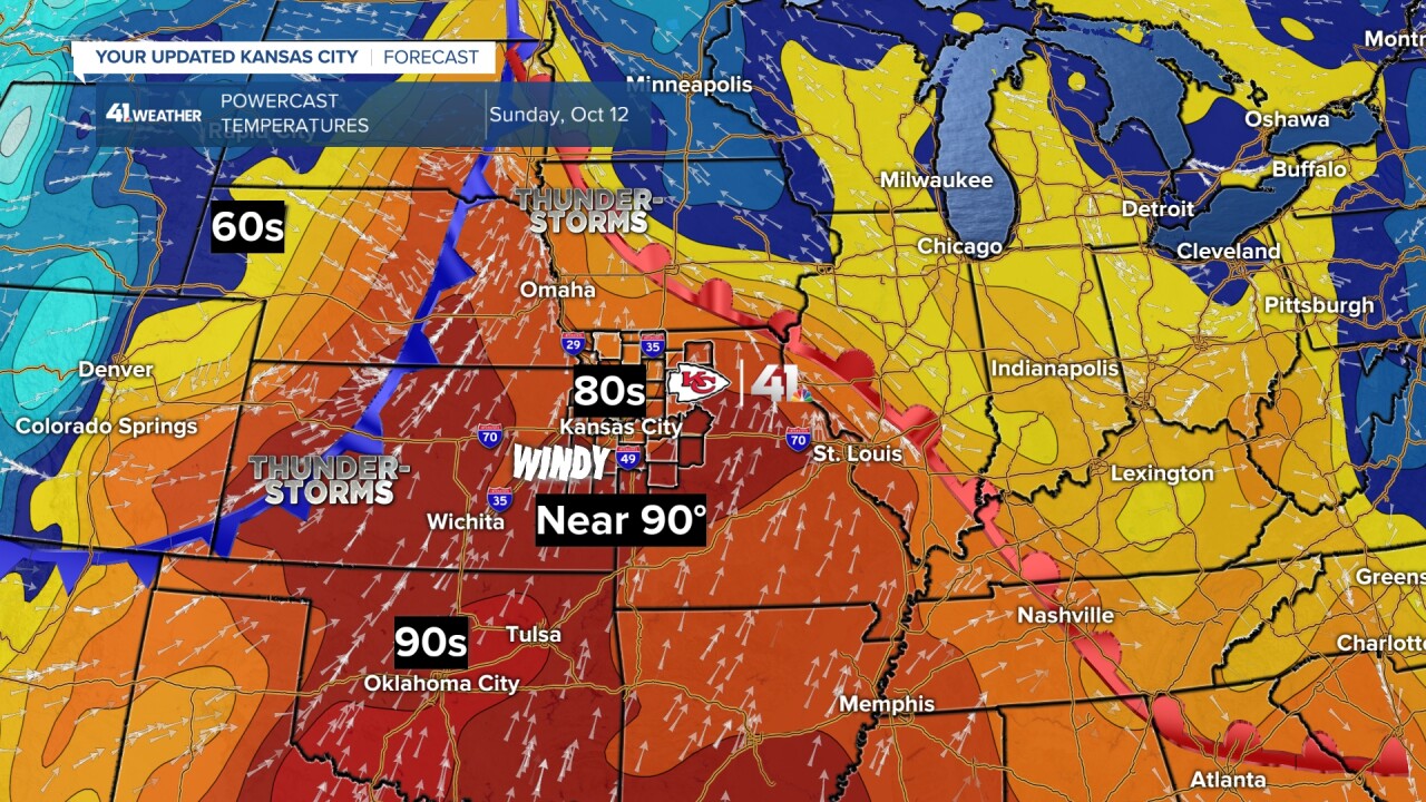
If you are planning to head to the Chiefs game, it will be very warm to hot and windy for tailgating.
Fortunately, the game is at night on KSHB 41, so temperatures during the game will be in the 70s with a nice south breeze.

Have a great rest of your week.
Stay healthy.
—
