


KANSAS CITY, Mo. — Good Friday bloggers,
After a stormy Thursday morning, we are in for a much calmer Friday. After today, we will be in a weather pattern where we see heat build to the south and southwest and a zone of thunderstorms that are tracking around the edge of the heat.
Let's go through this.
TODAY:
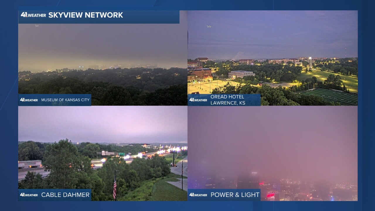
The front that came through Thursday as a cold front is returning north today as a warm front. This morning, it is located across northern sections of Oklahoma and Arkansas. It is creating a low overcast this morning. The sky looks more like fall or winter, not the middle of July. The ceiling of the overcast is a few hundred feet, covering the tops of the downtown buildings. Surface visibility is good.
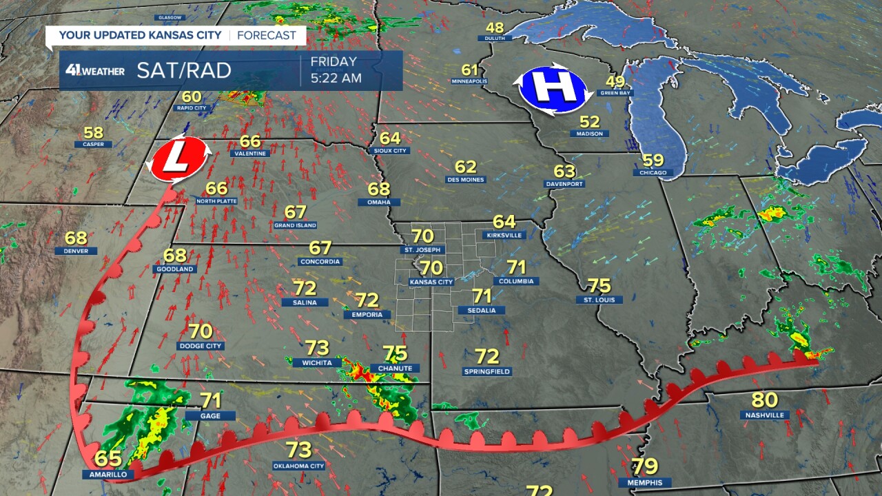
The warm front will be near Interstate 70 this afternoon and evening. There are some thunderstorms near the warm front this morning and there will be some this afternoon and evening. So, we have a chance to see a few showers and thunderstorms just about any time today as this front drifts north.
SATURDAY-SUNDAY:
We are going to be in a pattern where heat is building to our south and southwest as a thunderstorm zone sets up along the north edge of the heat. Our area is, of course, near the edge of both. So in this game of heat vs. thunderstorms in our area it looks like a tie with a slight edge to the heat. This set-up will not only be around this weekend, but much of next week. Also, each round of thunderstorms could produce some damaging wind gusts and flash flooding.
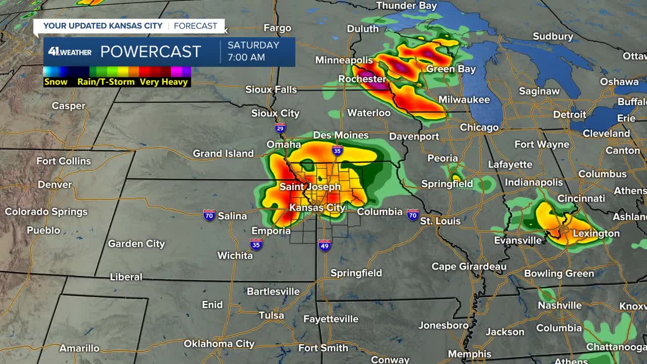
Here is a 30-second Powercast animation between today and Sunday. Note, the thunderstorms shown this evening may be a bit overdone. What you will also see is areas of thunderstorms forming across Nebraska, Iowa and even northern Missouri.
They will then track southeast from where the form. The question each time is...How far south will each round of thunderstorms get? The data below says they get to the I-70 corridor then fall apart. Some data has them getting to northern Missouri then falling apart as they move south, not reaching KC. There is a chance some could make it to south of I-70 before falling apart. We will have to take each chance one day at a time.
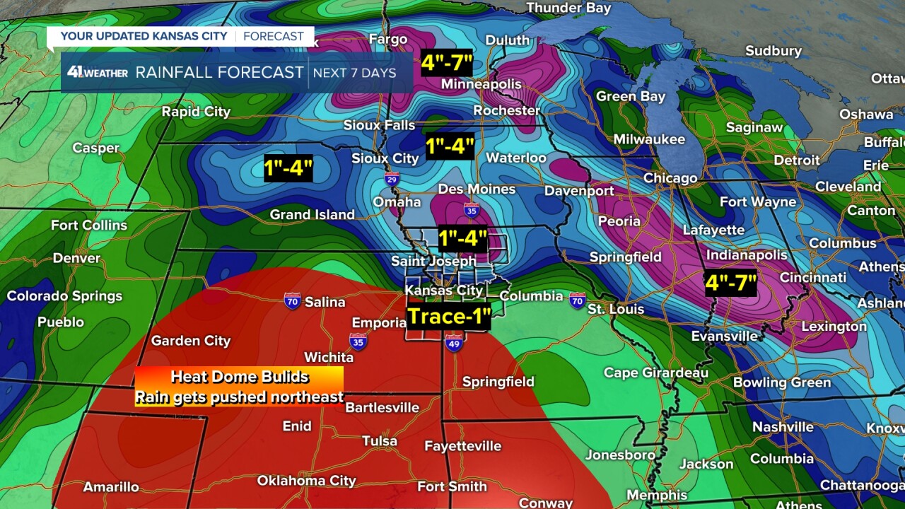
RAINFALL FORECAST NEXT 7 DAYS:
This tells the story pretty well. You can see a ton of rain from the northern Plains to Upper Midwest to the Tennessee Valley. Our area is on the southwest edge of the thunderstorm zone.
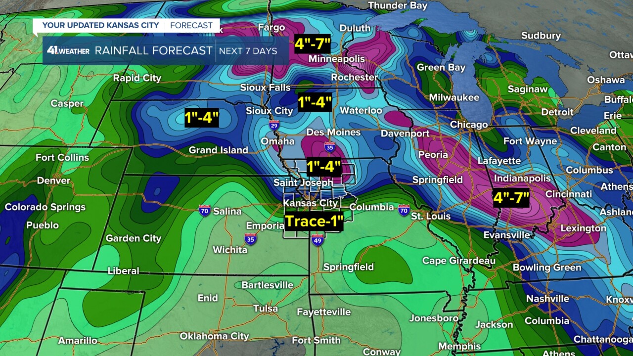
Our area is also on the northeast edge of the heat and drier area.
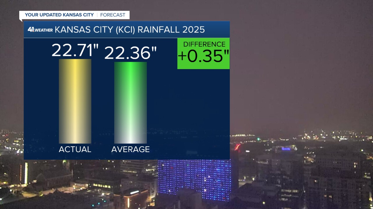
After the Wednesday night-Thursday deluge it brought our official 2025 rainfall total above average for the year and month.
We erased a 4.50" rainfall deficit and turned it into a 0.35" surplus. We also guaranteed above-average rainfall for July. The month average is 4.58". We received 4.84" of rain Wednesday-Thursday. When you add this to the paltry 0.15" we had seen in the first half of July, our monthly total sits at 4.99".
Have a great weekend.
Stay healthy
