


Good Wednesday, bloggers,
After a record low of 50° on Tuesday, with near record lows this morning and Monday morning, we are seeing some changes in the weather as summer tries to return.
The first change is going to be tonight and Thursday, as there will be a zone of very heavy rain and thunderstorms. It has been rather consistent that the heaviest rain will be found southwest of KC and that there will not be much, if any, severe weather.
Let's go through this.
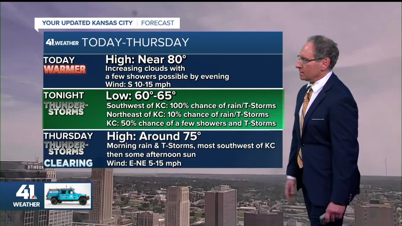
TODAY:
We will see increasing clouds with a high around 80°. Clouds, showers and thunderstorms will be increasing to our west. We may see a few showers by evening in KC.

TONIGHT-THURSDAY MORNING:
A large area of heavy rain and thunderstorms will track southeast from central Kansas to southwest Missouri to the southeast U.S. This means the heaviest will occur southwest of KC.
It is looking more like we will see scattered showers and thunderstorms form on the north edge of the main heavy area. It is this area that will affect KC.
Lows tonight will be in the low 60s.


THURSDAY AFTERNOON:
The heavy rain will track southeast into Arkansas as our area will see slow clearing from the north and a few showers ending. Highs will be in the 60s where it is cloudy, with showers most of the day.
Highs will be in the 70s where there is slow clearing and showers ending. Highs will be in the 80s where it is sunny most of the day. The KC area is in the 70s zone.
It will be cloudy, cool and wet at the Lake of the Ozarks, Table Rock Lake and into Arkansas.
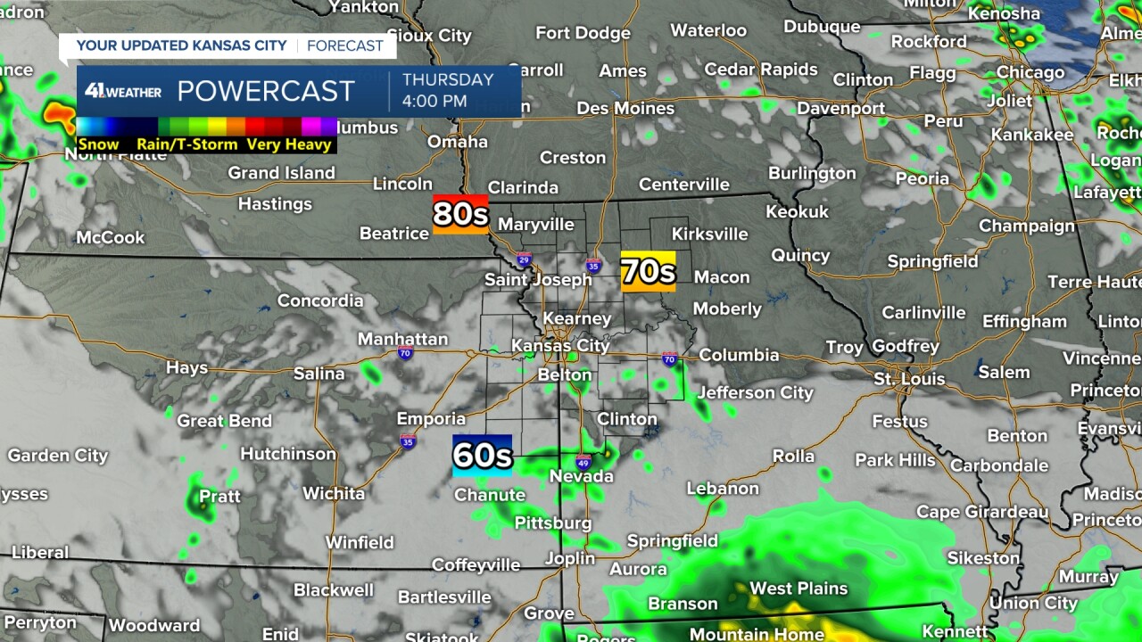
RAINFALL FORECAST TODAY-FRIDAY (MOST RAIN TONIGHT/THURSDAY MORNING):
Widespread 2"-4" rainfall amounts are possible from Salina, Kansas, to Iola, Kansas, to Springfield, Missouri, to Birmingham, Alabama! Ottawa, Kansas, may see 2"-4" of rain, while 30 miles to the northeast in Olathe, rainfall may end up being none to .25".

The northern edge is pretty set. It may end up 20-30 miles south of this map.
What is not on this data is the chance to see a trace-.50" inside the yellow circle as we see scattered showers and thunderstorms form on the north side of the main area tonight.

LABOR DAY WEEKEND:
FRIDAY:
If you are heading to the Lake of the Ozarks and Table Rock Lake, clouds will linger, but highs should still reach the 70s. If you are heading to Arkansas Friday, it will be cloudy and cool with highs in the 60s and rain ending.

SATURDAY:
It will be nice in KC and all lake locations with highs in the low to mid-80s.
There is a system across Nebraska and Iowa that will be producing showers and thunderstorms up there. This is a sneaky system, as the models are not handling it very well. It could affect Sunday and Labor Day.

SUNDAY:
Scattered thunderstorms may sag into northern Missouri and northeast Kansas. These could affect the Kansas lakes and KC. Highs will be in the 80s.
It still looks dry for the Lake of the Ozarks and Table Rock with highs in the 80s.

LABOR DAY:
That system continues to drift southeast. This may lead to scattered showers and thunderstorms for the Kansas lakes, Lake of the Ozarks and KC.
These will not be all-day rain events, but if you are out and about, especially on a lake or pool, keep an eye to the sky. These thunderstorms can come up fast.
Highs in all locations will be in the low to mid-80s.

Have a great rest of your week and holiday weekend.
Stay healthy.
—
