


KANSAS CITY, Mo. — Good Wednesday, bloggers —
We are in for a hot and dry Wednesday, then we have a setup for thunderstorms Thursday and Friday. Flash flooding and some strong winds will be the main threats.
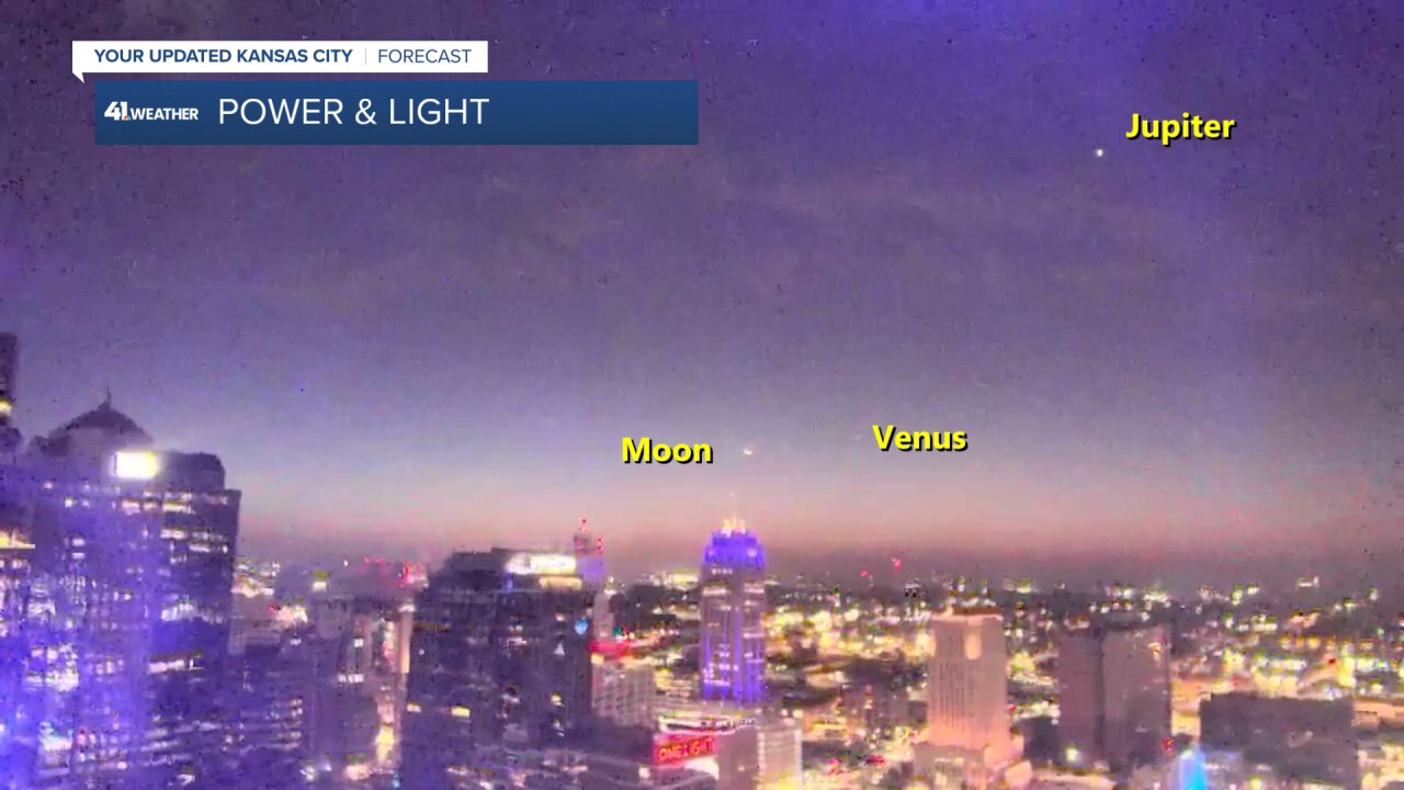
The day started so clear, we were able to see Jupiter, Venus and the crescent moon. The next two mornings may not be so clear.
At least today will be at least 10 times cooler than Venus! It is around 900° on Venus, so 90°-95° seems chilly.
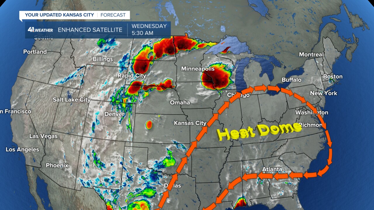
We are having a clear morning because a heat dome to the south has built far enough north to shove the thunderstorm track to the north and west.
The heat dome retreats Thursday and Friday, bringing the thunderstorm track back south into our region.
Let's go through the forecast.
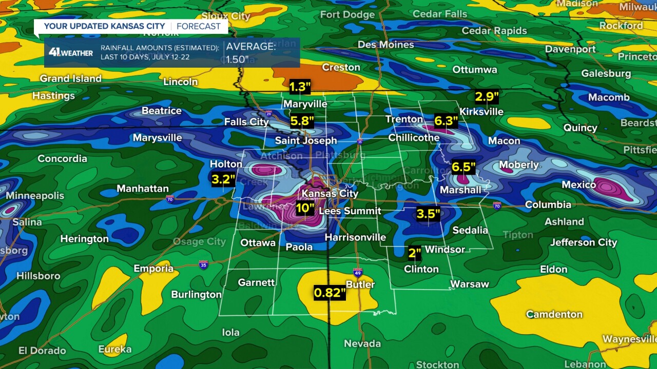
RAINFALL LAST 10 DAYS:
These are estimated totals, so your rain gauge may read differently. Keep in mind the average rainfall for the last 10 days is around 1.50".
7"-11" (some 12"-13" amounts are not out of the question) has occurred from around Riverside, Missouri, to Gardner, Kansas.
The locations that have not seen the huge amount of rain, like Lee's Summit to Braymer, Missouri, still saw 1.50"-2.50", which is near to a bit above average.
It's hard to believe that in the locations that saw 7"-11" of rain the last 10 days needed rain before that, seeing 1"-2" of rain in the previous six weeks.
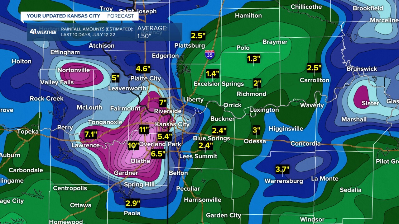
Rainfall around the region has been mostly plentiful, with amounts 5"-7" across north and central Missouri.
The only locations that have not seen much rain are around Butler, Missouri, to the state line, where amounts were under 1". Those areas had a lot of rain prior to the last 10 days.
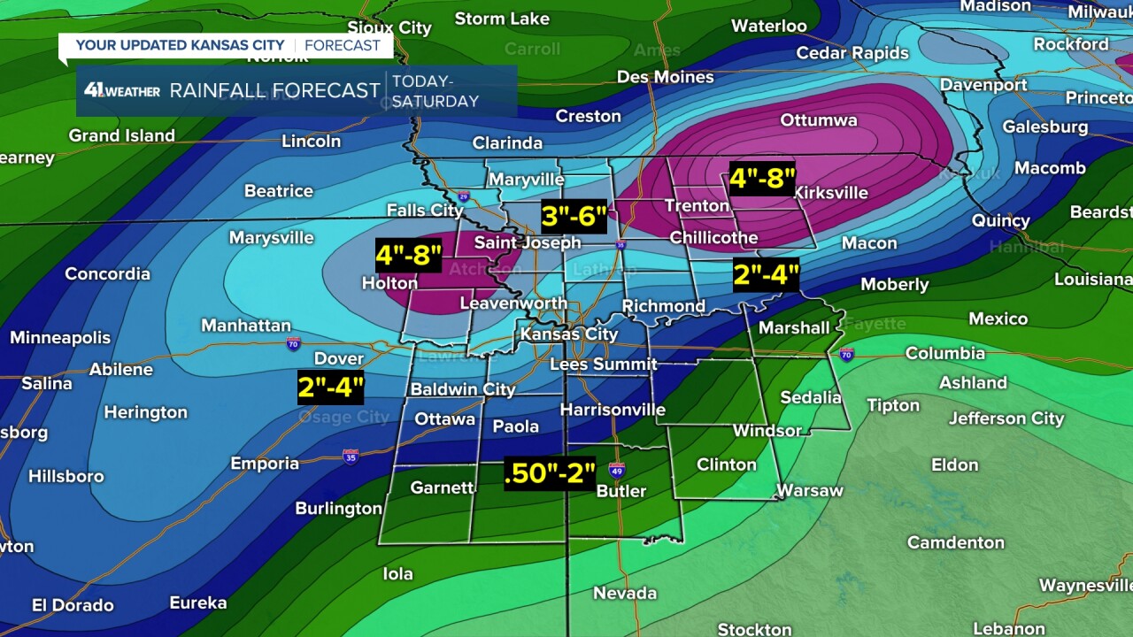
RAINFALL FORECAST THROUGH SATURDAY:
Here we go again. One to two months of rainfall is possible in some locations, where amounts may climb to 4"-8" of rain.
Right now, the locations that may see the heaviest rain look to be northeast Kansas to northeast Missouri.
The KC area is in the 1"-4" range. Flash flooding is the main issue with some thunderstorms capable of strong winds.
The zone of heaviest rain can still shift south or north by 50-100 miles. It depends on where the thunderstorms set up.
Also, these high amounts can occur in 2-3 hours or less, as rainfall rates will be 1"-3" per hour in the thunderstorms.
Let's time out the thunderstorms.
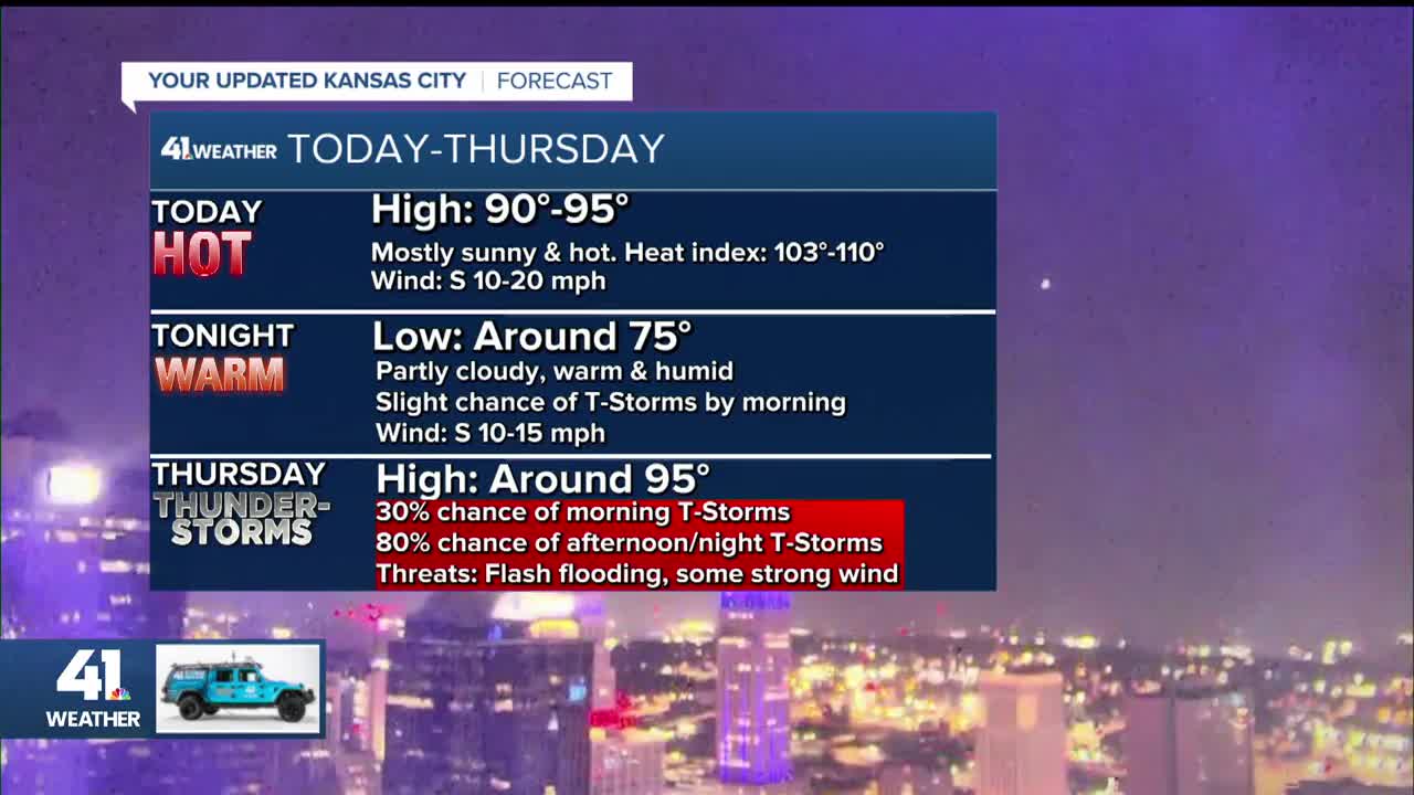
TODAY:
There is little to no chance of rain. It will be hot with highs 90°-95°.
The main thunderstorms will be found from northwest Kansas to Nebraska and Minnesota through northwest Iowa.
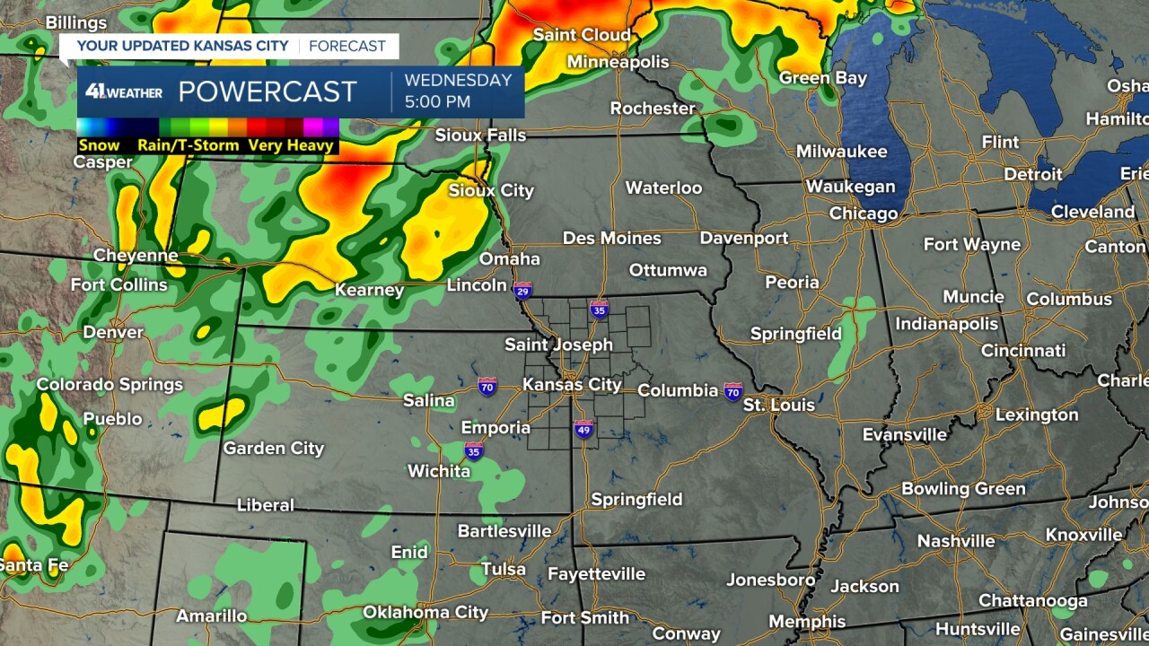
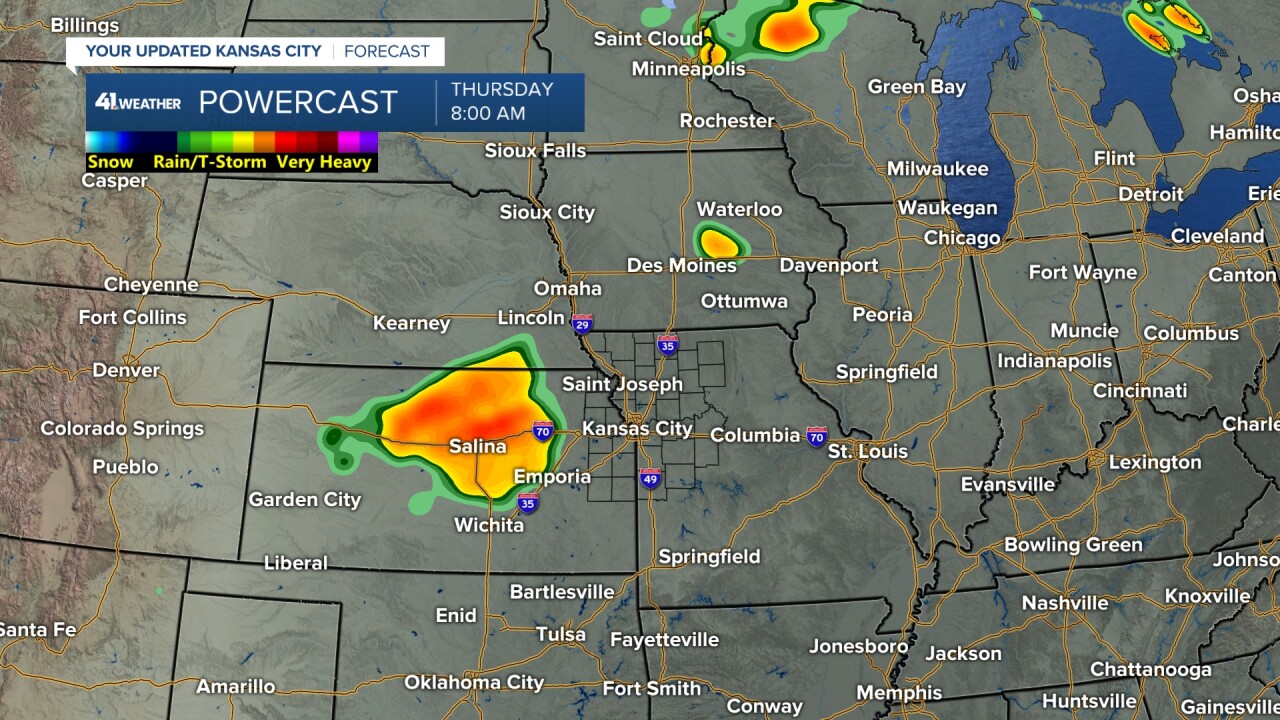
THURSDAY MORNING:
A cluster of thunderstorms may drop south into Kansas or Missouri as the main thunderstorms to the north weaken. This data has a cluster in Kansas, west of our area.
There is a slight chance we see some thunderstorms Thursday morning. If we get the thunderstorms, there will be a slight chance of flash flooding and strong winds as these thunderstorms will be falling apart.
THURSDAY AFTERNOON:
Thunderstorms will line up from western Kansas to the Great Lakes, through our area.
A slow-moving cold front will be heading south as a series of disturbances track northeast along the front.
This is the recipe for training echoes, in other words, thunderstorms tracking over the same areas with rainfall rates 1" to 3" per hour. That is where flash flooding becomes the problem.
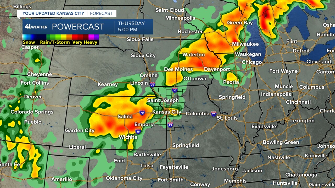
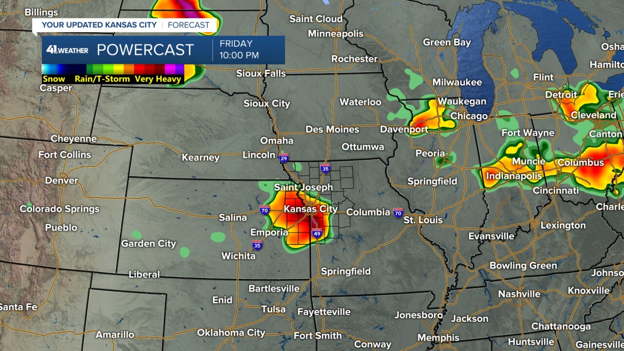
THURSDAY EVENING/NIGHT:
The thunderstorms will start to sag south. This is when we have the highest chance to see flash flooding and strong winds.
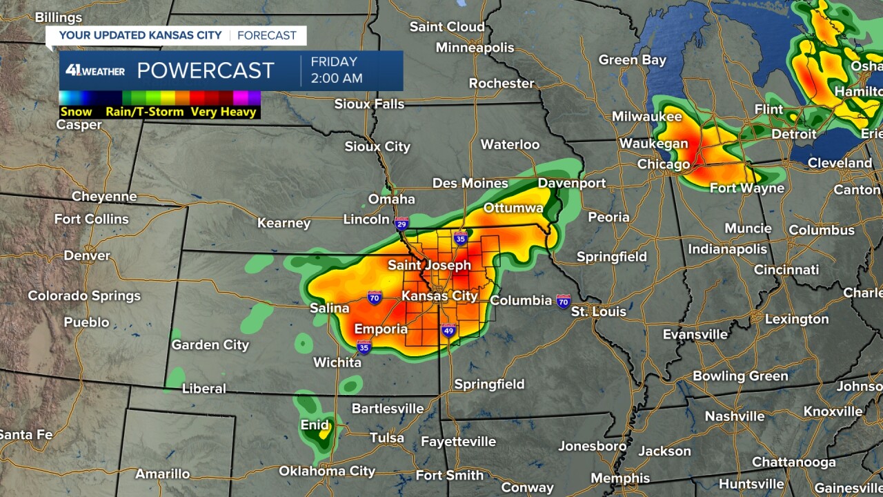
FRIDAY MORNING:
The thunderstorms will wind down and end.
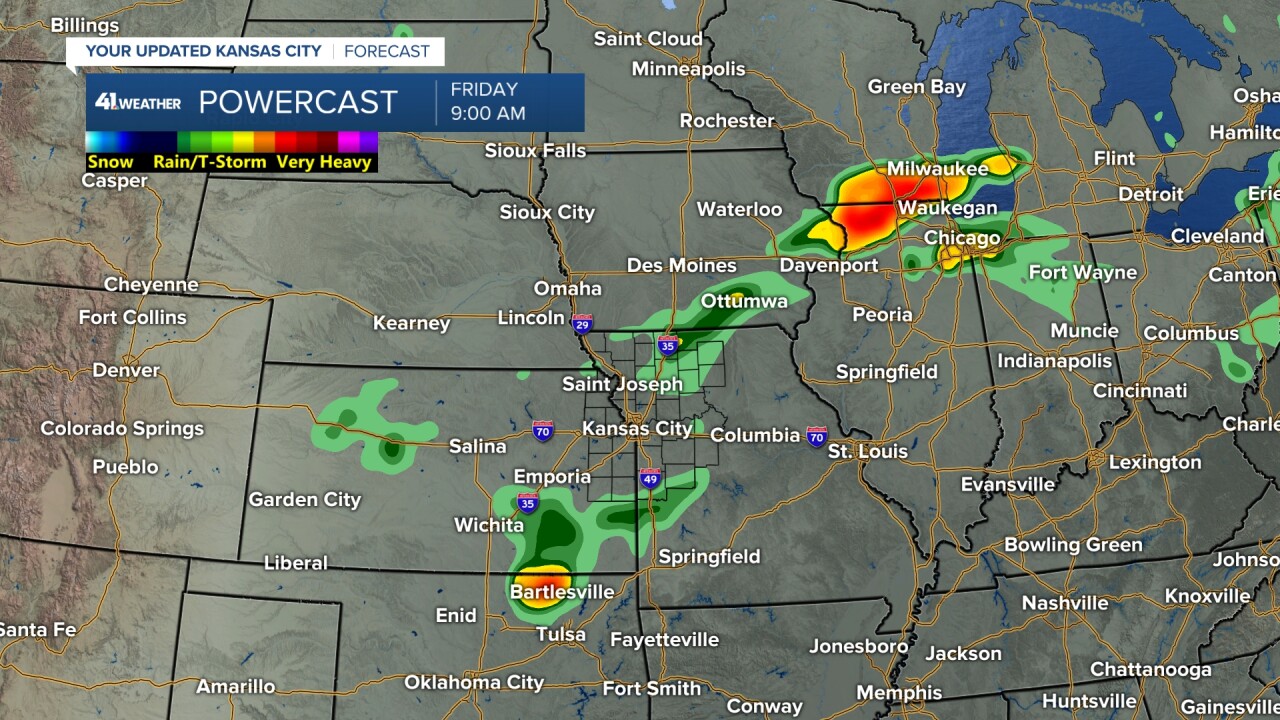
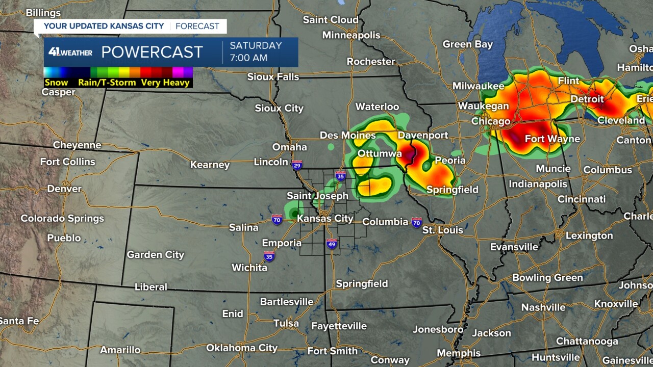
FRIDAY AFTERNOON/EVENING:
New thunderstorms will form. They will form wherever the front and any outflow boundaries are located. This will set up more flash flooding and strong wind threats.
We will see highs in the 80s.
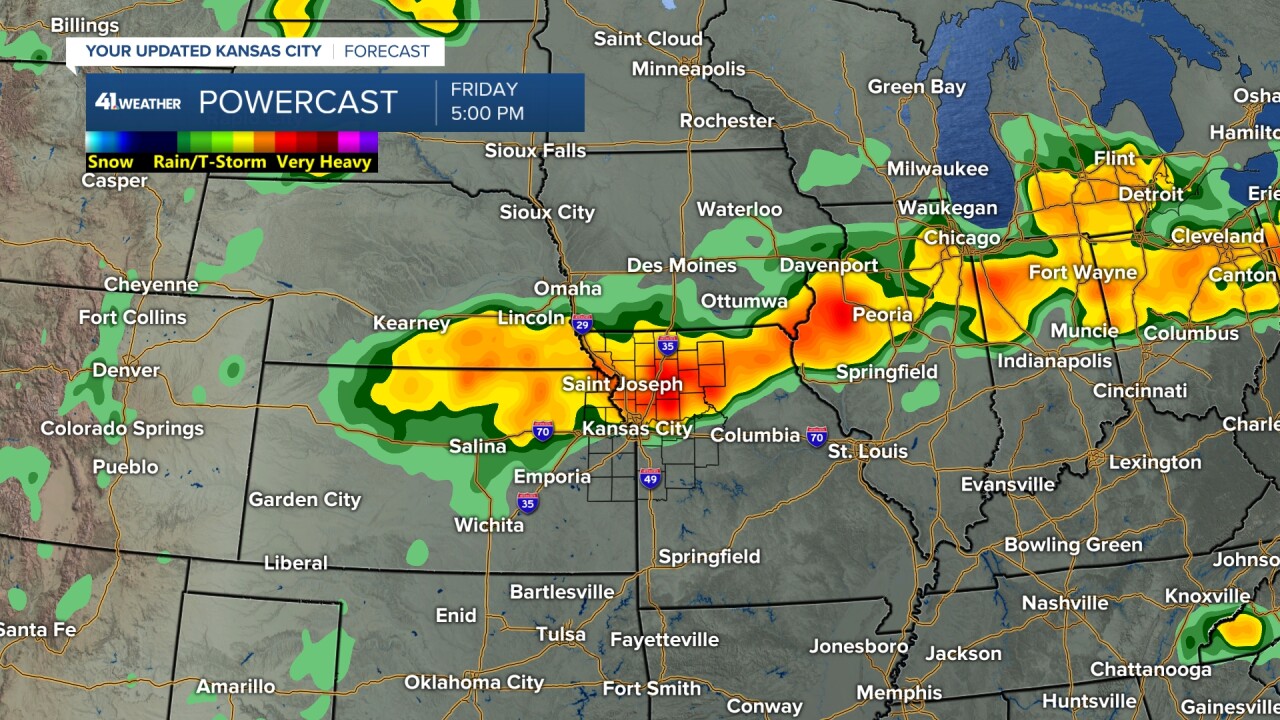
FRIDAY NIGHT:
Thunderstorms will drop south from the zone they form in. These thunderstorms are still a flash flooding threat with some strong winds.
SATURDAY:
The zone of thunderstorms will be shifting north as the heat begins to build back north. Our highs will creep back to the low 90s.
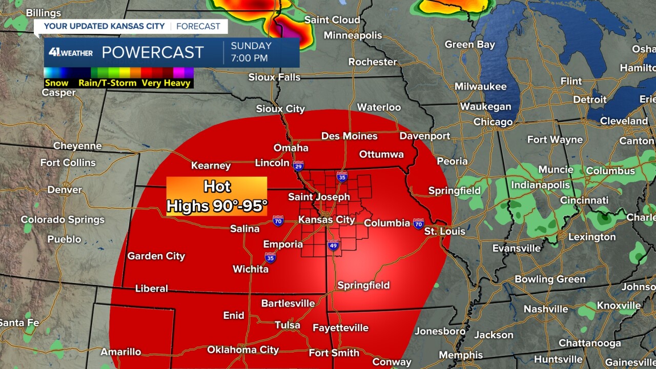
SUNDAY:
We return to where we are starting today. There will be little to no chance of rain, with highs back to 90°-95° and heat indices 103°-110° as the heat dome heads back north.
A stronger cold front and more thunderstorms are likely at the end of next week.
Remember, 6" of flowing water can float an SUV.
"TURN AROUND DON'T DROWN."
Have a great rest of your week and weekend.
Stay healthy.
Stay with KSHB 41, and we'll keep you advised.
—
