


Good Saturday morning, weather blog readers!
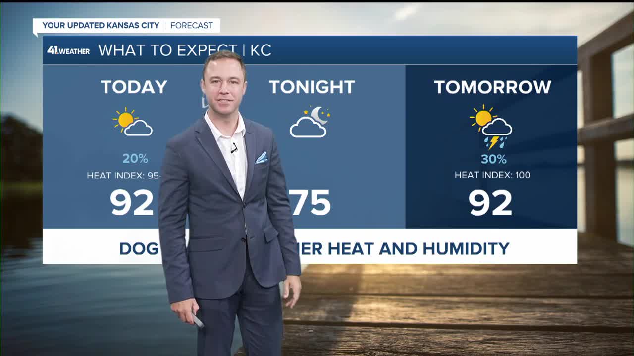
The heat and humidity are sticking around for a few more days, but with pop-up showers and storms trying to break it up in the afternoon.
The biggest concern with any storm that develops this afternoon will be brief heavy rain and gusty winds, especially where storms can tap into a little more instability along a front that slowly tries to move through.
Storm chances today will be highest across northern Missouri and into areas near a cold front, where a few stronger cells could linger into this evening. Even so, this does not look like a widespread severe weather day. It’s more of a scattered, hit-or-miss setup, with some storms capable of producing a quick downpour and a strong wind gust or two.
Sunday brings one more chance of showers and thunderstorms as the front lingers nearby, mainly south of Highway 36 and east of Highway 65. Again, coverage looks limited, but enough to keep a few neighborhoods under the gun for a pop-up storm during the afternoon.
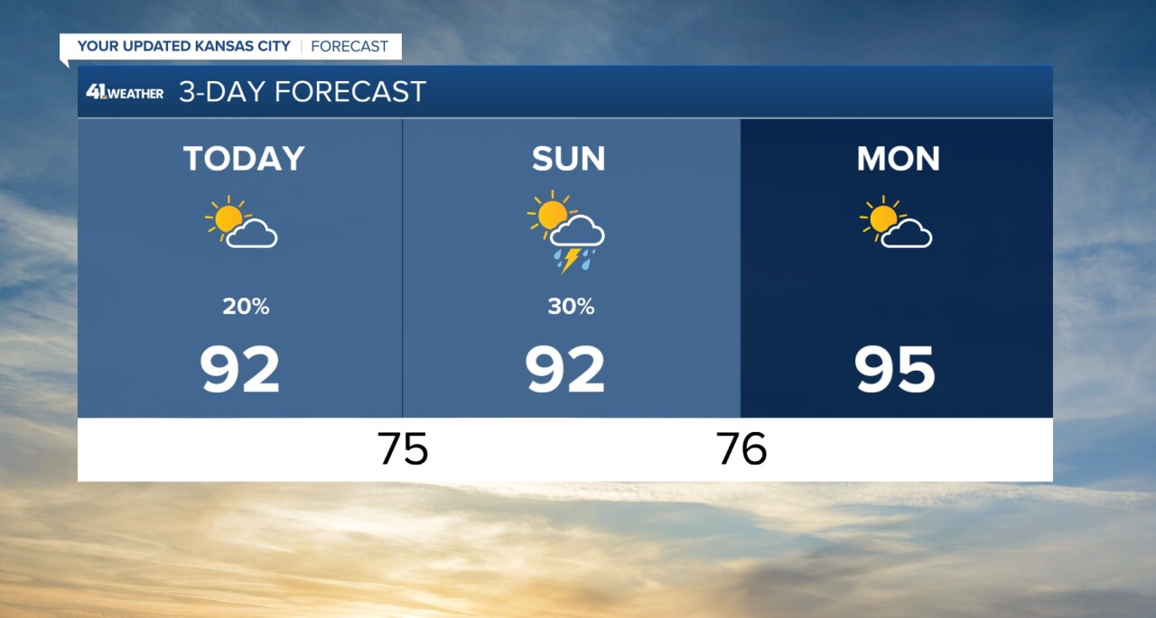
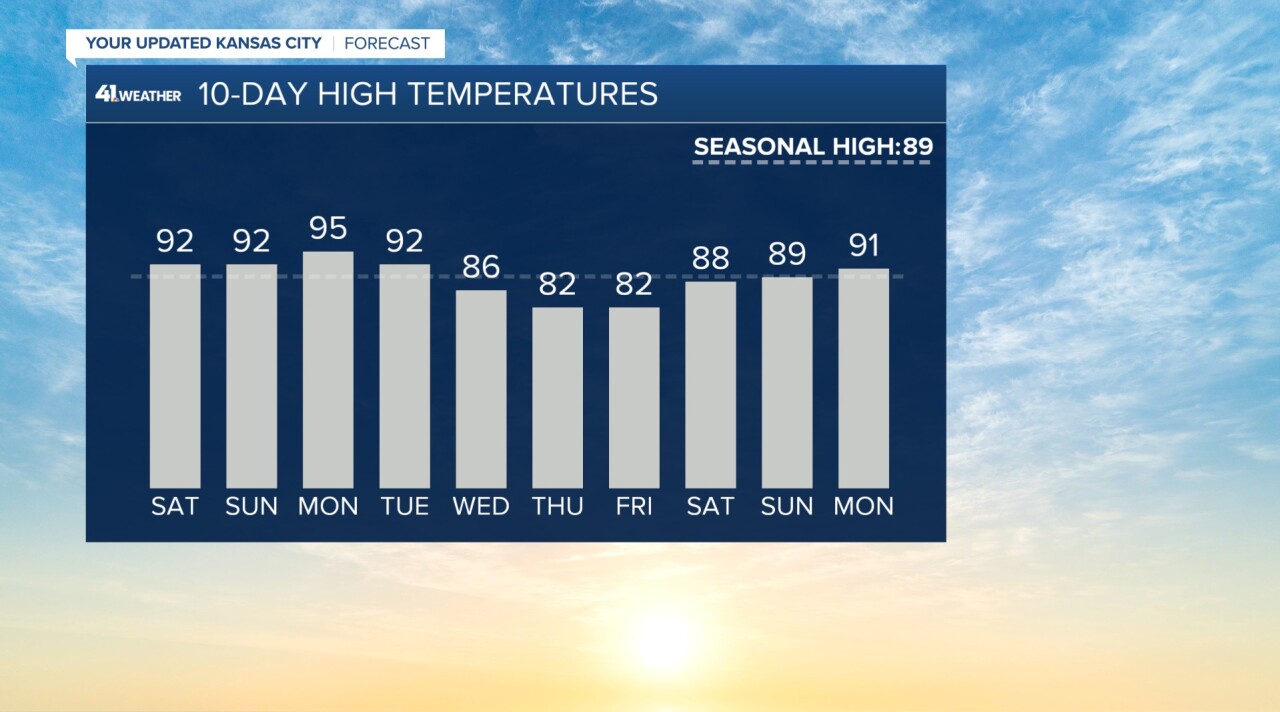
The bigger story is the heat. Temperatures climb into the 90s today and continue to run hot into Monday and Tuesday, with heat indices pushing near or above 100 degrees area-wide.
Monday looks like the peak of the heat, and while a few spots could briefly flirt with advisory-level heat, widespread criteria does not appear likely just yet. This isn't a perfect setup to get high heat. A shower or storm isn't totally out of the question either, so a bit of cloud cover or rain helps reduce the heat.
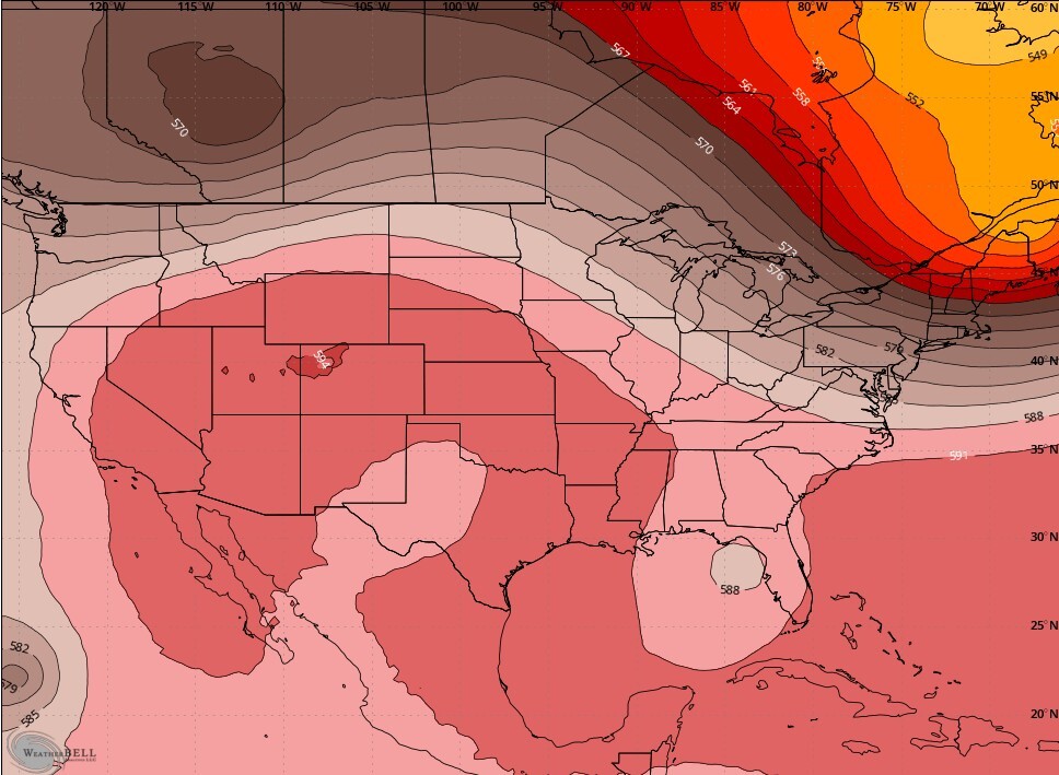
Usually to get very hot temperatures, we need to be fully under an area of high pressure or centered underneath a ridge. That setup gives us very little cloud cover or rain chances. That's just not happening — we're on the edge or the periphery of the high-pressure hot zone. So while it will be hot, outlandish hot temperatures seem unlikely.
Relief is finally on the way by midweek. A stronger front should start to break down the heat early next week, and by Wednesday and Thursday, highs should fall back into the 80s with dew points dropping into the 50s and 60s.
That will bring a much more comfortable feel to the air, though a few late-week disturbances may eventually bring more storm chances back into the picture.
—