


KANSAS CITY, Mo. — Good Thursday, bloggers,
The area of heavy rain we have been talking about that would target locations to the southwest of Kansas City is still ongoing as of early Thursday. But it set up about 50-100 miles farther south than I had thought, so that is why we are not even seeing a drop here.

There are flash flood warnings from Hutchinson to Wichita as rainfall has been 3"-5". If the rain zone had set up 50-100 miles farther north, we would have been in the trace-.50" like I had thought.
I thought the northern edge of the heavy rain would be from Emporia to Ottawa.

This event is causing 2-3 bands of 1"-4"+ rainfall from western Kansas to Arkansas.

After a wet July, it has been a rather dry August around here. Rainfall has been mostly 25% to 50% of the 4.25" average.

We are not in drought conditions as the subsoil moisture is in good shape after the wet July. The topsoil is dry.
If you want to keep the yard green or have a garden, a sprinkler/watering is necessary. Now, farmers want the dry weather for the corn as harvest is around the corner. The soybeans could probably use a drink of water.
Our area looks dry through Saturday, but there is a system to watch for Labor Day weekend that is trending toward being a rain-maker in our area.
Let's go through this.
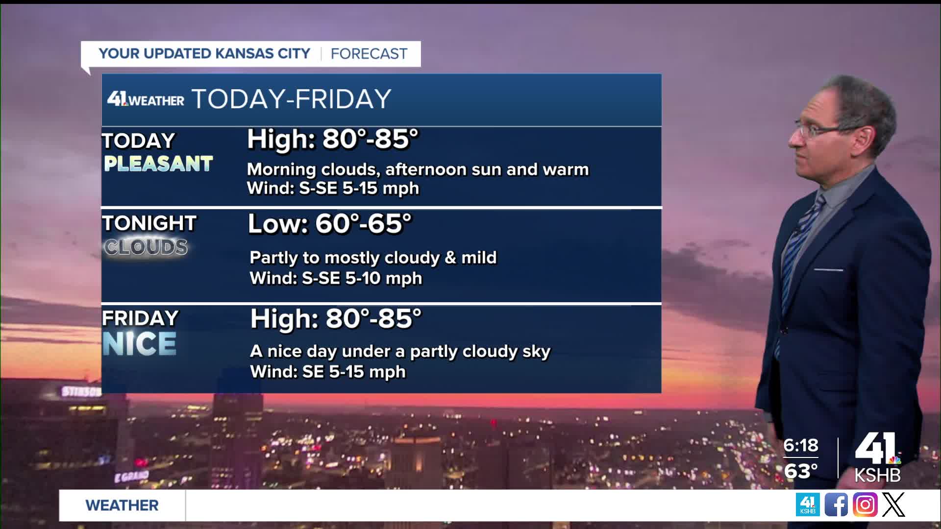
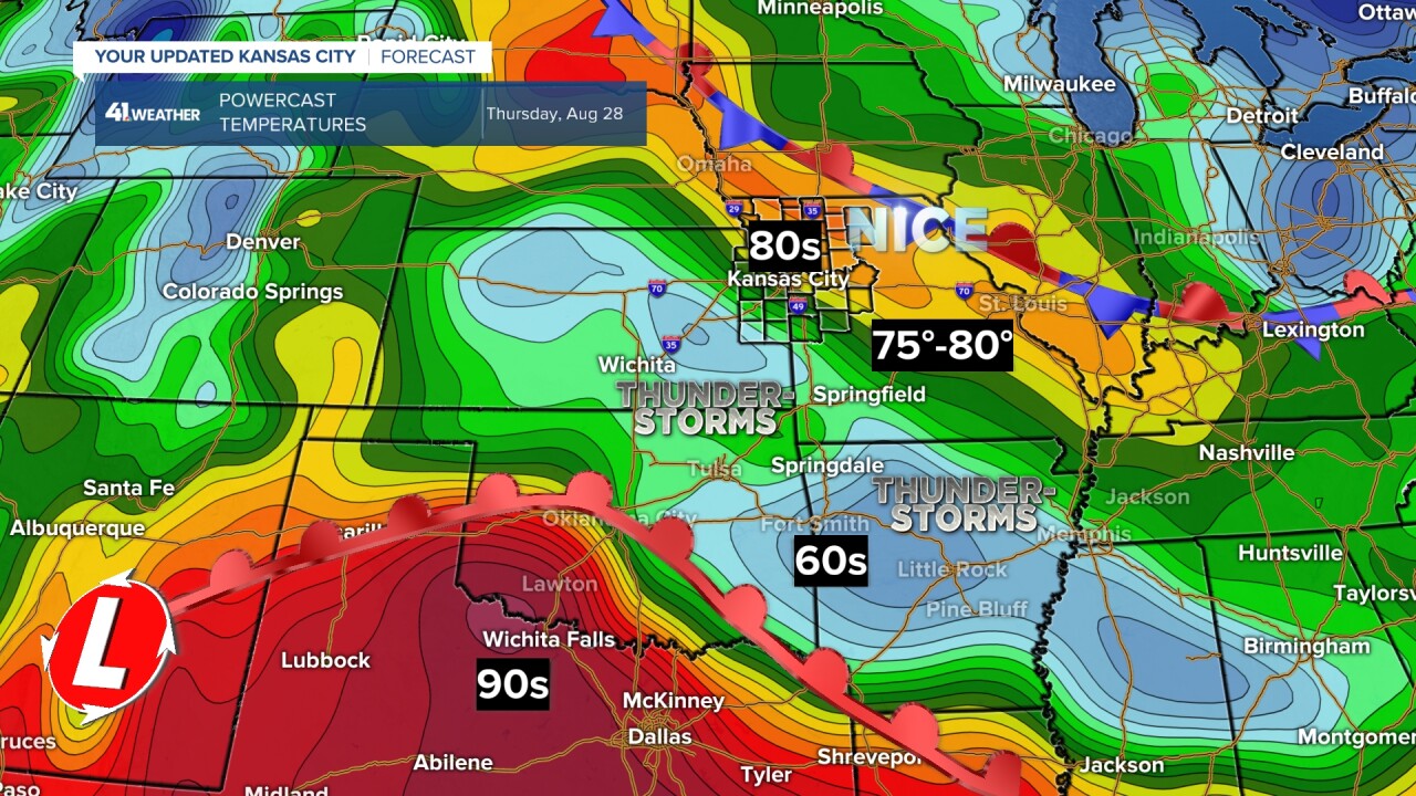
TODAY:
We will see nice weather with increasing sunshine and highs in the 80s. You can see the rain areas where temperatures are in the 60s.
FRIDAY:
It looks good for KC, the Kansas lakes, Lake of the Ozarks and Table Rock Lake as any thunderstorms will be found across southeast Oklahoma to western Arkansas. Highs in most locations will be in the low to mid-80s.

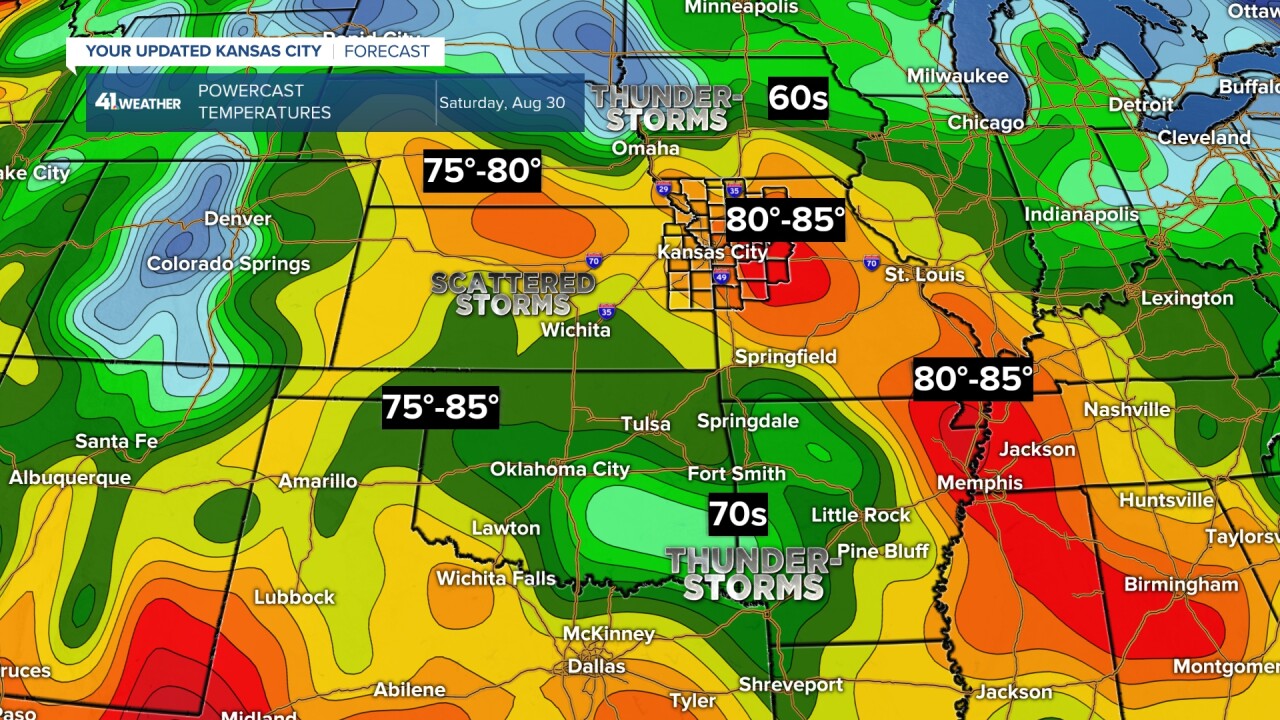
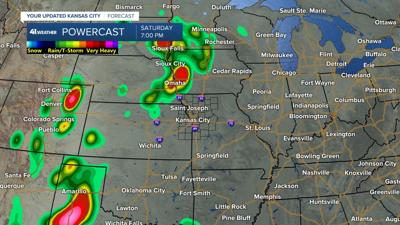
SATURDAY:
It still looks good for KC, the Kansas lakes, Lake of the Ozarks and Table Rock Lake as any thunderstorms will be found across southeast Oklahoma to western Arkansas.
Now, we may see a few thunderstorms form in central Kansas as a system organizes in eastern Nebraska and western Iowa. Highs in most locations will be in the low to mid-80s.

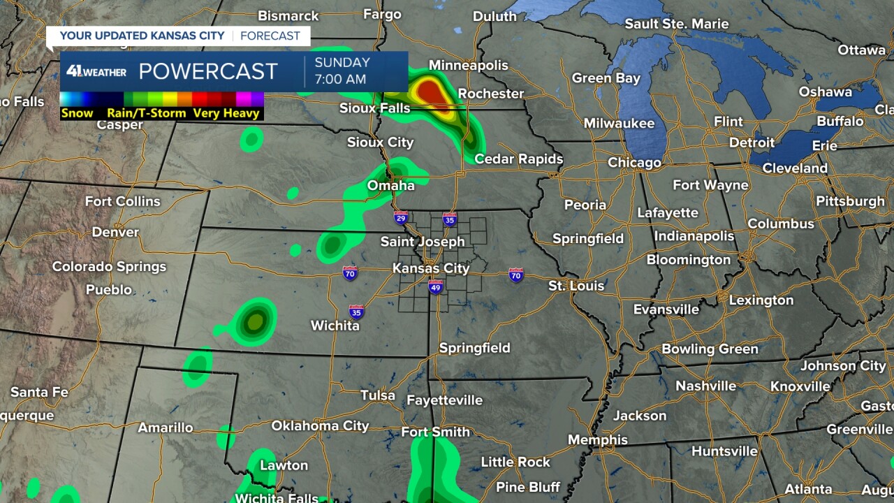
SUNDAY:
The system will begin to track southeast into northeast Kansas and northwest Missouri. This will increase the chance of scattered thunderstorms for the Kansas lakes and KC.
The Lake of the Ozarks and Table Rock Lake may see an isolated thunderstorm. Overall, it looks pretty good into Sunday.
Highs in most locations will be in the 80s, dropping to the 70s in any rain areas.

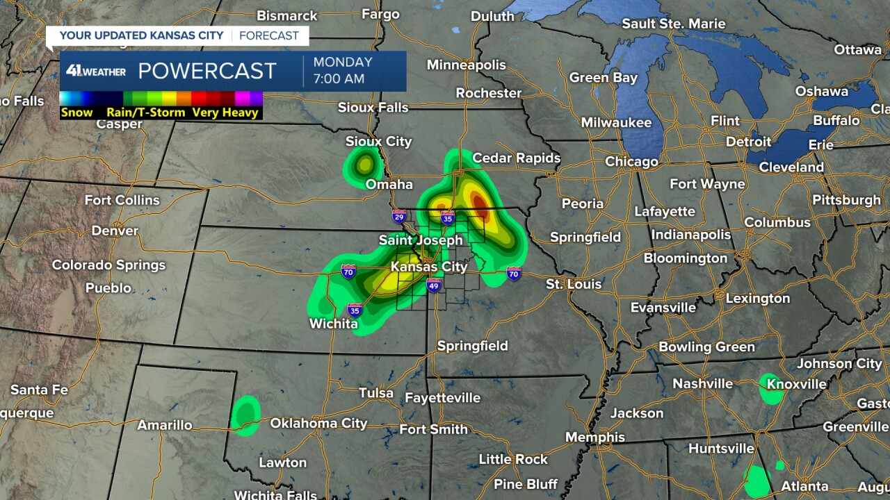
LABOR DAY:
This is when the storm system will track southeast into eastern Kansas and western Missouri. This will increase the chance of seeing periods of rain and thunderstorms for all locations.
Highs will drop to the 70s in most locations.
Now, not all models are showing this storm system to be as organized as this model. But there is a trend on all data that this is possible. We will continue to watch it.


LABOR DAY WEEKEND FORECAST SUMMARY:

Have a great and safe Labor Day weekend.
Stay healthy.
—
