


KANSAS CITY, Mo. — In true December fashion, the first official snowfall of the season is here!
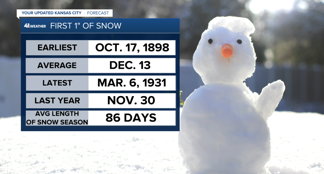
We aren't too far off from last year, as that first 1"+ of snow fell on Nov. 30, 2024. Typically, the Kansas City Metro averages the first 1"+ snow on Dec. 13. We are slightly ahead of schedule.
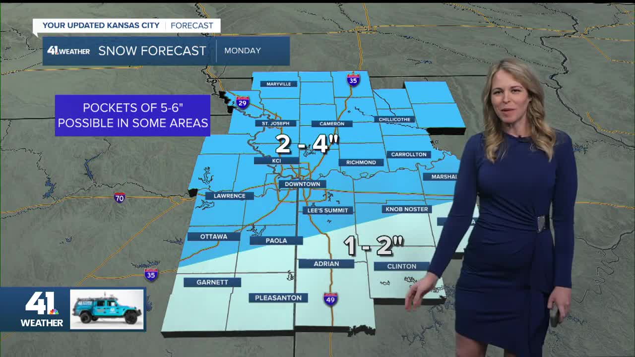
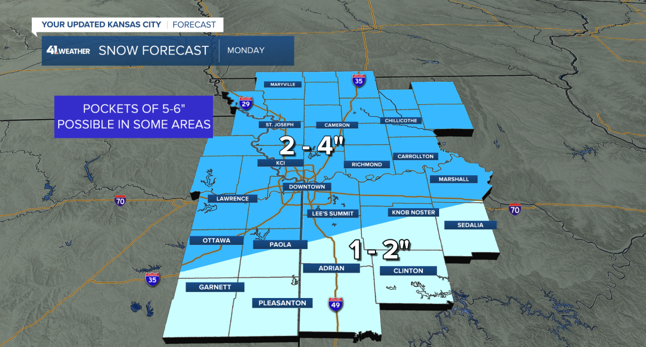
As of early Monday morning, most of the viewing area remained in a winter weather advisory through 6 p.m. Monday; Most locations can expect a few inches of snow.
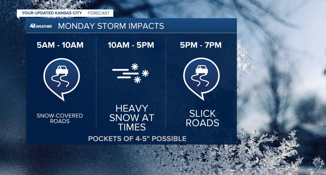
Snow intensity continued to ramp up Monday morning. Roads are slick and snow-covered. There have been several reports of less than 1-mile of visibility across the Kansas City area.
By midday, expect the snow coverage and intensity to peak. At times, there will be periods of heavy snowfall. After 5 p.m., look for snow to diminish from west to east. Roads will remain slick for the evening commute.
By the time this event wraps up Monday evening, most locations will have received 2-4." Keep in mind, there will likely be local pockets of 5-6" of snow. Locations north of Interstate 70 will receive the highest snowfall amounts.
On Tuesday, quiet, cold weather resumes. Below-normal temperatures are here to stay this week.
—
