


KANSAS CITY, Mo. — Good Friday bloggers,
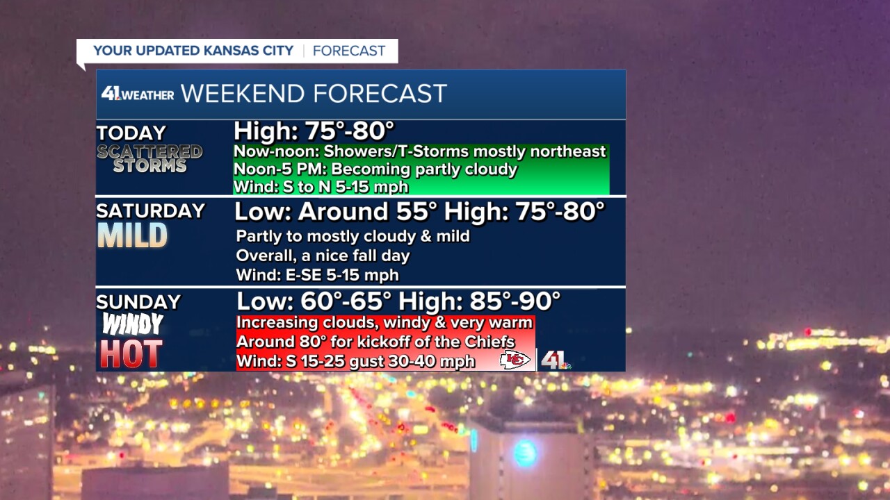
If you are looking for rain on your yard or farm and you live in Kansas City, you will likely have to wait until later Sunday night into Monday. The thunderstorms we have been talking about for this morning are staying 50-100 miles northeast of Kansas City. Now, that being said, there will be a few thunderstorms this morning in Kansas City.
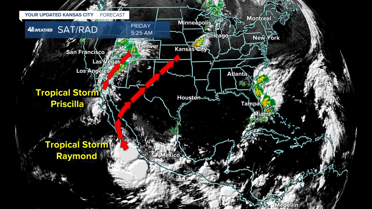
As of 5:30 a.m., you can see the main thunderstorms are crossing north and central Missouri as all the rain is tracking southeast. You can also see a few thunderstorms are trailing back to Kansas City. So, this morning a few thunderstorms will cross the city, but the beneficial rain is staying 50-100 miles northeast of Kansas City.
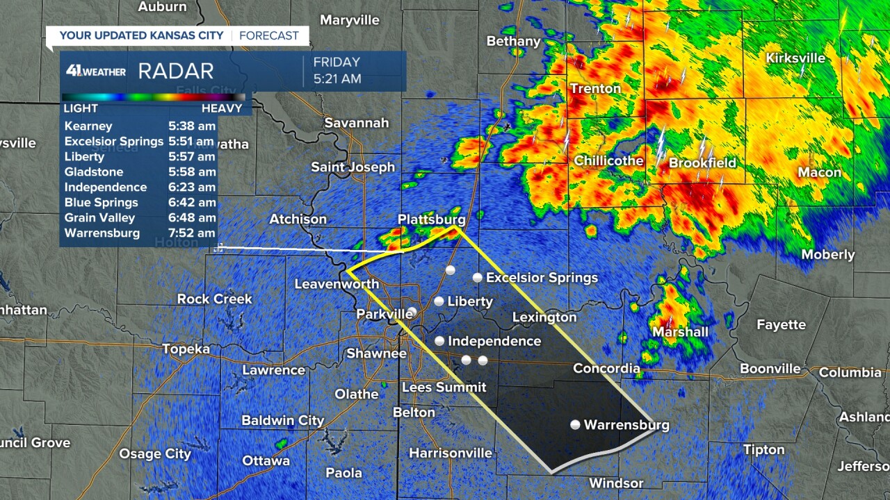
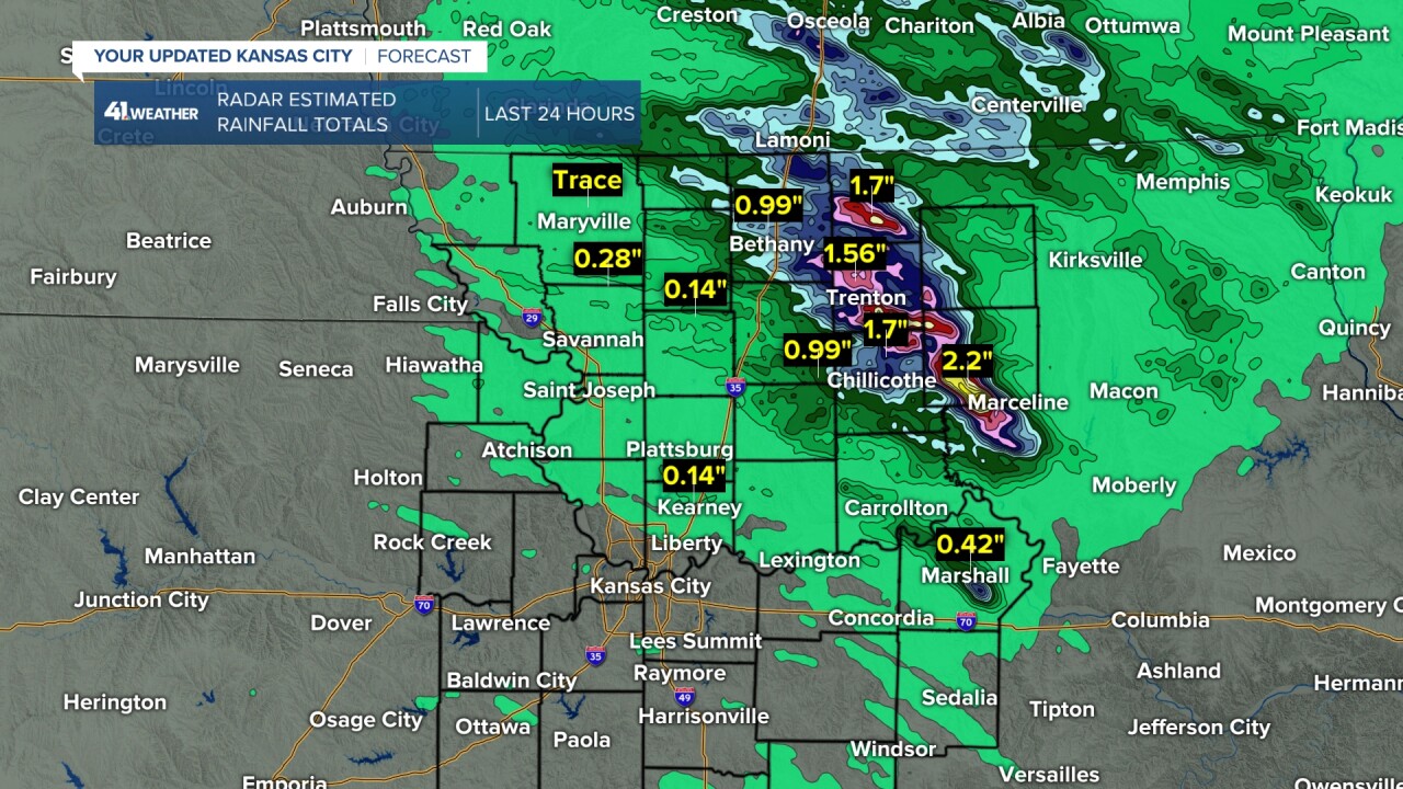
Rainfall has been 1"-2" in a line from Trenton to Marceline, Missouri.
Later today, the best chance to see any T-Storms will be in south and southeast Missouri as the morning system heads that way.
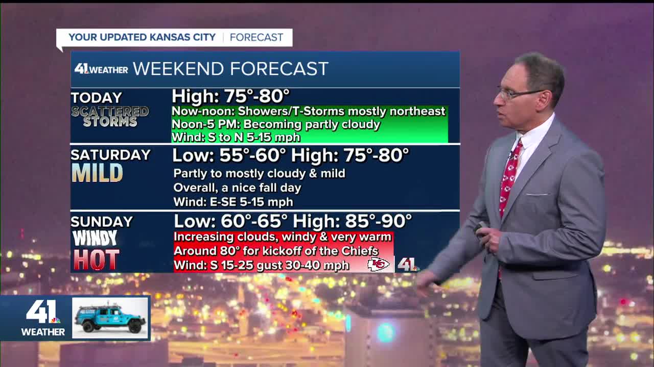
A weak cold front will drift in, making for a nice afternoon with highs in the mid to upper 70s and a light wind. The evening will be very nice with temperatures dropping to the 60s.

SATURDAY:
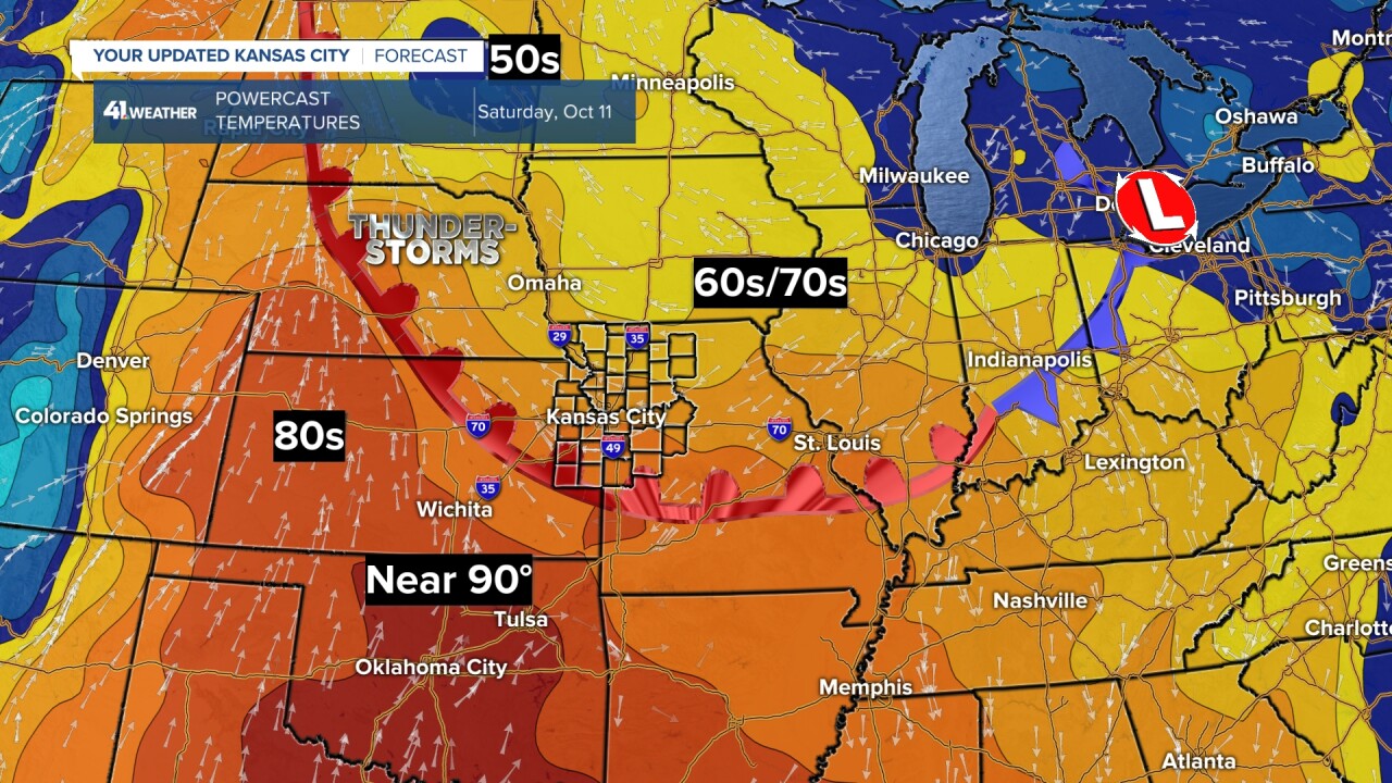
It will be a nice day as the cold front from today becomes a warm front. We will be on the cooler side of the front, which means a partly to mostly cloudy sky with highs 75 to 80. The best chance of thunderstorms will be way north across northern Nebraska to the Dakotas. The flow above the warm front in our area is not set up to produce thunderstorms.
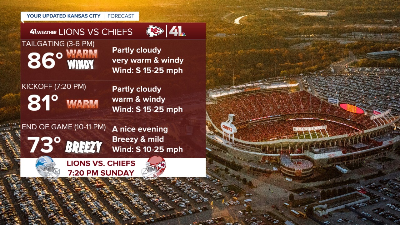
CHIEFS SUNDAY:
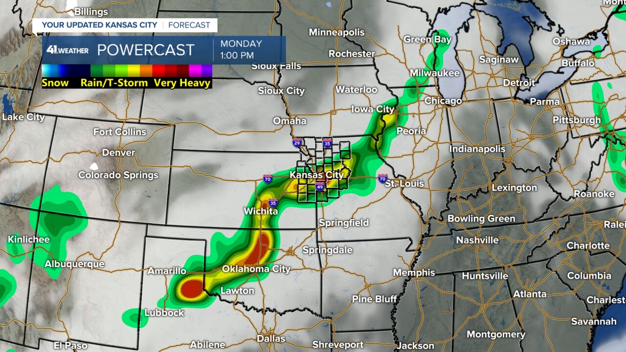
It will be windy and very warm as the warm front surges north. We will see increasing clouds as moisture from the remnants of what is now tropical storm Raymond in the Pacific Ocean streams this way. We are also tracking a cold front approaching from the western Plains.

This is where tropical storm Raymond is early Friday morning. It is south of Baja, California. Tropical Storm Priscilla is going to bring flooding rain today and Saturday to the southwest USA.
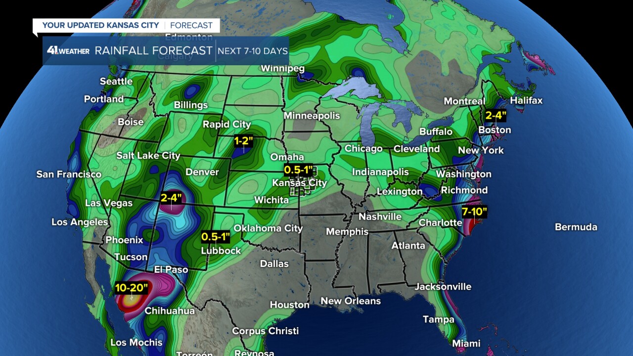
You can see the two paths of rainfall from Priscilla and Raymond on the rainfall forecast map for the next seven days. Yes, this is less than yesterday, as it does not look as wet next week after Raymond exits. It could still change as the weather pattern is undergoing big changes.
So, as of this moment, we may see .50"-1" from the remnants of Raymond and other possible chances next week. This map does not include the rain from this morning.
When is this chance of rain from Raymond? The answer is from around midnight Sunday night after the game to Monday afternoon.
Here is the weekend weather forecast summary:
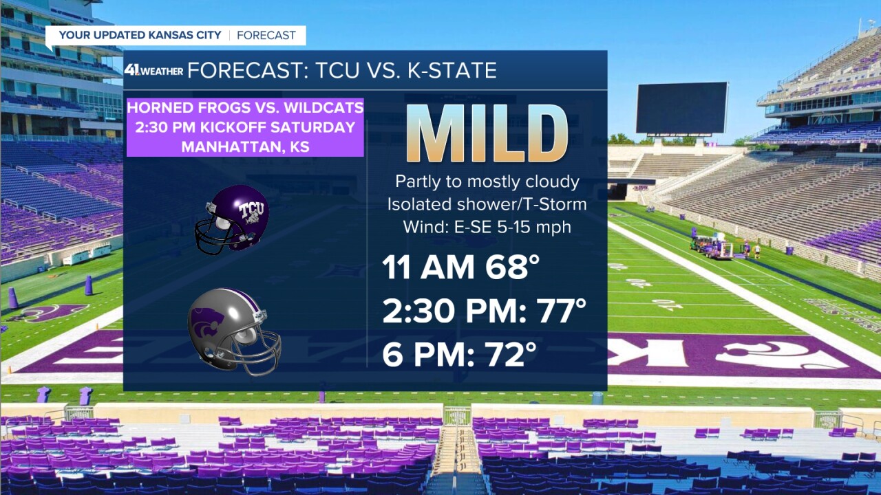
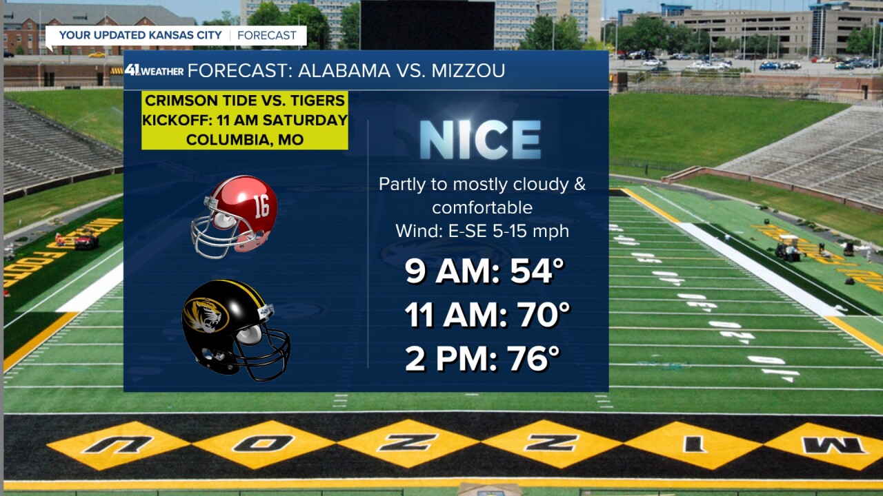
There is not much change to the forecast for the big football games this weekend in Manhattan, Kansas, Columbia, Missouri and at GEHA Field at Arrowhead Stadium. The weather looks pretty good for these games.
It will be dry, warm and breezy for the Jayhawks in Lubbock, Texas, Saturday evening. Temperatures will drop from the low 80s to mid-70s.
Have a great weekend
GO CHIEFS!
