


KANSAS CITY, Mo. — Good Tuesday, bloggers,
UPDATE:
It looks like there was a microburst with around 60 mph winds between Roeland Park and Kansas City, Kansas, around 5:45 a.m. There are some neighborhoods that have downed trees and power lines.

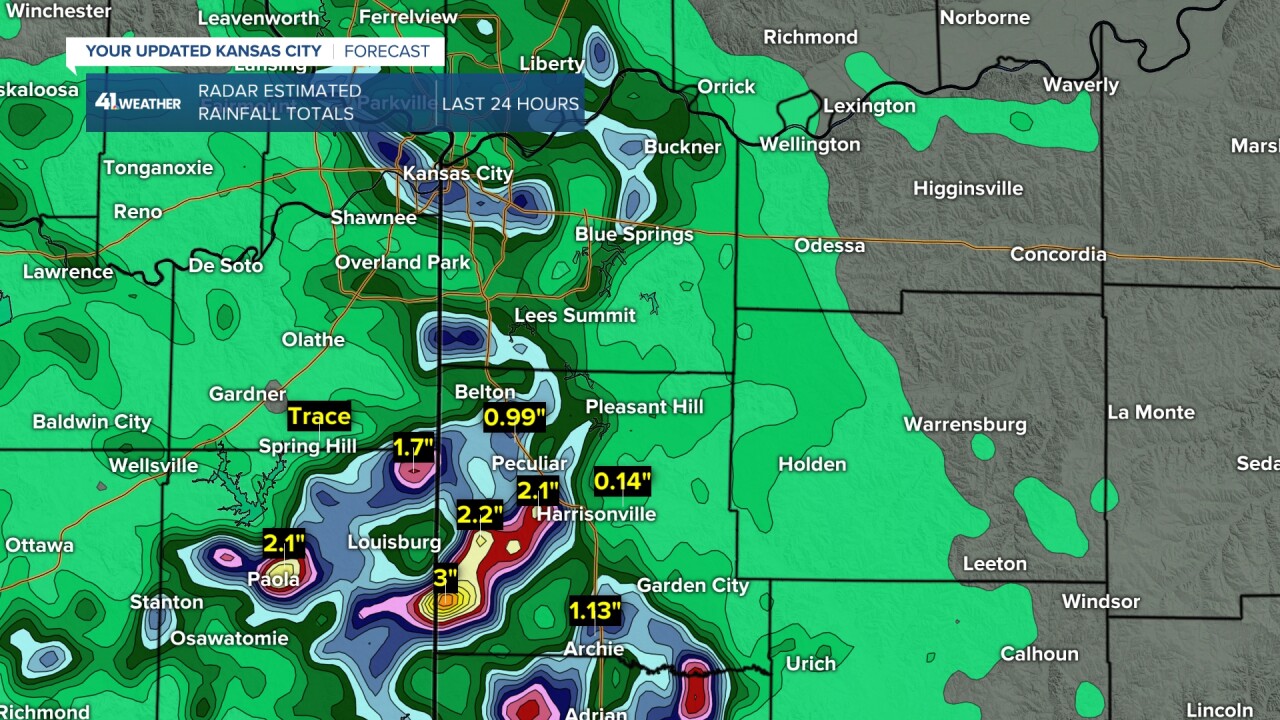
RAINFALL THIS MORNING:
Rain around the area ranged from none to a trace to as much as 2"-3". In KC, the heaviest was where the microburst occurred. You can see 1"-1.50" amounts from south of Parkville to south of downtown KC.
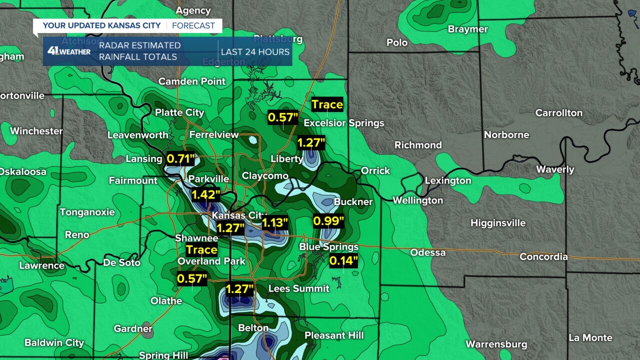
The heaviest rain was south of KC from around Paola to Harrisonville, where there were pockets of 2"-3" of rain. The thunderstorms became less strong but increased in coverage to a larger area of heavy rain.
We had four straight days with highs of 95° or higher between Friday and Monday.
Now, the heat wave is ending as we are having scattered thunderstorms this morning with a disturbance from the west. The cold front may bring new scattered thunderstorms this afternoon.
We had quite a lightning display with the thunderstorms this morning. There was a zone from around KC to Emporia, drifting southeast.


This is just the first cold front we are tracking the next five days.
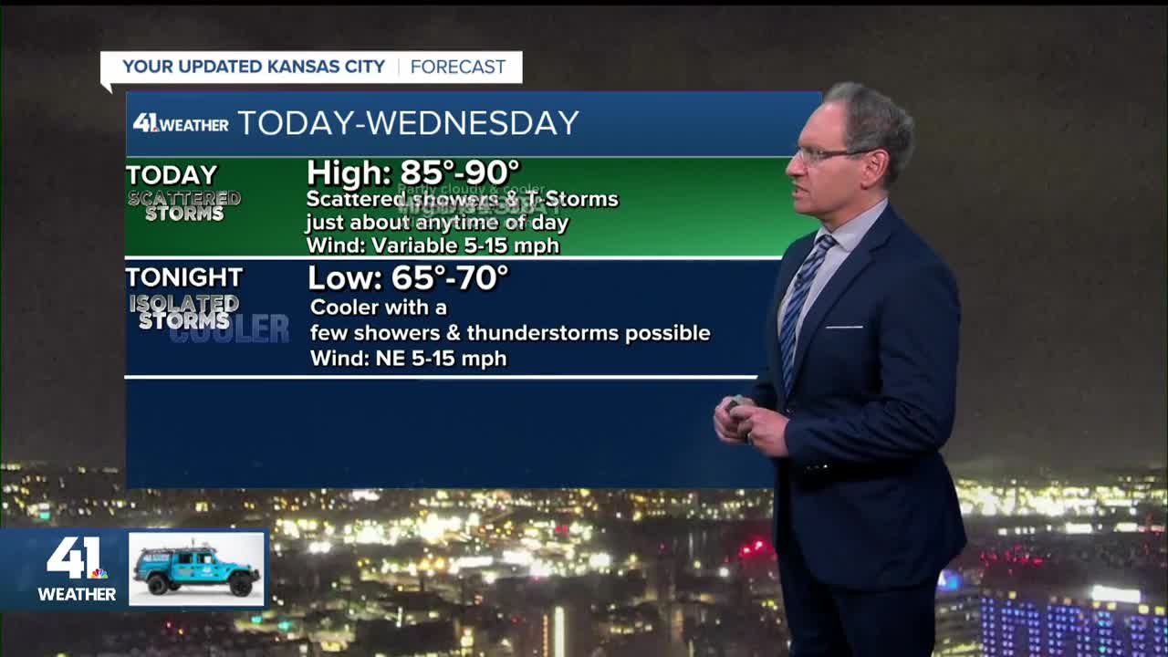
TODAY:
After the morning thunderstorms exit, we may see new scattered thunderstorms this afternoon as we track the first cold front.

WEDNESDAY-THURSDAY:
We are looking at nice summer weather with highs in the mid to upper 80s, lows in the 60s and lower humidity.

The front coming through today will become a warm front Thursday to our west, as you can see highs in the 90s across much of Nebraska.

FRIDAY-SATURDAY:
This is when we will see the second cold front move in from the northwest as the newly formed warm front approaches from the west. This setup will generate more scattered thunderstorms in our area Friday night-Saturday.
Hopefully, this will happen after the game. But we will have to watch this.

Have a great rest of your week.
Stay healthy.
—
