


KANSAS CITY, Mo. — Good Wednesday, bloggers,
We are in another period today through Friday where we will see several chances of rain and thunderstorms. It is looking like this period of active weather will set up like so many of its predecessors.
This means some will see very heavy rain and flash flooding, while others will hardly see any rain.
Let's go through this.
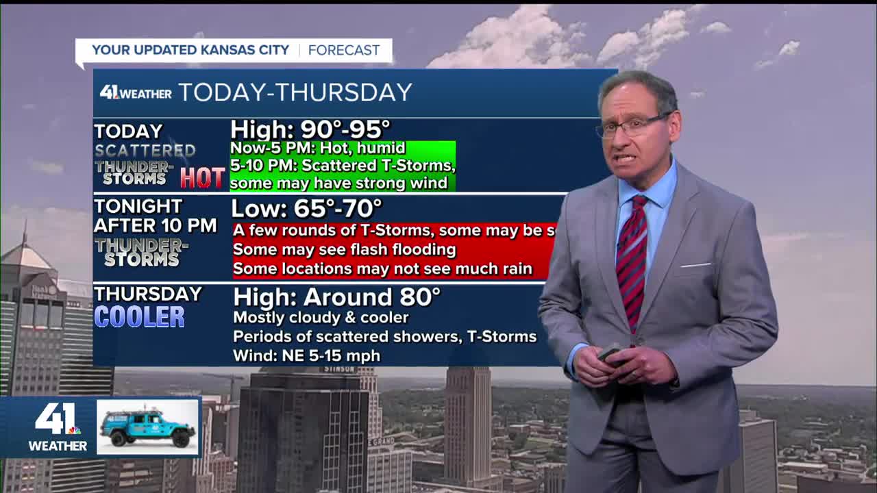
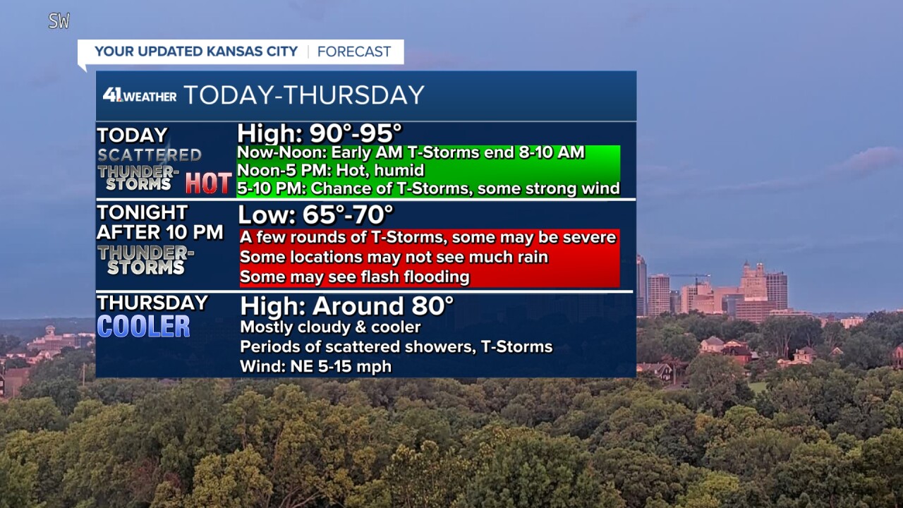
TODAY (NOW-NOON):
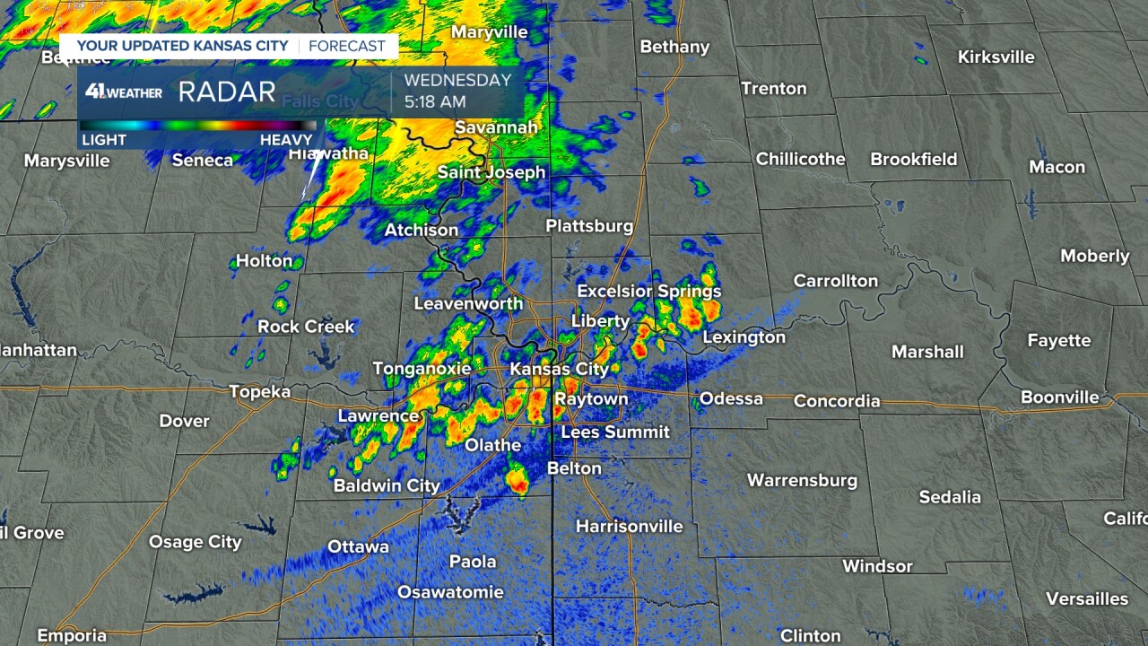
We had an outflow boundary (the blue line on radar below) move through this morning. It is like a mini cold front as it is the leading edge of rain-cooled air.
This boundary has forced thunderstorms across Nebraska and Iowa to form south. But as the thunderstorms form south, they are decreasing in coverage.
After 10 a.m., most of the rain will have dissipated. By noon, it will become partly cloudy, warm and humid.
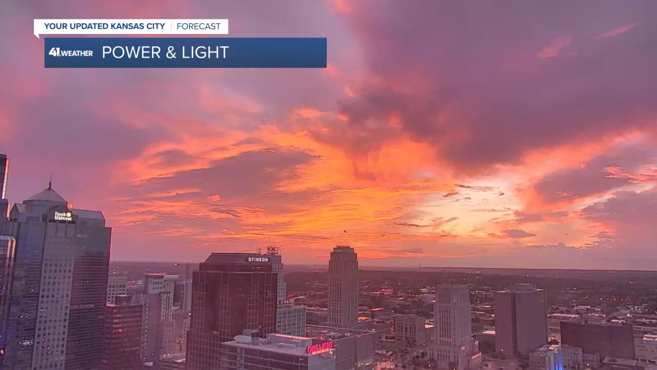
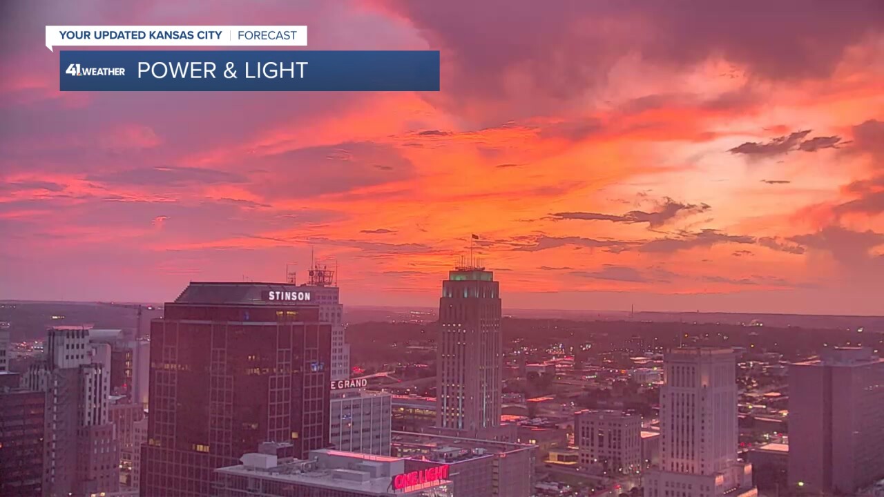
The decreasing thunderstorms did help create a beautiful sunrise, with the sun shining on a variety of clouds.
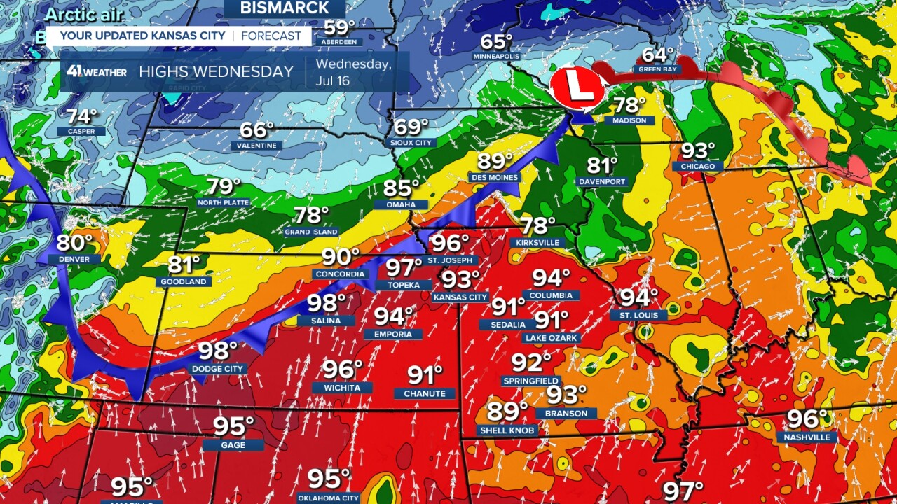
TODAY (NOON-5 p.m.):
It will become hot and humid as we have a setup that is conducive to widespread rain and thunderstorms. A slow-moving cold front will be heading south as the flow aloft will be almost parallel to the front.
Highs here will be in the low 90s, and it will be only in the 60s across northern Nebraska.
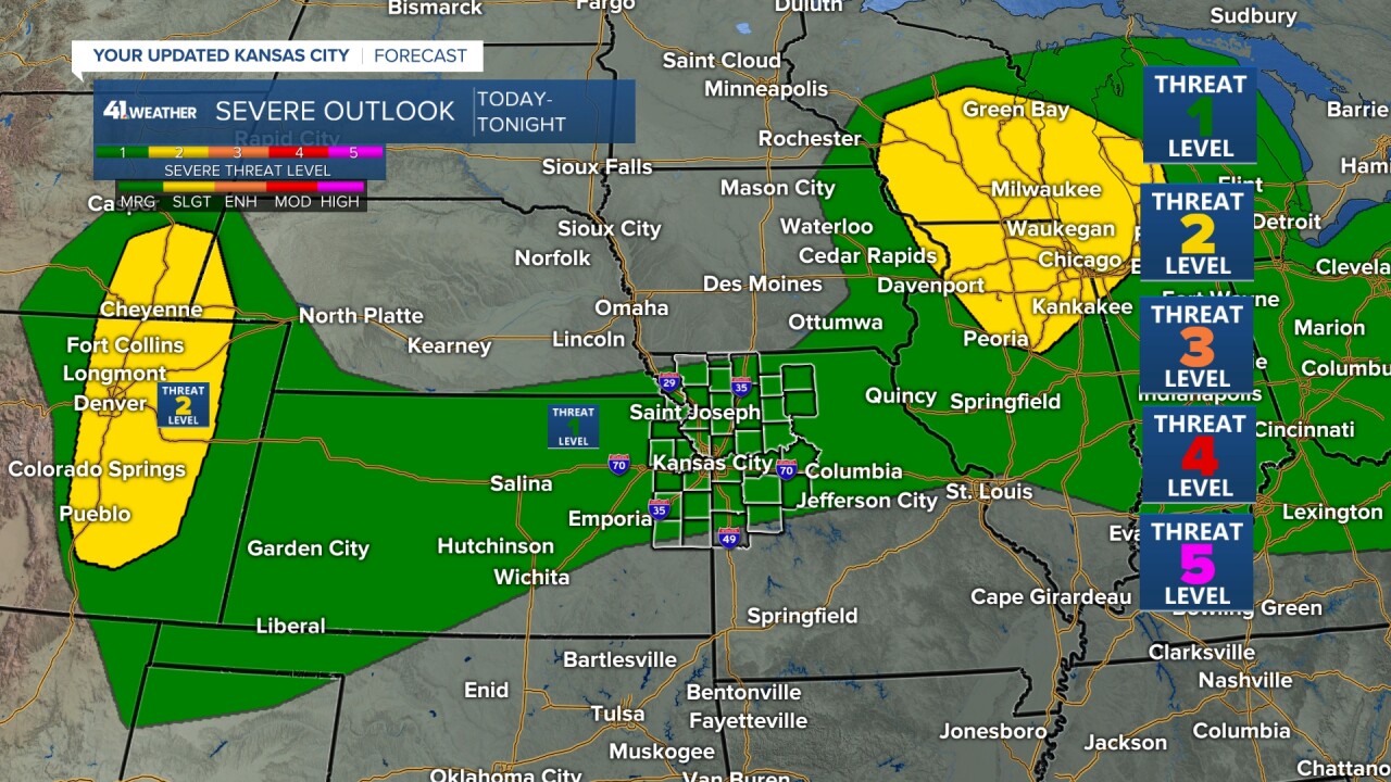
New thunderstorms will likely form on the front after 5 p.m. We are in a level 1 of 5 risk of severe weather, as some thunderstorms may contain strong winds.
The best chance to see severe weather is before midnight.
TODAY (5-10 p.m.):
We will see at least scattered thunderstorms form on the front. It is these thunderstorms that may produce strong winds.
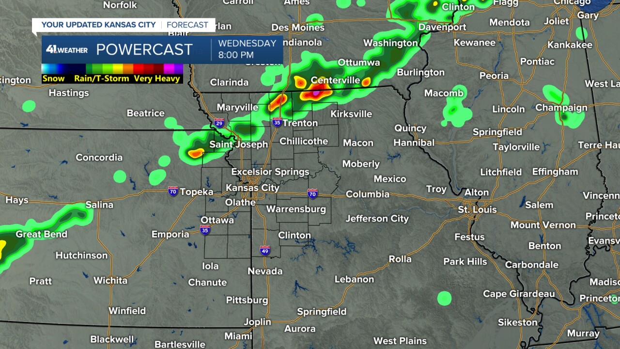
TONIGHT (10 p.m. to 3 a.m.):
We will likely see a large area of rain and thunderstorms form along and north of the front. The strong wind threat will shift to a flash flooding threat.
Now, you can see this heavy rain is not hitting all locations. This data shows most rain north of Interstate 70.
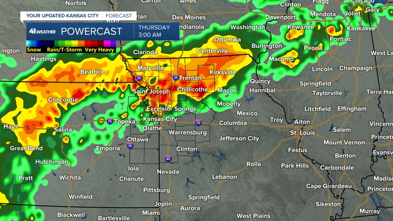
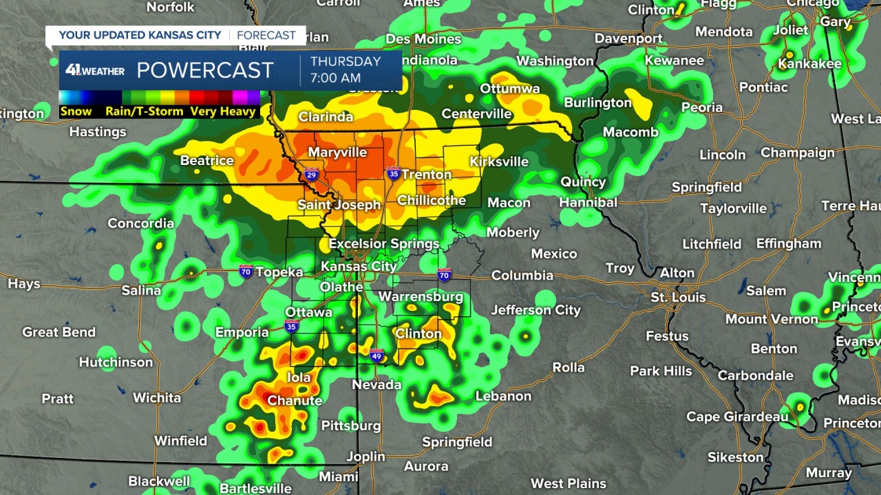
THURSDAY (3-7 a.m.):
The large area of rain/thunderstorms continues across northern Missouri as new scattered thunderstorms form south. If you look closely, the driest areas south of I-70 in Kansas City are not getting much.
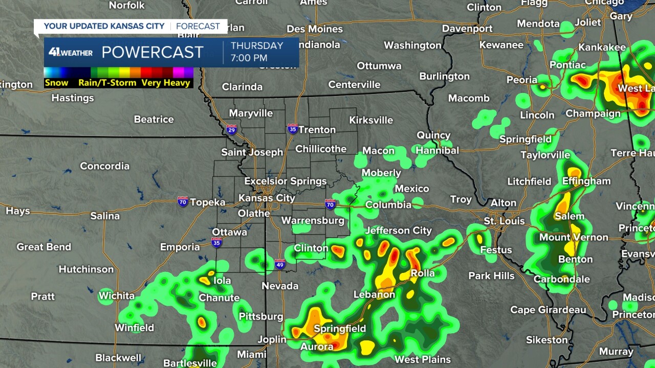
THURSDAY (7 a.m.-7 p.m.):
We will see periods of scattered showers and thunderstorms. The coverage will be highest during the morning.
Now, all locations will be much cooler as we see highs around 80°. The humidity will still be high.
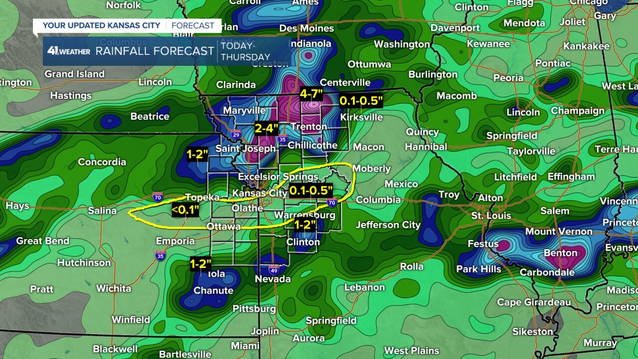
RAINFALL FORECAST (TODAY-THURSDAY):
This data is showing a rainfall forecast that we have become used to. The areas that have seen the most rain, such as northern Missouri, southeast Kansas and southern Missouri, see the most rain. Amounts of 2"-7" are possible.
The locations that have seen the least rain, such as south of I-70 in KC, see the least rain. Amounts may struggle to .50".
Now, could this change? Absolutely! But until we see evidence that it will change, this is the forecast to go with.
Tonight could be the night it changes. We can hope.
There is a chance of scattered thunderstorms again Friday. But after that, rain chances go down as temperatures go up.
Next week, we may see several days with highs around 95° and little rain. Hopefully, your yard or farm gets the rain it needs.
WEATHER FORECAST SUMMARY:
Have a great day and rest of your week.
Stay healthy.
—
