


KANSAS CITY, Mo. — Stormy summer weather will take hold this week, with severe storm chances and high heat forecast.
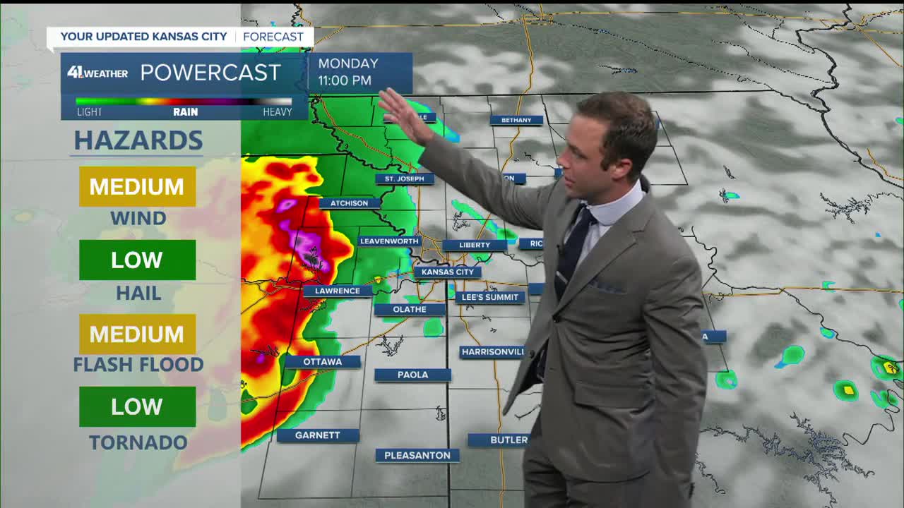
Monday night
While there is some uncertainty about when storms will arrive, I have high confidence that storms will occur.
Storms will form west of Kansas City on Monday afternoon/evening and move west with time. Storms may arrive in eastern Kansas as early as 10 p.m. or as late as 1 a. m. with the threat of damaging wind gusts, brief tornadoes, and flash flooding. Storms may also produce hail, but it's unlikely to be large enough to be damaging.
We're currently split between a level 2 and 3 threat of severe weather.

Once storms move east of the Kansas City metro, they will likely weaken but may still produce severe wind gusts.
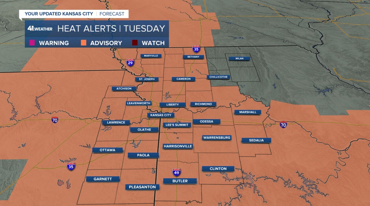
Tuesday
A few showers or storms may linger into Tuesday morning as our focus shifts from storms to sultry conditions.
Heat indices on Tuesday afternoon may reach 100° to 110°, so a heat advisory is in effect from 12 p.m.-10 p.m.
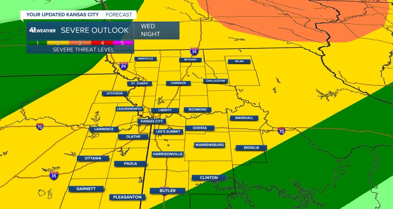
Wednesday Night
As the hot and humid conditions continue for the rest of the week, more severe storms are possible. There is a level 2 and 5 threat for storms that may form after 7 pm
Look out for updates on our website and on my social media pages @WesWeather
