


KANSAS CITY, Mo. — Good Monday, bloggers,
I am not a big fan of repeating myself, but when it comes to rain in KC, I am forced to. We need rain.
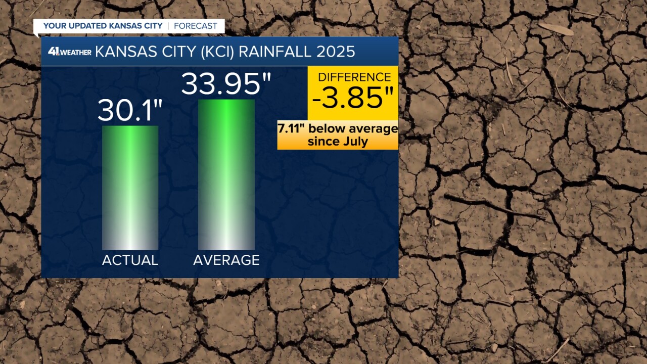
We are now over 7" below average rainfall since the end of July. We are getting close to 4" below average for the year.
If it were not for the very wet June and July, where we were 6" above average, we would really be in need of rainfall.
There has been rain during the last 7 days around KC with amounts 1"-2" from Emporia, Kansas, to Maryville, Missouri, then southeast to south of Marshall, Missouri.
The KC area has seen a trace to 0.25" with a few sparse 0.50" amounts.

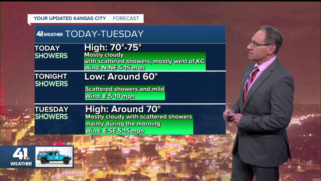
TODAY:
We have a setup for decent rain today and Tuesday as a front is stalled in the area with moisture streaming in from the southwest.
However, the upper-level flow is not really set up for widespread rain, and a ridge will be building in, so most of the rain will get pushed to the north and west.
Highs will be in the low to mid-70s.

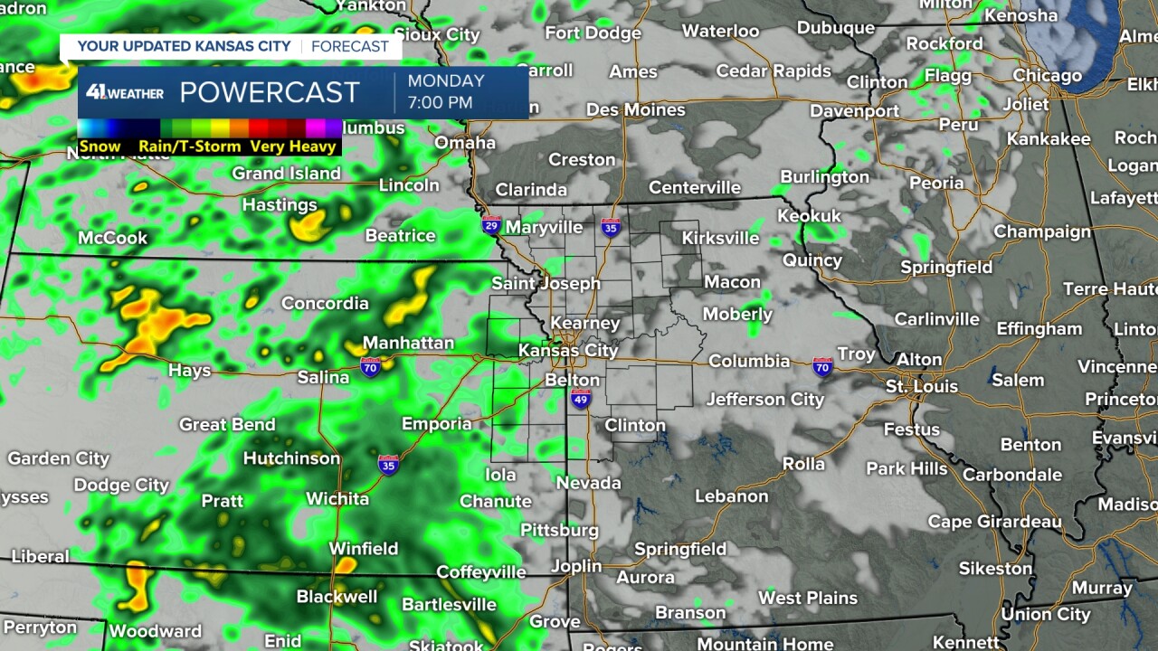
You can see a stream of rain showers and a few thunderstorms from eastern Kansas to the southwest U.S. by afternoon.

When you look closely, the rain is just south and west of KC, and it is moving northeast. But...

By 7 p.m., it refuses to shift east. It is moving northeast but falling apart as it gets to KC and increases to the west.
TONIGHT:
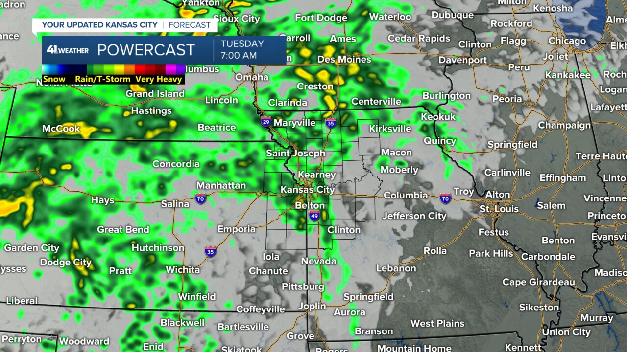
If KC is going to see any rain, it will be tonight as the eastern edge of the main rain expands east a bit.
Lows tonight will be around 60°, which is 10-15 degrees above average. We will talk temps below.
TUESDAY:
The rain zone begins shifting north as the front in the area today begins to shift north.

Highs will be around 70°, but low to mid-70s if there are fewer clouds.

WEDNESDAY-THURSDAY:
The 80s return as our unseasonably warm weather continues under a partly cloudy sky. Lows will be in the 60s.
Now, the record highs these days are 91° and 90°, respectively. Keep in mind, the average high is in the upper 60s with the average low in the upper 40s.


FRIDAY:
A cold front will approach and move through either Friday or Saturday. It should bring some showers and thunderstorms.
It will also drop temperatures to about where they should be for this weekend. That means highs will be in the upper 60s to low 70s.
It is looking like a very nice weekend, including Sunday for the Raiders vs. Chiefs game.

The first 12 days of October have an average temperature of 69.9°. This is the second-warmest October in recorded history, so far.
We do not see anything that will reverse this trend at this time.

Have a great week ahead.
Stay healthy.
—
