


KANSAS CITY, Mo. — Good Tuesday, bloggers,
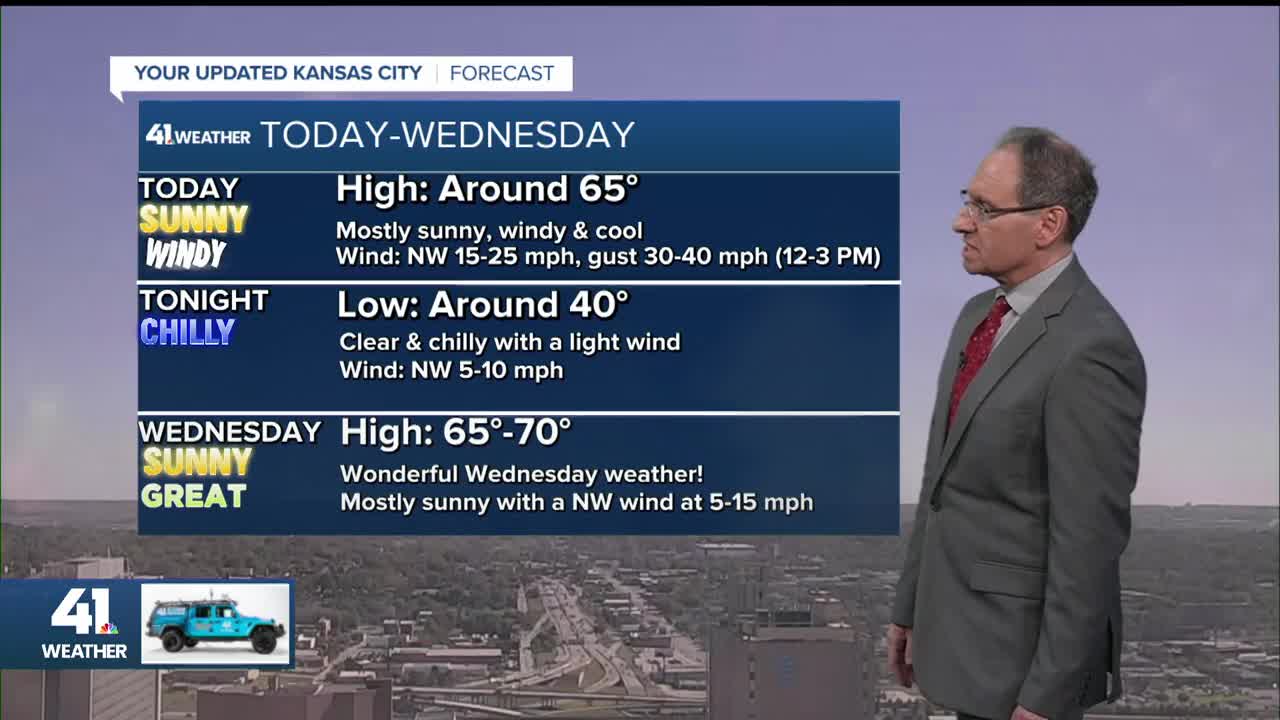
Today through Thursday will see abundant sunshine with highs in the 60s and lows around 40. Some lows will be in the upper 30s, and far northern Missouri may see some patchy frost.
Today will see windy conditions with northwest winds 15-25 mph. There will be gusts to 30-40 mph between noon and 3 p.m.
Friday through Monday, we will be tracking two storm systems. They will try to bring rain to our area.
The first system is now spinning off the southern California coast with little to no moisture.

You can see this better on the upper-level flow at 18,000 feet, which is the graphical version of the satellite. There is also a big trough in the Great Lakes, and we will be on the windy southwest side of this system today.

The first system we are tracking will move from off the California coast on Wednesday to southern Colorado on Friday. This puts our area in southwest flow.
This would bring the rain north, but you can see a dry, northern branch to the flow north of Interstate 80. The northern branch will determine how far north the northern edge of the rain will travel.
Right now, we are in the wetter southern branch, but it is close.
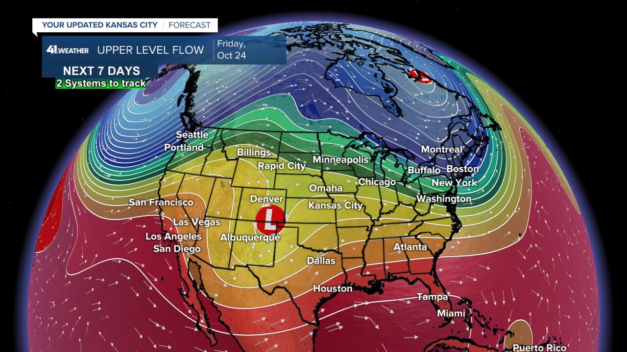
Between Friday and Sunday, the first system will actually drift north near Kansas City, but it will be weakening.
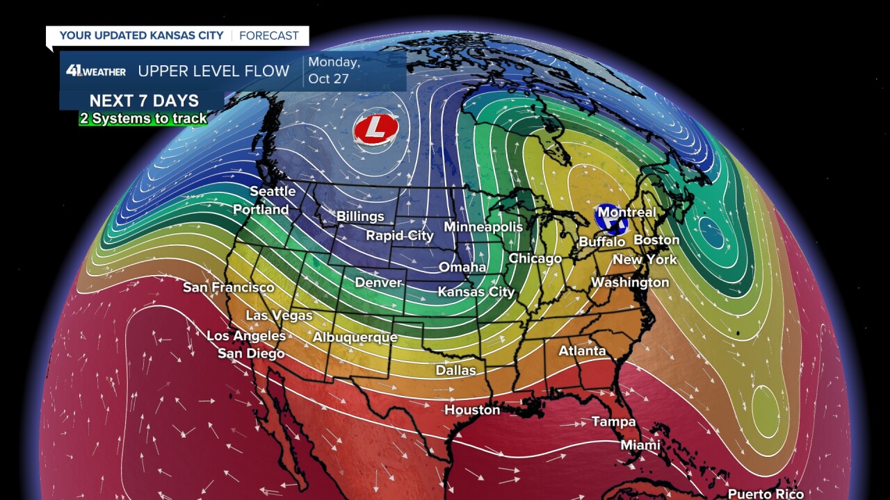
The second system will be in the form of considerable jet stream energy plowing into the western U.S.

By next Monday, the first system will be absorbed rapidly by the second storm. The second storm is forming a trough from our region to western Canada on Chiefs Monday.
Let's look at the latest details.
FRIDAY MORNING:
We are starting here as today-Thursday will be sunny and quiet, except for the wind today.
The first wave of rain is most likely to move in on Friday morning, but notice there is not much rain north of St. Joseph. Lows will be around 50°.
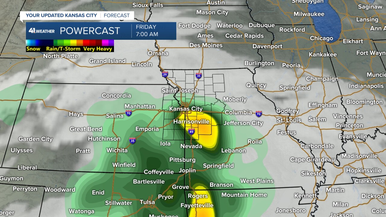
FRIDAY AFTERNOON:
The heaviest rain will probably be well south as our area sees periods of drizzle and showers. The heavier rain in the morning tracked east-northeast and weakened.
Highs will be in the 50s where it is raining most of the day and 60s where it is mainly cloudy without much rain.

SATURDAY:
It will be cloudy with areas of drizzle and rain showers. Expect temperatures generally between 55° and 65°.

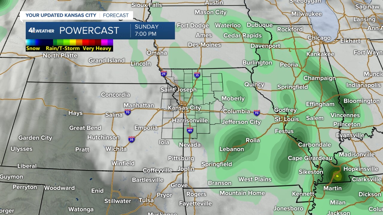
SATURDAY NIGHT-SUNDAY:
As the first storm lifts north through our area and weakens, it will bring more areas of drizzle and rain showers. There is a chance to see an area of heavier rain if the system holds together long enough.
Again, temperatures will generally stay between 55° and 65°.
CHIEFS MONDAY:
The first system will exit later Sunday, leaving a mostly cloudy sky Sunday night into Monday morning with lows in the 50s.
The second system will move through Monday afternoon and night. As of this moment, it looks like there will be one band of rain and some thunderstorms that last a couple of hours, followed by clearing, breezy and cool conditions.

Based on the latest data, and we know it will change quite a bit as it is still nearly a week away, it looks like the best chance of rain is between noon and 7 p.m., before kickoff but during tailgating.
Remember, this is NOT set yet.

RAINFALL FORECAST THURSDAY-MONDAY:
Right now, it looks like the heaviest rain will occur across Oklahoma, Arkansas and into southeast Kansas and southern Missouri. Amounts could be as high as 2"-4" with some locations seeing 4"-7".
These are very dry areas, even after the rain last weekend, as they are in mostly severe to extreme drought (Level 3/4 of 5).
We are rather dry as well, with most locations now in a moderate to severe drought (Level 2/3 of 5). Our area is on the northwest side of the rainfall.

Rainfall in our area between Thursday night and Monday looks to be in the 0.50"-1" range, with a 0.25"-0.50" less to the northwest and 0.25"-0.50" more to the southeast.
This can still shift north or south by 50-100 miles. 0.50"-1" is not much, but let's hope we get at least that much.

Have a great rest of your week.
Stay healthy.
—
