


KANSAS CITY, Mo. — Good Thursday afternoon bloggers,
We are almost 100% going to see flash flooding in some locations. There seems to be a trend toward the Interstate 70 corridor. Let's go through this.
The setup is rather potent for flash flooding. We are tracking a slow-moving cold front as a series of upper-level disturbances track northeast from the southwest US along the front. And we know there is copious amounts of moisture to work with, just step outside.
TODAY:
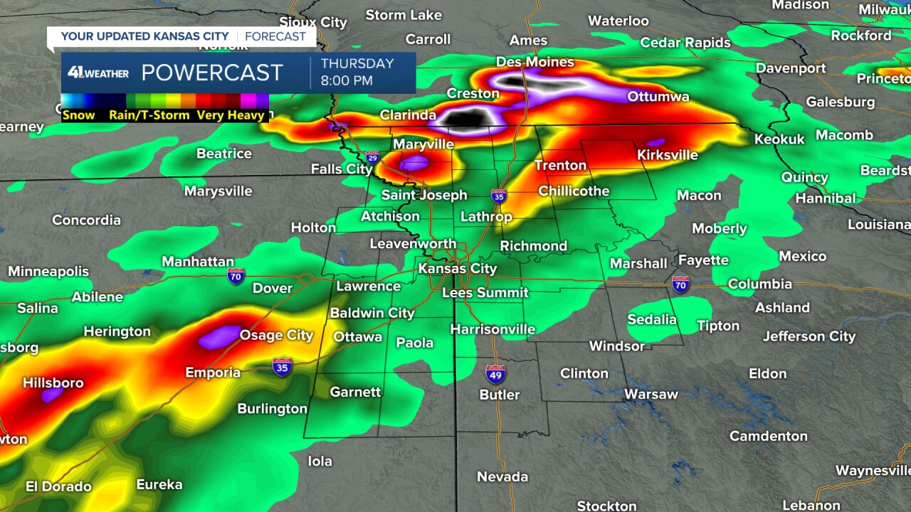
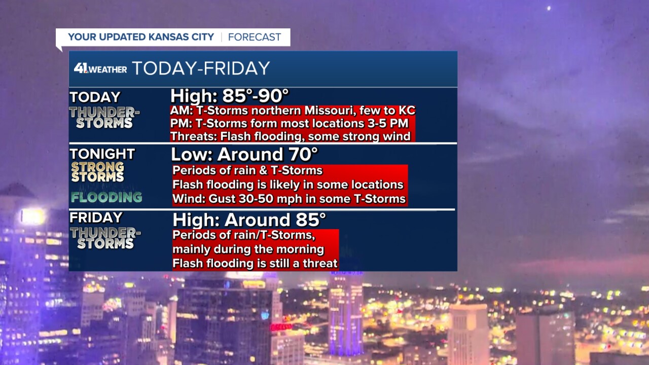
At 2 p.m., we are starting to see a few showers and thunderstorms across northeast Kansas and north Missouri. Highs will be 85°-90° with out-of-control humidity.

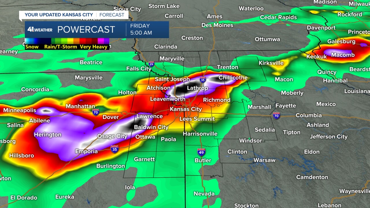
TODAY (2-8 PM):
We will see thunderstorms increase from central/south-central Kansas to north Missouri through the Kansas City area. The line will have some gaps in it. This data has a gap around Kansas City at 8 p.m. But, during the period, there will be thunderstorms tracking southwest to northeast along the line. Any thunderstorms may contain 30-60 mph wind gusts and 1"-3" per hour rainfall rates. In other words, flash flooding is possible with almost any thunderstorm.
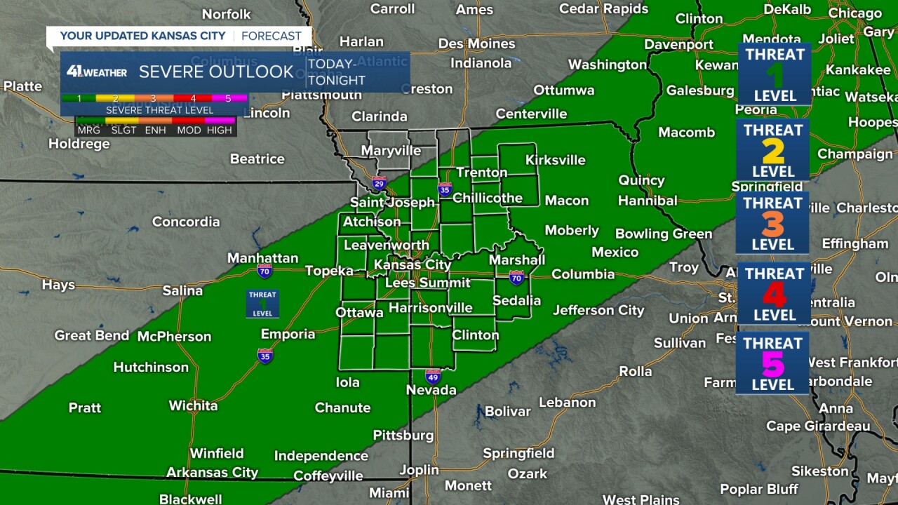
We are in a level 1 of 5 severe weather risk today and tonight for the chance that a few thunderstorms could produce a 60 mph wind gust.
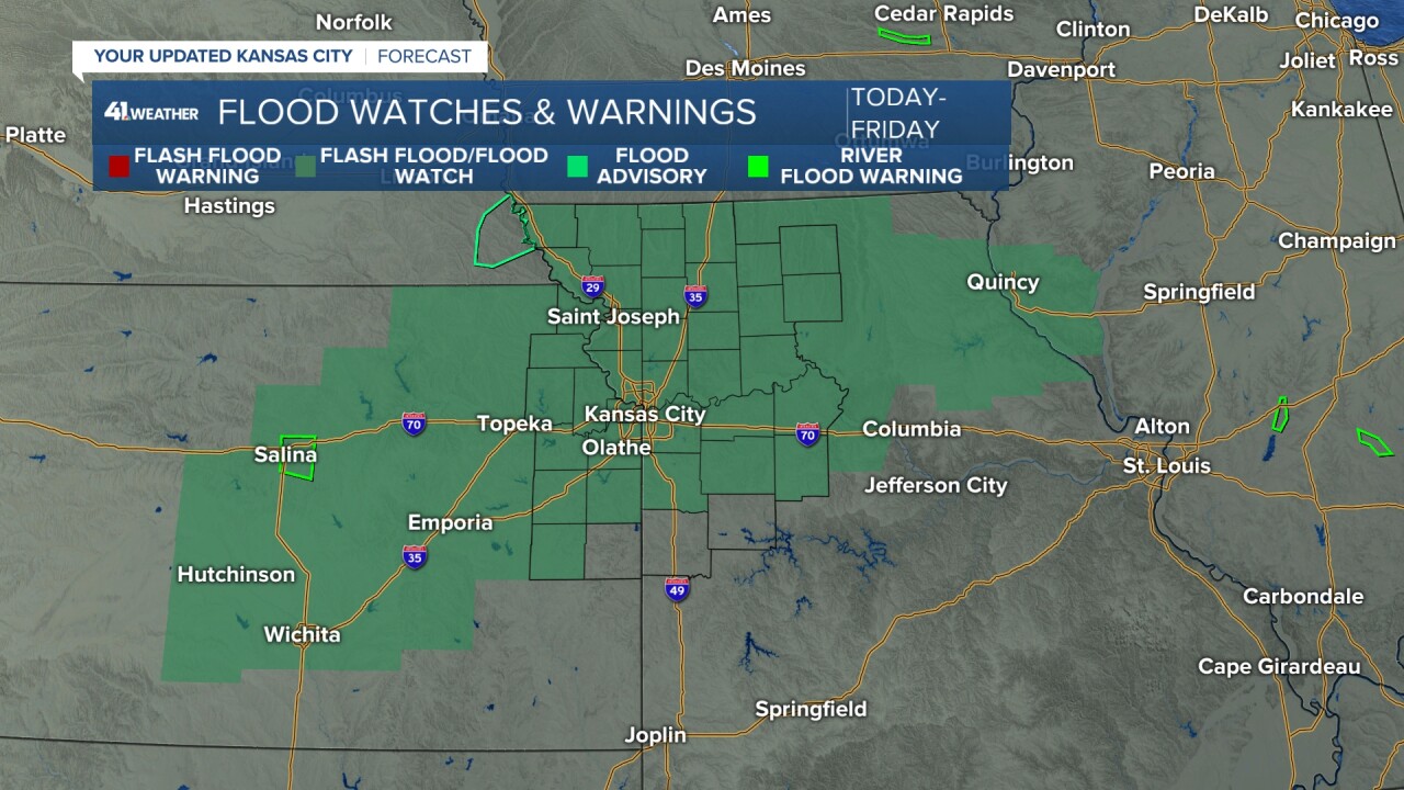
We are in the middle of a Flood Watch for today through Friday that extends from Hutchinson, Kansas, to just west of Springfield, Illinois.
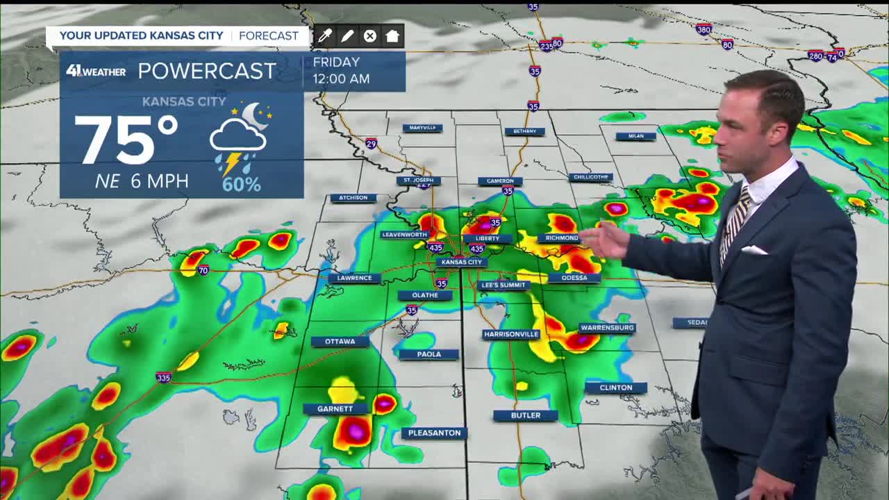
TONIGHT/FRIDAY (8 PM-7 AM):
This is when we will see the thunderstorms become widespread in a zone. The flash flooding threat will ramp up in more locations. Again, a few thunderstorms may produce a brief 60 mph wind gust.
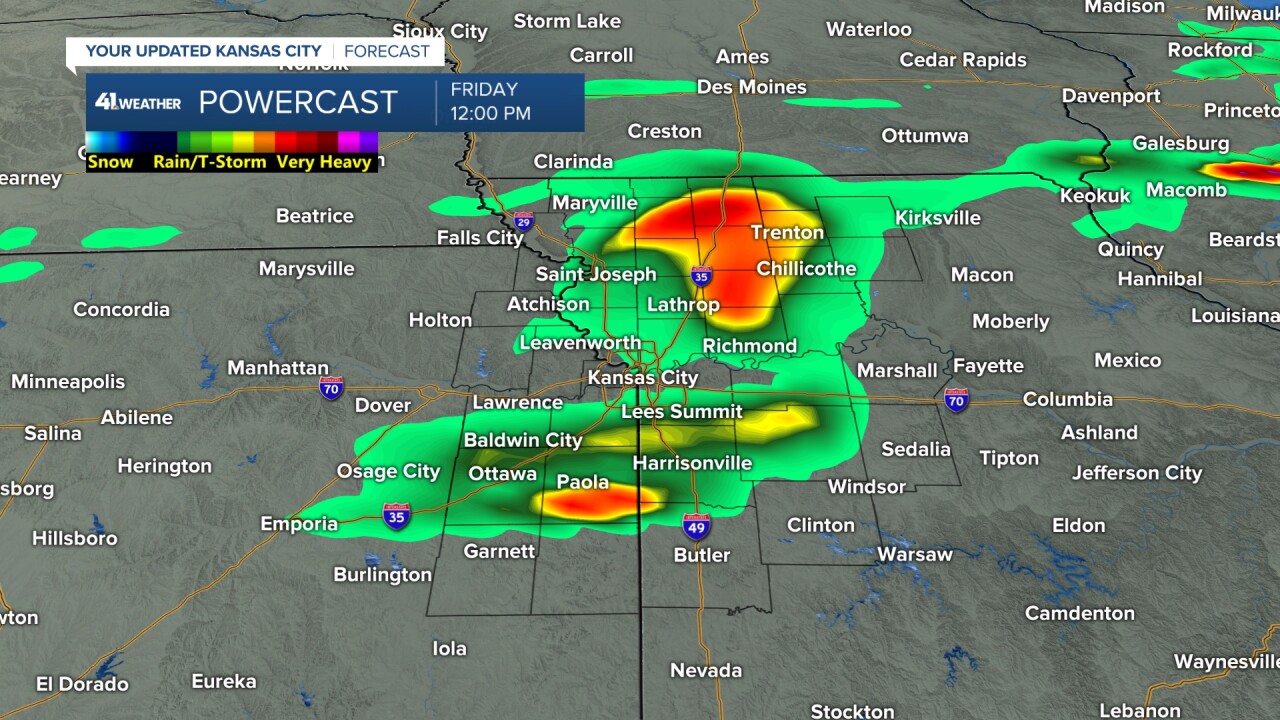
FRIDAY (7 AM-NOON):
We will see the rain and thunderstorms gradually wind down.
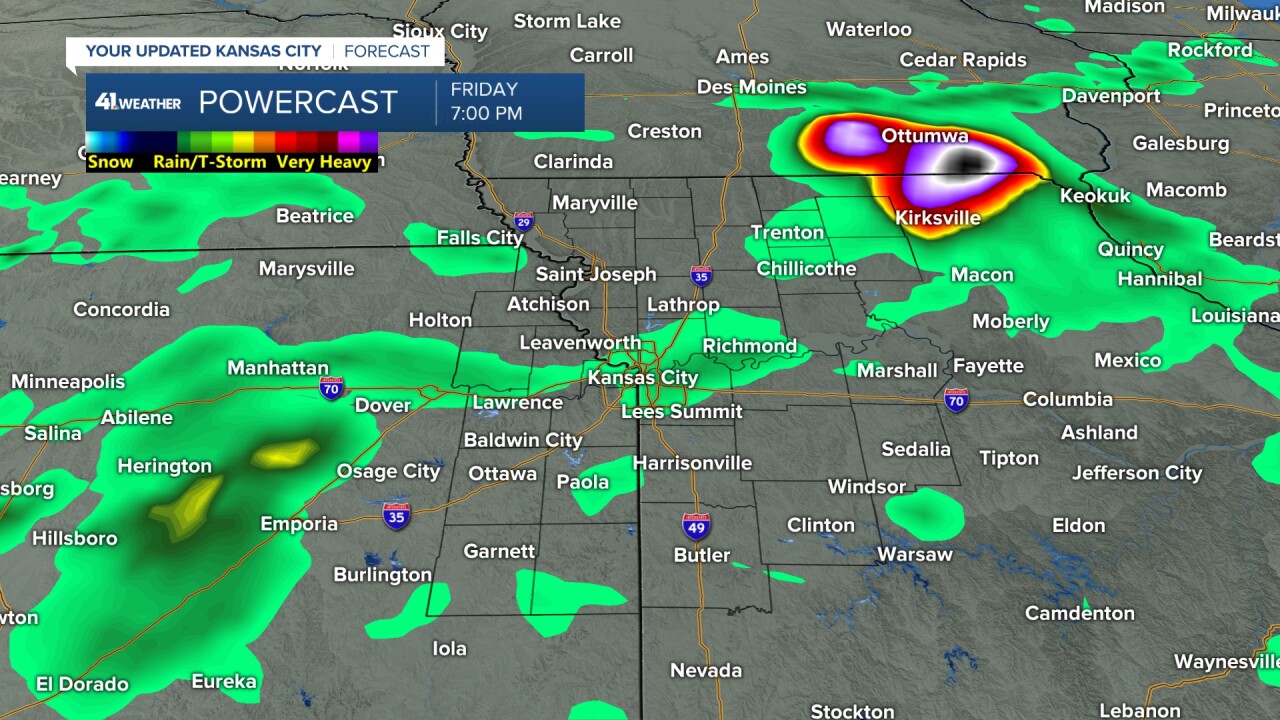
FRIDAY AFTERNOON & NIGHT:
Scattered showers and thunderstorms will be possible. There is the chance a new zone of more widespread rain and thunderstorms forms again. There is more of a question on this as it depends how the thunderstorms tonight leave the atmosphere. Highs tomorrow will be in the low to mid-80s.
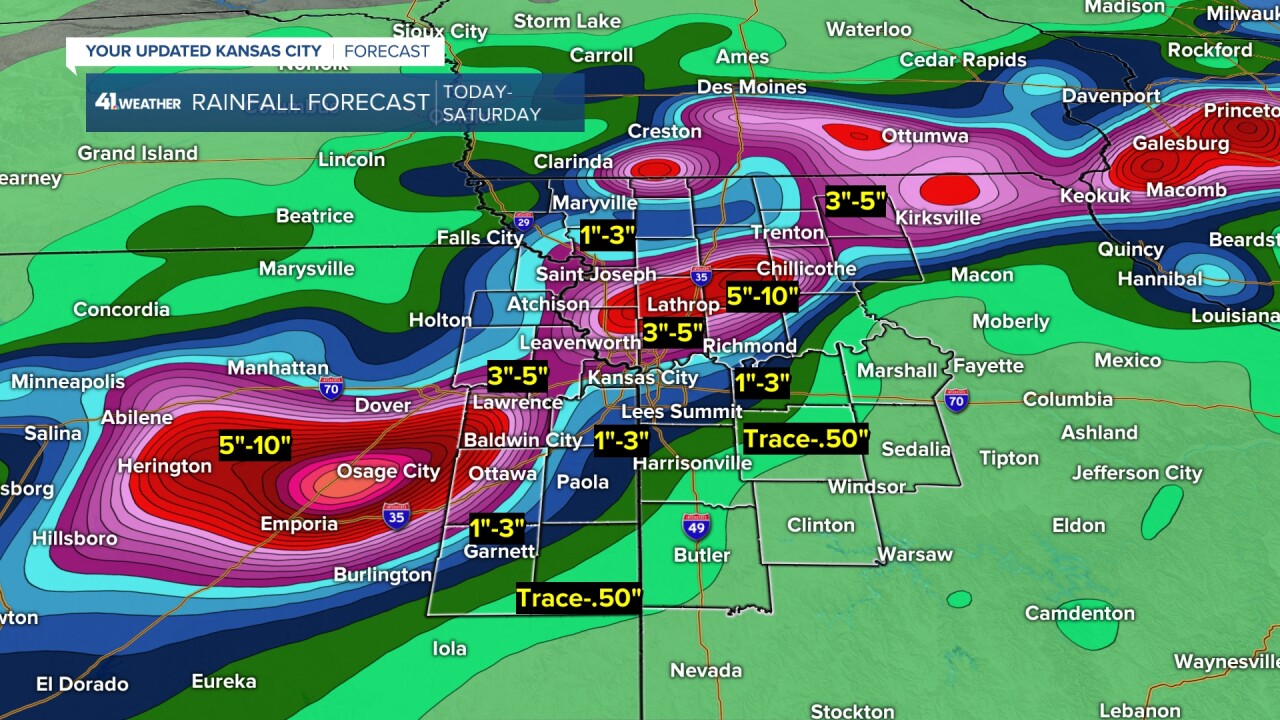
RAINFALL FORECAST TODAY-SATURDAY:
There is going to be a zone where 3"-5" of rain falls. And, within that zone there will be locations that see 5"-10". We average 4.58" of rain for all of July. So, some locations will see 1-2 months of rainfall tonight. This will be on top of some locations that saw 1-2 months of rainfall Monday and last Thursday-Friday.
This data has the zone (80-100 miles wide) from around Emporia, Kansas, to Kirksville, Missouri. Locations in the light blue to pink/purple colors are the ones most likely to see flash flooding. You can see there is a sharp cut-off line just to the south.
It is important to know that this zone can still shift 50 miles north or south. But, it seems to be targeting the I-70 corridor.
Here is the forecast summary.
We may see some rain linger into early Saturday. Then, the heat comes back for Saturday afternoon through Tuesday, along with out-of-control humidity and little to no chance of rain. We are seeing signs of a decent cold front moving through next Wednesday-Thursday. We will have more on that in the coming days.
Have a great rest of your week and weekend.
Stay healthy and safe
Stay with KSHB 41 and we'll keep you advised.
