


Good Sunday morning, weather blog readers!
Clouds are making a comeback on Sunday, as mid- and high-level clouds have spread across the region, giving us a mostly cloudy start.
It’s a typical chilly beginning, with temperatures in the upper 20s and a light breeze. The good news is we slowly climb out of that chill as the day goes on.
We stay mostly cloudy through the late morning and around lunchtime, but a south wind starts to kick in and helps temperatures rise into the lower 40s. By mid to late afternoon, the clouds begin to thin and break apart, especially on the Kansas side, with sunshine becoming more common.
Missouri clears out as well, and that sets the stage for a pretty pleasant January afternoon with highs approaching 50 degrees. That's about 10 degrees warmer than yesterday.
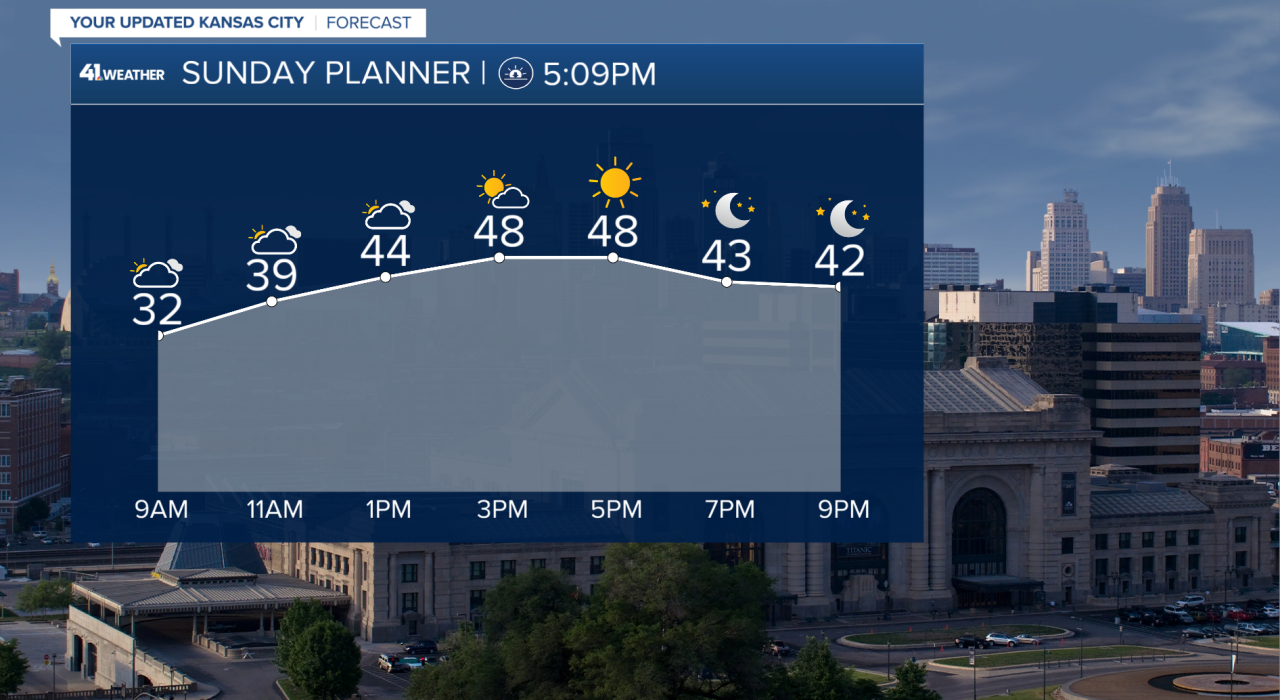
Skies stay mostly clear into the evening, with temperatures dropping back into the lower 40s around dinnertime and settling into the mid to upper 30s overnight. Overall, not a bad night for this time of year.
Looking ahead, fog is something to keep in mind ... tonight and on several mornings this week. The setup is similar to what we saw before Christmas, when mild air and moisture led to foggy starts. It may not be an exact repeat, but fog will be possible.
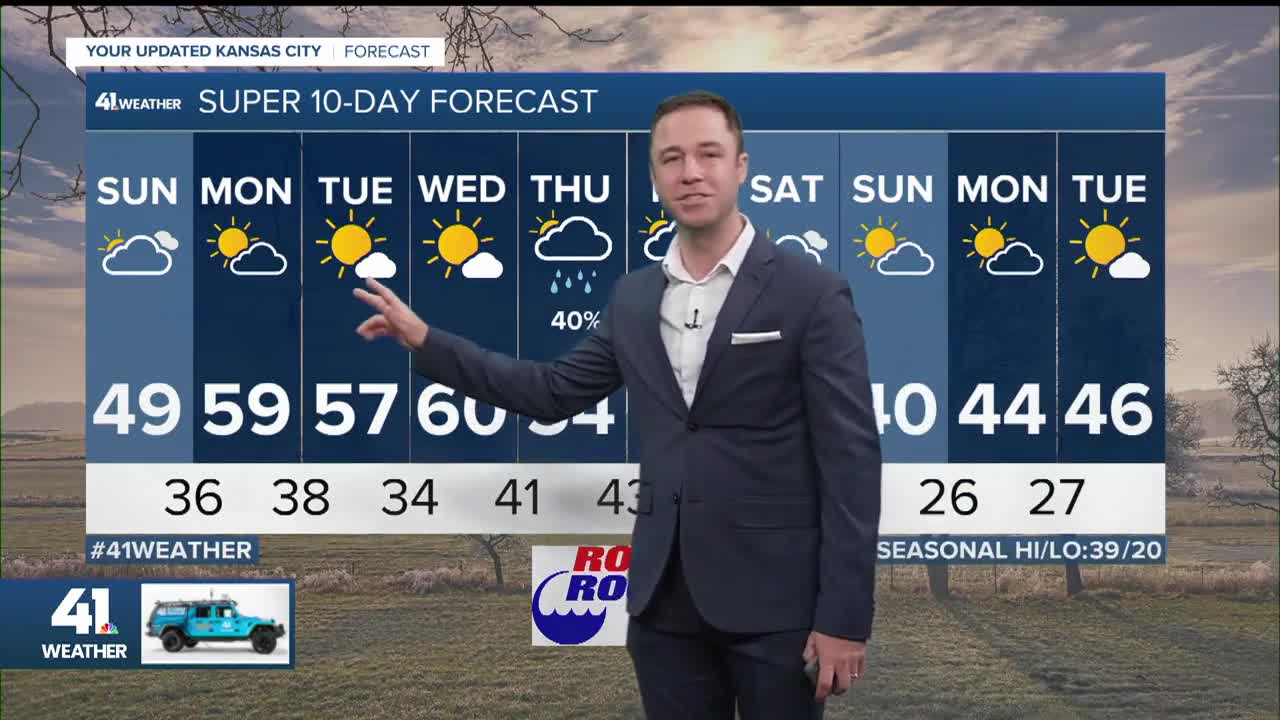
On that note, every day will be somewhere between 55°-65° with Wednesday likely being the warmest day. It will be tough to string together days in the 60s because of the possibility of fog and changing wind direction.
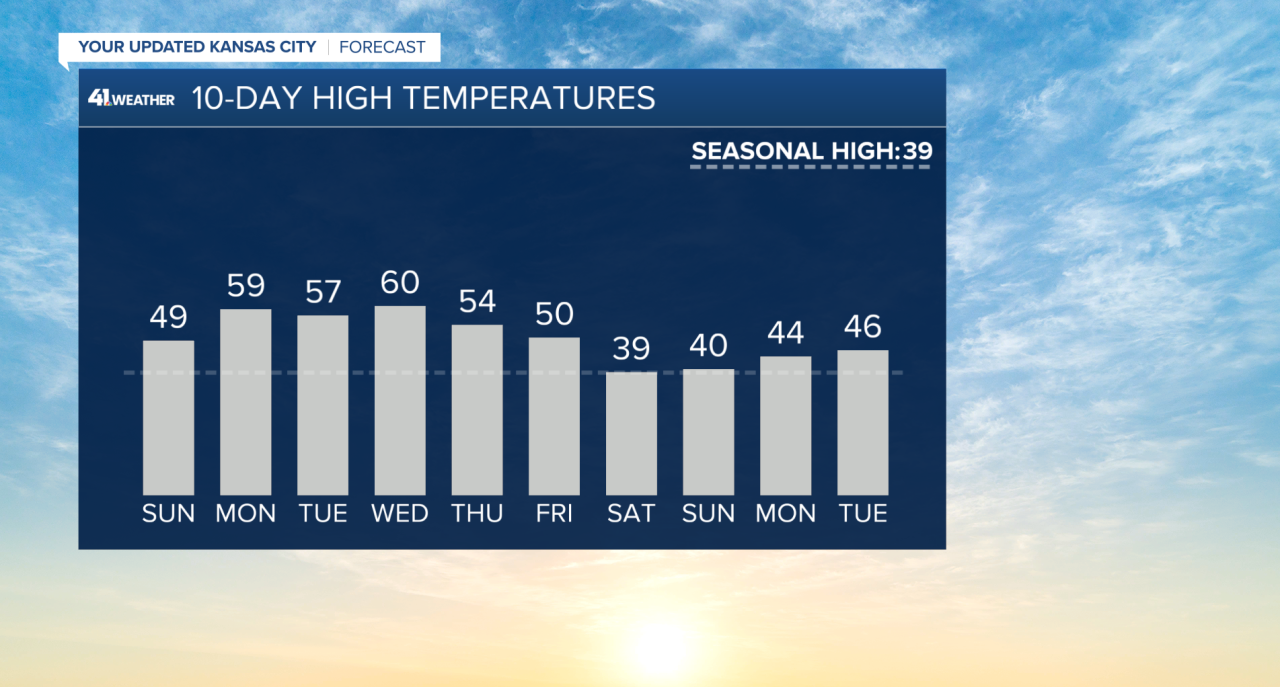
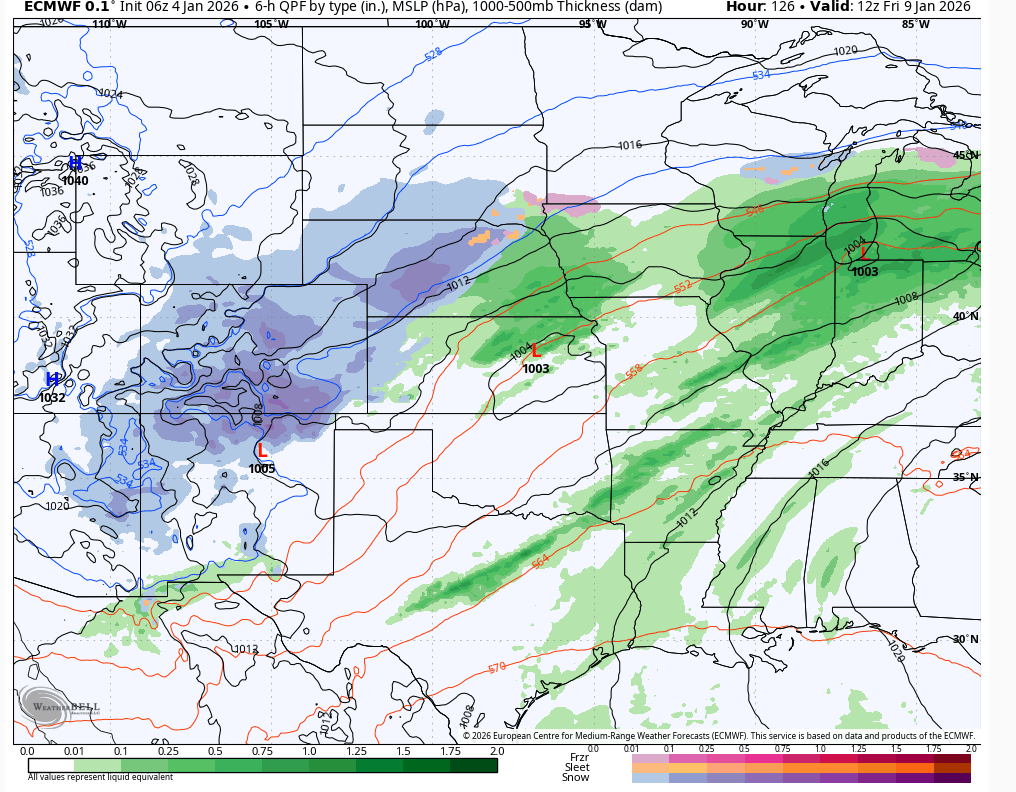
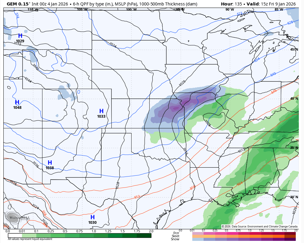
By the end of the week, rain chances return. And with it being January, we'll need to watch the timing and track of this closely, as it could lead to wintry weather.
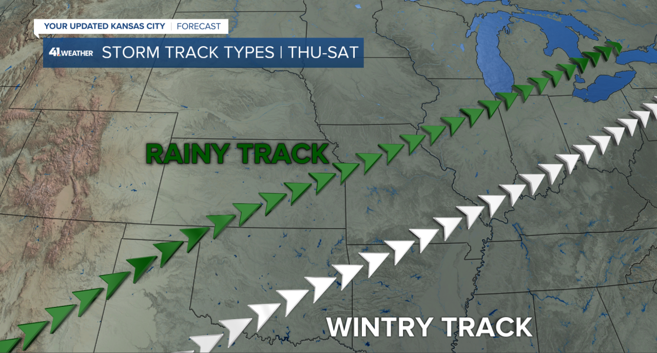
If the storm lingers or slows down and takes a track near Interstate 44, that would increase our chances of getting some snow or a wintry mix as the cold air moves further south.
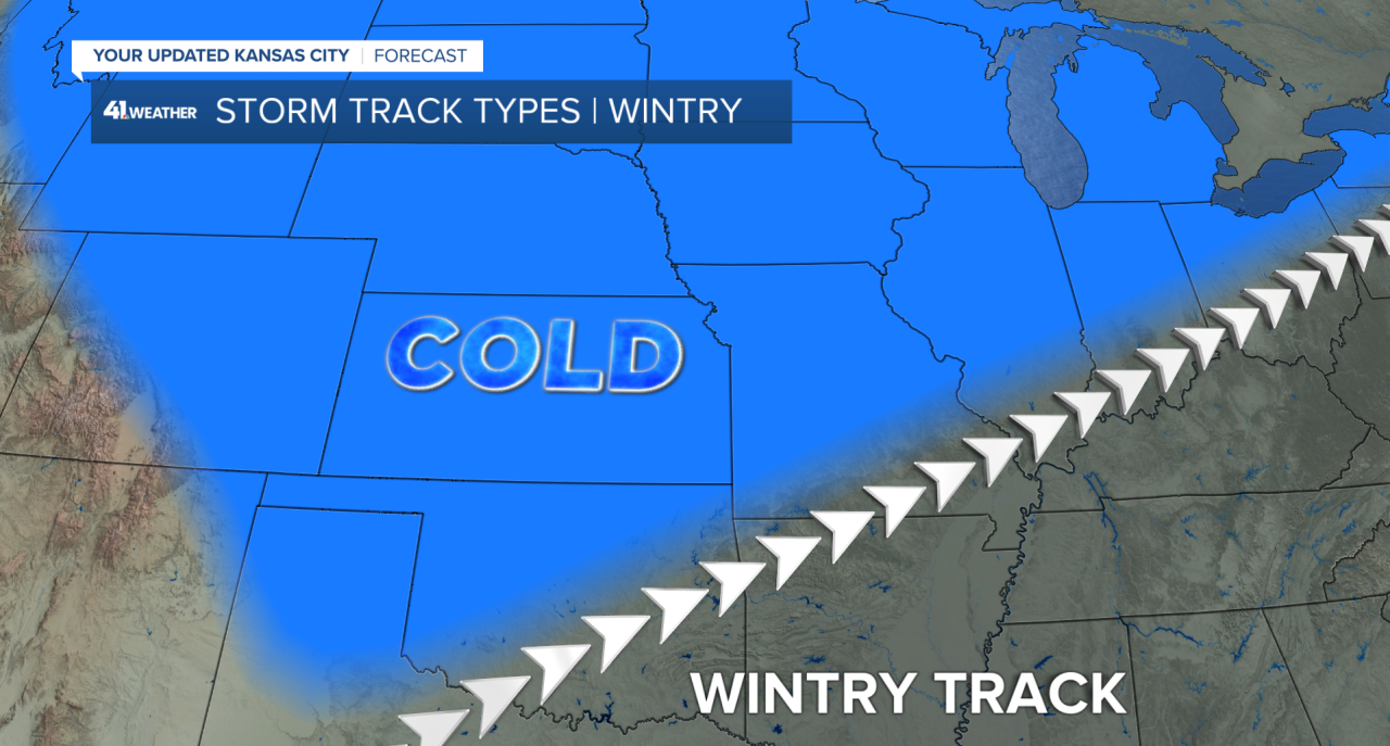
That will be tough to do, though, as we're so warm ahead of the storm. Right now, it looks like rain is more likely than snow, but we're still several days away, and the signal for snow needs to be monitored.
Looking at our weather models, they're split on the track and temperatures.
I think some people wouldn't mind the snow, considering how mild winter has been so far.
Have a great week, everyone!
Follow Wes on social media and listen to his podcast "The Kansas City Weather Report."
—
