


KANSAS CITY, Mo. — Good Sunday morning, weather blog readers! A lot is changing with the weather Sunday as we/the weather returns from a holiday vacation down south.
Temperatures are going to fall fast as a cold front moves through this morning. We’ll go from the middle to upper 50s this morning to the 20s later this afternoon, and the real shock will be how it feels outside.
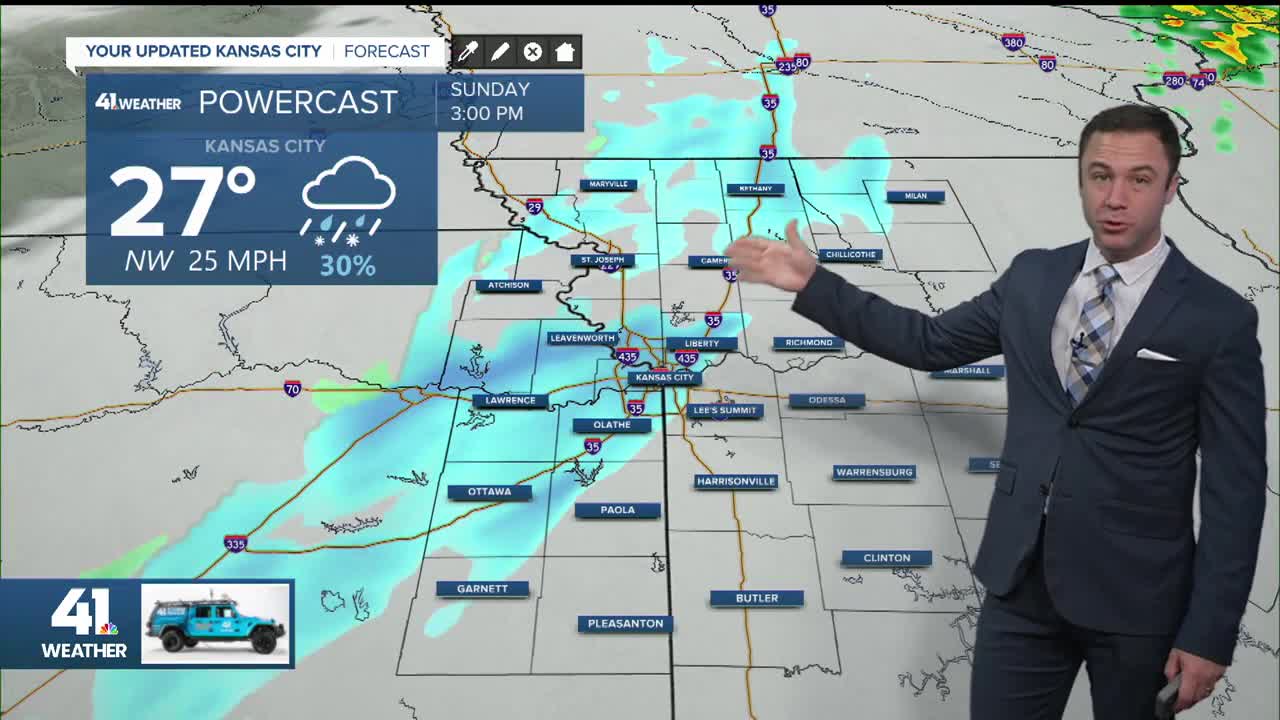
Wind chills drop from feeling like about 55° this morning to around 10–15° by mid to late afternoon, then closer to 5° this evening, and eventually near zero to -5° overnight into Monday morning, especially north of the Kansas City area.

Rain is ongoing this morning across northeastern Kansas and northern Missouri, with a few heavier downpours and even some thunder and lightning in spots, but nothing severe, just a wet start to the day and some beneficial rainfall for our still-dry areas.
As colder air moves in later this morning, that rain may briefly mix with sleet or snow in far northern areas, and by early afternoon, a band of snow develops in northwest Missouri and northeastern Kansas before moving through the Kansas City metro between roughly 2 and 6 p.m.
Most locations may see a light dusting, and because it’s been so mild recently, significant road impacts aren’t expected, though a few brief slick spots are possible as the snow moves through.

At the same time, strong winds will make the cold feel even more intense, with a wind advisory in effect from 9 a.m. to 6 p.m., sustained winds around 20–30 mph, and gusts up to 45–50 mph.

The strongest winds overspread the area by mid-morning and stay blustery through the afternoon and early evening, with the possibility of a few spotty power outages. Skies clear later today, setting us up for a cold Monday morning, followed by sunshine and highs in the 20s.
This cold front should return us back to mainly seasonal highs in the 30s and 40s with sub-freezing mornings. Models do hint at a return to the 50s this weekend, though.
