

WEATHER HEADLINES
- Heavy storms overnight may cause some flash flooding
- Several periods of rain and thunderstorms tonight-Friday; some may see a lot of rain, others not much
- Hottest weather of the season is possible next week
KANSAS CITY'S FORECAST
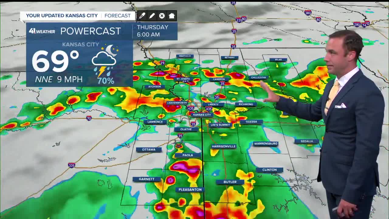
Tonight: Periods of rain and thunderstorms. Some thunderstorms may contain strong winds. Also, some locations may see flash flooding, while other locations may not see much rain at all.
Wind: Variable and gusty in thunderstorms
Low: 68º
Thursday: Mostly cloudy and much cooler with periods of scattered showers and thunderstorms. Best chance of rain is south of I-70
Wind: NE 5-15 mph
High: 80º
Friday: Mostly cloudy, warm and humid with periods of scattered showers and thunderstorms.
Wind: SE 5-15 mph
Low: 67º High: 85º
Get more updates from our weather team:
View our interactive radar
Read our Weather Blog
Check out the current conditions in our area
The KSHB 41 Weather Storm Shield is a life-saving app that acts like an NOAA Emergency Weather Radio on your iPhone or Android phone. You will receive critical alerts via voice and push notification regarding major, potentially life-threatening weather events.
