

WEATHER HEADLINES
- Clear and cold tonight with single-digit wind chills
- Cold weather through Monday
- Much warmer Tuesday into next week
KANSAS CITY'S FORECAST
Saturday night: A cold front comes through with a few clouds.
Low: 16°
Wind: N 5-15 to NW 10-20 mph
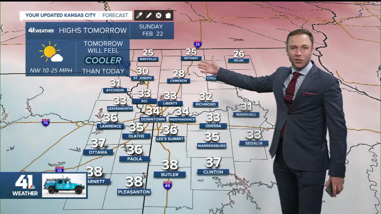
Sunday: Mostly sunny and frigid. Morning wind chills in the teens.
Low: 16°
High: 33°
Wind: NW 10-25 mph
Monday: Mostly sunny and still cold.
Low: 14°
High: 36°
Wind: N to S 5-10 mph
Get more updates from our weather team:
View our interactive radar
