

WEATHER HEADLINES
- This is the wettest 2 day period since 2019
- A few showers and thunderstorms possible tonight with a bit higher coverage Friday
- A few thunderstorm chances over the weekend, but the chances shift north
- Hot with less rain chances next week
KANSAS CITY'S FORECAST
Tonight: A few showers and thunderstorms are possible. No threat of flooding or severe weather.
Wind: E-NE 5-15 mph
Low: 67º
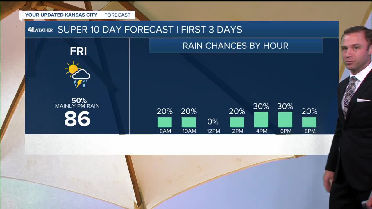
Friday: Mostly cloudy, warm and humid with periods of scattered showers and thunderstorms possible in the morning and afternoon.
Wind: SE 5-15 mph
High: 85º
Saturday: Morning showers and storms possible, some could have strong wind gusts. Partly cloudy, hot, and humid.
Wind: S 10-25 mph
Low: 72º High: 92º
Get more updates from our weather team:
View our interactive radar
Read our Weather Blog
Check out the current conditions in our area
The KSHB 41 Weather Storm Shield is a life-saving app that acts like an NOAA Emergency Weather Radio on your iPhone or Android phone. You will receive critical alerts via voice and push notification regarding major, potentially life-threatening weather events.
