

WEATHER HEADLINES
- Sunshine and much warmer again on Monday; possibly record warm
- The next storm brings thunderstorms and colder air Tuesday-Wednesday
- Storms could be severe Tuesday evening, along with the chance of flash flooding
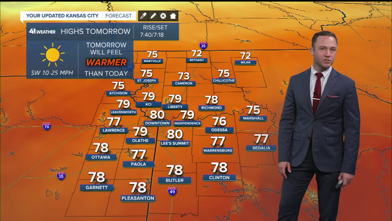
KANSAS CITY'S FORECAST
Sunday night: Clear, breezy and not as cold.
Low: 48°
Wind: S 10-20 mph
Monday: Abundant sunshine and warmer again with a record high temperature possible.
High: 79° (Record 77°, 2021)
Wind: S-SW 10-20 mph
Tuesday: A chance of thunderstorms, mainly during the late afternoon, evening and night. Severe weather and flash flooding are possible.
Low: 56°
High: 77°
Wind: S-SW 10-20 mph
Get more updates from our weather team:
View our interactive radar
Read our Weather Blog
Check out the current conditions in our area
