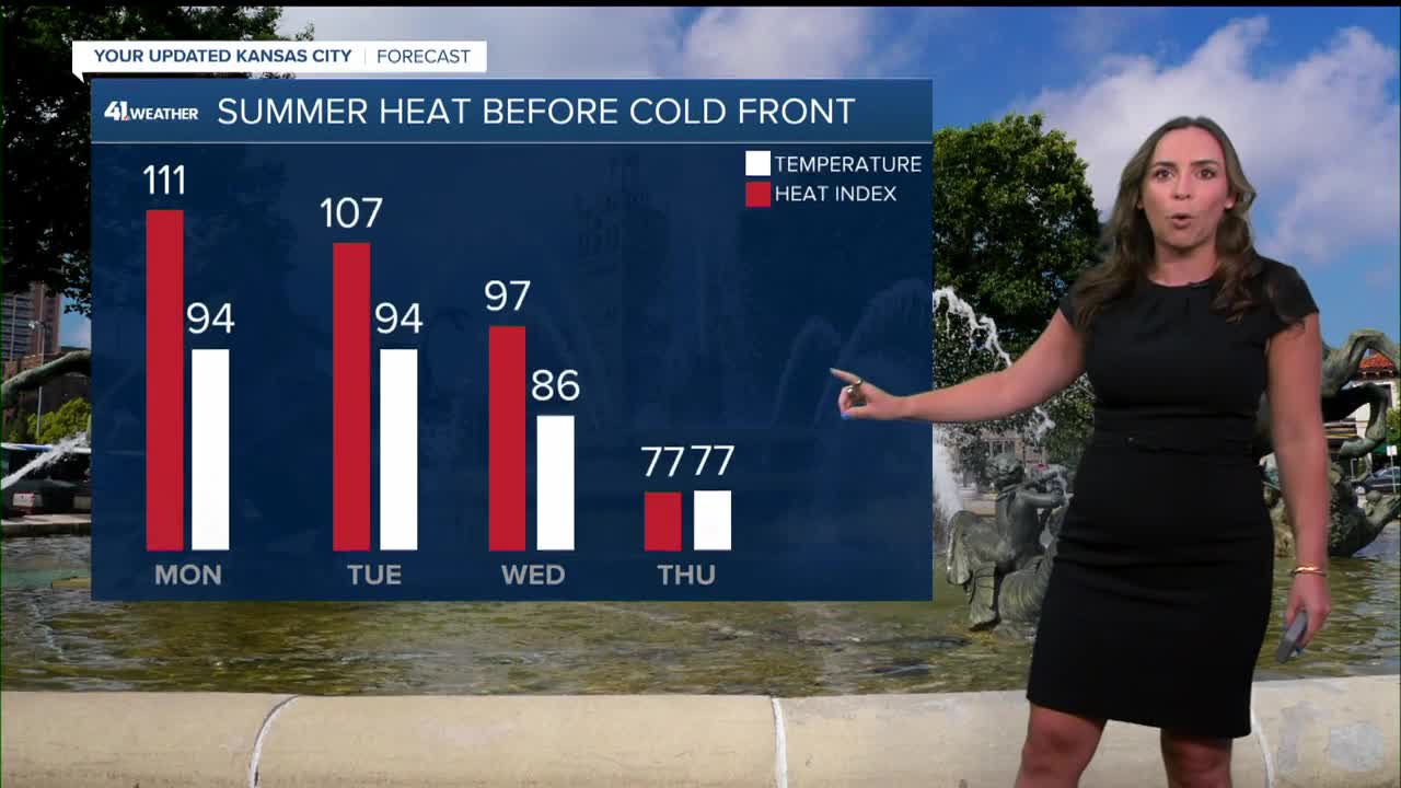


WEATHER HEADLINES
- Hot & very humid; heat index near 108-125 through Tuesday
- Strong summer cold front arrives Wednesday-Thursday with thunderstorms
- Much cooler & less humid next weekend
KANSAS CITY'S FORECAST
Monday: Chance of an early morning thunderstorm, best chance northern Missouri. Then, another hot day with triple-digit heat index values.
Wind: S 10-15 mph
High: 94º
Heat Index: 108º-125°
Tonight: Mostly clear sky and mild.
Wind: S 5-10 mph
Low: 75º
Tuesday: Mostly sunny, hot and very humid.
Wind: S 5-15 mph
Low: 75º High: 94º
Heat Index: 108º-125°
Wednesday: An increasing chance of rain and thunderstorms. There is a chance to see flash flooding.
Wind: S to NE 5-15 mph
Low: 72º High: 86º
Heat Index: 100º-105°
Get more updates from our weather team:
View our interactive radar
Read our Weather Blog
Check out the current conditions in our area
The KSHB 41 Weather Storm Shield is a life-saving app that acts like an NOAA Emergency Weather Radio on your iPhone or Android phone. You will receive critical alerts via voice and push notification regarding major, potentially life-threatening weather events.
