

WEATHER HEADLINES
- Hot and humid weather will persist tonight
- Multiple rounds of rain and storm chances are expected from Saturday morning through Monday night
- These storms could bring damaging wind gusts and flash flooding
KANSAS CITY'S FORECAST
Tonight: Partly cloudy skies. Humid and breezy. Isolated shower or storm possible.
Wind: S 10-15 mph
Low: 78º
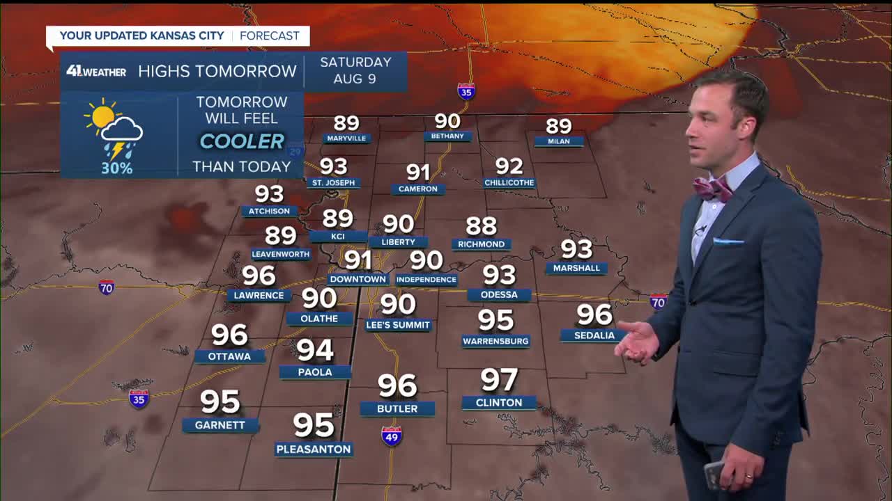
Saturday: A shower or storm is possible in the morning and afternoon. Rain is becoming likely Saturday night. Flash flooding and damaging wind gusts are possible.
Wind: S 10-25, Gusts 35 mph
High: 89º Heat index: 95-100º
Sunday: Showers and storms are possible throughout the day. Storms may produce strong wind gusts and flash flooding.
Wind: S 10-25 mph
Low: 72º
High: 82º
Monday: Showers and storms are possible again throughout the day. Storms may produce strong wind gusts and flash flooding. 2-5" rain totals possible by evening.
Wind: S 10-25 mph
Low: 67º
High: 82º
Get more updates from our weather team:
View our interactive radar
Read our Weather Blog
Check out the current conditions in our area
—
