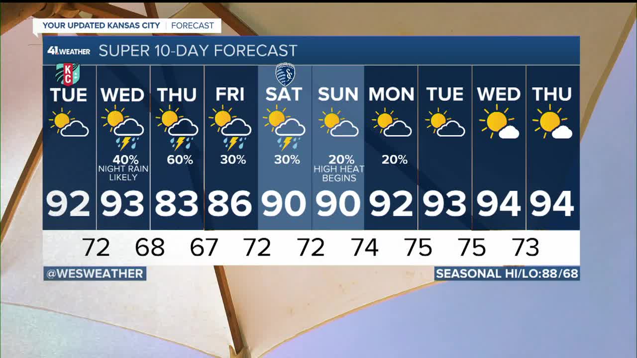


WEATHER HEADLINES
- Lower 90s with heat indices near 100 through Wednesday
- Good rain chance Wednesday night-Thursday morning
- Hottest weather of the season possible next week
KANSAS CITY'S FORECAST
Tonight: A mild night with mostly clear skies. Maybe some patchy fog for some.
Wind: E 5-10 mph
Low: 71º
Tuesday: Partly to mostly sunny, hot and humid. Slight chance of an isolated shower or thunderstorm in the afternoon.
Wind: S 10-20 mph
High: 92º
Wednesday: Partly cloudy, hot and humid. There is a 30% chance of thunderstorms.
Wind: S-SW 10-25 mph
Low: 73º High: 93º
Get more updates from our weather team:
View our interactive radar
Read our Weather Blog
Check out the current conditions in our area
The KSHB 41 Weather Storm Shield is a life-saving app that acts like an NOAA Emergency Weather Radio on your iPhone or Android phone. You will receive critical alerts via voice and push notification regarding major, potentially life-threatening weather events.
