

WEATHER HEADLINES
- Strong summer cold front arrives Wednesday-Thursday with thunderstorms
- Much cooler & less humid next weekend
KANSAS CITY'S FORECAST
Tonight: Mostly clear sky and mild.
Wind: S 5-10 mph
Low: 72º
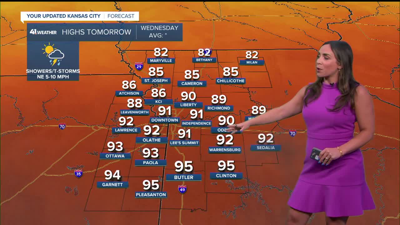
Wednesday: An increasing chance of rain and thunderstorms. There is a chance to see flash flooding.
Wind: S to NE 5-15 mph
Low: 72º High: 86º
Heat Index: 95º-105°
Thursday: Rain could linger into the first part of the day. Cooler and less humid.
Wind: NE 5-15 mph
Low: 68º High: 77º
Get more updates from our weather team:
View our interactive radar
Read our Weather Blog
Check out the current conditions in our area
The KSHB 41 Weather Storm Shield is a life-saving app that acts like an NOAA Emergency Weather Radio on your iPhone or Android phone. You will receive critical alerts via voice and push notification regarding major, potentially life-threatening weather events.
