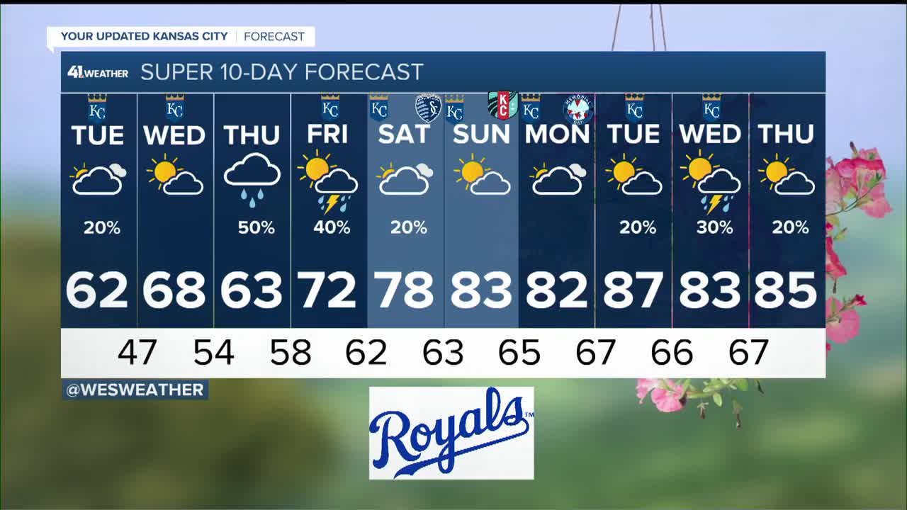
Weather

Actions

KSHB 41 Weather | Rain and T-Storms end around noon, Severe T-Storms possible tonight

Monday Morning Weather Update
Posted
and last updated

WEATHER HEADLINES

  • Rain and non-severe thunderstorms end around noon
  • A round of thunderstorms tonight will bring the potential of all modes severe weather and flash flooding
  • Much cooler and calmer Tuesday and Wednesday

KANSAS CITY'S FORECAST

Monday: Rain and thunderstorms will end around noon. Then, partly to mostly cloudy, breezy, warm and humid.
High: 80°
Wind: S-SE 15-25 mph

Monday night: A round of thunderstorms, possibly severe, along with flash flooding will track northwest to southeast across the area between 9 PM and 5 AM. The timing for Kansas City is 10 PM to 4 AM. All modes of severe weather are possible.
Low: 63°
Wind: Variable and gusty in T-Storms then NW 10-20 mph

Tuesday: Rain ends early then mostly cloudy and much cooler.
High: 62°
Wind: NW 10-20 mph

Get more updates from our weather team:
View our interactive radar

Read our Weather Blog

Check out the current conditions in our area