

WEATHER HEADLINES
- Rain and storms possible Tuesday morning
- Hottest days this week will be Tuesday and Wednesday
- Strong storms and flooding possible Thursday-Friday
KANSAS CITY'S FORECAST
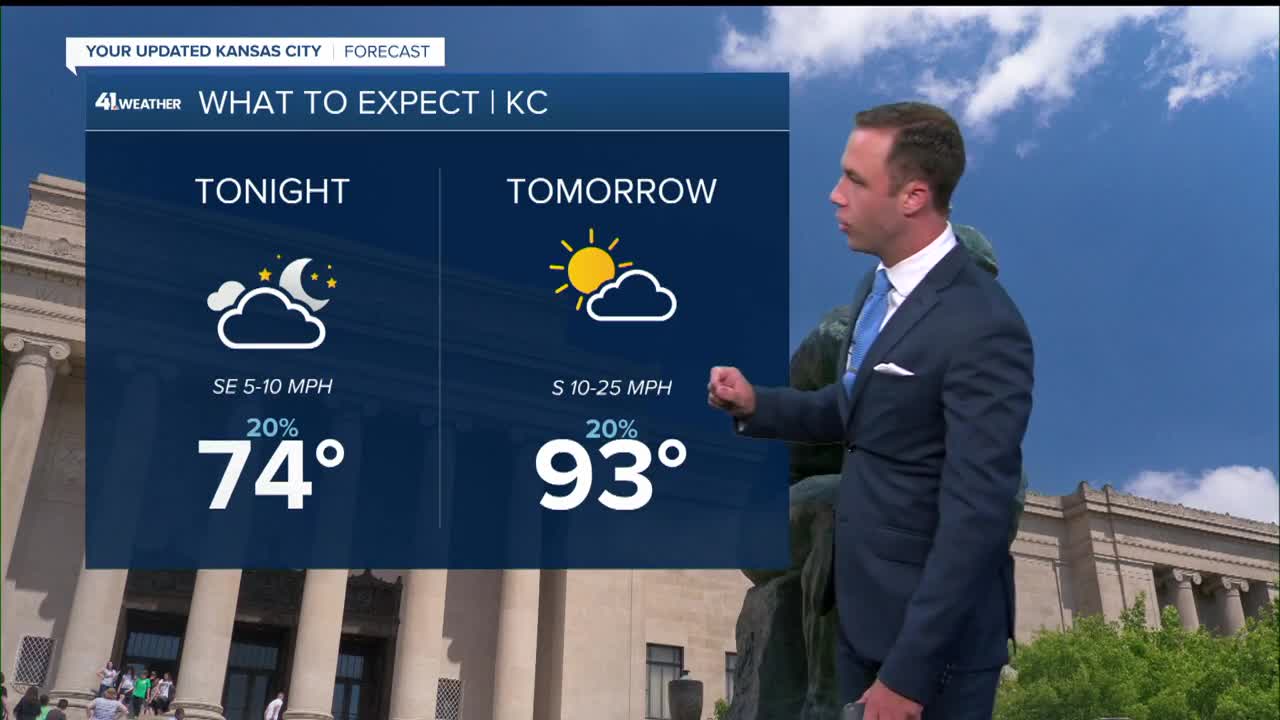
Tonight: Showers and storms possible by early morning.
Wind: S 10-15 mph
Low: 74º
Tuesday: Showers and storms possible in the morning. Becoming sunny, hot, and humid in the afternoon.
Wind: S-SW 10-20 mph
High: 90º
Heat Index: 102º
Wednesday: Mostly sunny, hot & humid with dangerous heat indices.
Wind: S-SW 10-20 mph
Low: 78º High: 93º
Heat Index: 102º
Get more updates from our weather team:
View our interactive radar
Read our Weather Blog
Check out the current conditions in our area
The KSHB 41 Weather Storm Shield is a life-saving app that acts like an NOAA Emergency Weather Radio on your iPhone or Android phone. You will receive critical alerts via voice and push notification regarding major, potentially life-threatening weather events.
