

WEATHER HEADLINES
- Shower or storm possible early and in the afternoon Wednesday
- Rain and storms likely Wednesday night-Thursday
- Hottest weather of the season possible next week
KANSAS CITY'S FORECAST
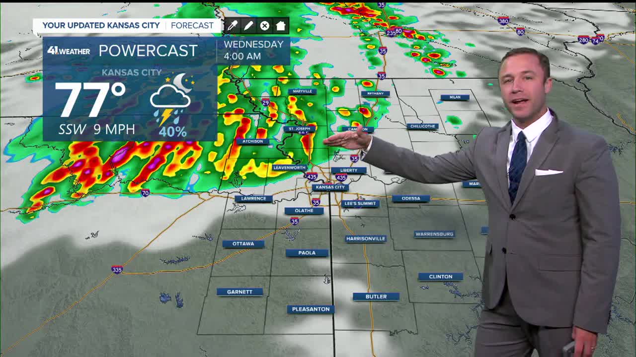
Tonight: A weakening line of storms pushes in from the northwest. The highest chance of rain is north and west of Kansas City, but storms are possible in Kansas City early Wednesday morning. Storms could produce damaging wind gusts
Wind: S 5-10 mph
Low: 73º
Wednesday: Partly cloudy, hot and humid. Storms possible before 8 a.m., then again in the afternoon. Rain and storms likely after 7 p.m. into the overnight.
Wind: S-SW 10-25 mph
High: 93º
Thursday: Showers and storms likely in the morning, with occasional rain possible throughout the day. Much cooler temperatures.
Wind: N 5-15 mph
Low: 68º High: 80º
Get more updates from our weather team:
View our interactive radar
Read our Weather Blog
Check out the current conditions in our area
The KSHB 41 Weather Storm Shield is a life-saving app that acts like an NOAA Emergency Weather Radio on your iPhone or Android phone. You will receive critical alerts via voice and push notification regarding major, potentially life-threatening weather events.
