

WEATHER HEADLINES
- Countless rounds of rain and storm chances are expected from today through Monday night
- These storms could bring damaging wind gusts and flash flooding
- Some locations may see 3"-6" of rain or more
KANSAS CITY'S FORECAST
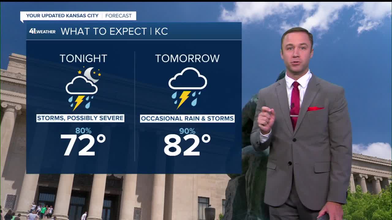
Tonight: Widespread thunderstorms will form across northeast Kansas and northern Missouri before midnight. They will likely head south around and after midnight to the I-70 corridor. Flash flooding and damaging wind are the main threats.
Wind: Gust 30-60 mph in some T-Storms
Low: 72º
Sunday: Periods of rain and thunderstorms, especially during the morning and again at night. Thunderstorms may produce strong wind gusts and flash flooding.
Wind: Gust 30-60 mph in some T-Storms
High: 82º
Monday: Showers and storms are possible again throughout the day. Storms may produce strong wind gusts and flash flooding. Some locations will see 3"-6" of rain or more by Monday night.
Wind: S 10-25 mph
Low: 67º
High: 80º
Get more updates from our weather team:
View our interactive radar
Read our Weather Blog
Check out the current conditions in our area
—
