

WEATHER HEADLINES
- Rain and storms are possible on Thursday, especially in the morning
- This rainy period may last through next week
- Temperatures will stay near 80 for the next week
KANSAS CITY'S FORECAST
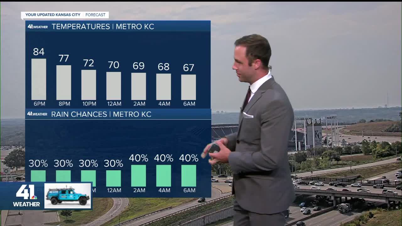
Tonight: Periods of scattered showers and thunderstorms possible after 4am.
Wind: Variable 5-10 mph
Low: 66°
Thursday: Scattered showers and storms possible throughout the day.
Wind: Variable 5-10 mph
High: 78º
Friday: A chance of mainly morning rain and thunderstorms, then partly to mostly cloudy and warm.
Wind: Variable 5-10 mph
Low: 62º
High: 81º
Get more updates from our weather team:
View our interactive radar
Read our Weather Blog
Check out the current conditions in our area
—
