

WEATHER HEADLINES
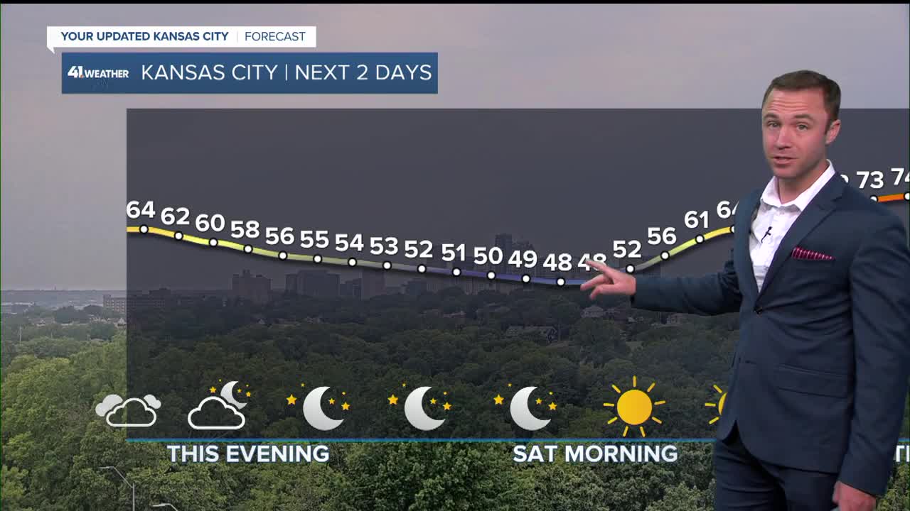
- Cloudy and chilly this evening, cold Saturday morning
- The weekend looks nice, highs in the mid-70s
- Warming to near 90 by late next week
KANSAS CITY FORECAST
Tonight: Clear skies with cold conditions by morning.
Wind: W 5 mph
Low: 48º
Saturday: Super Saturday! Sunshine and comfortable after a chilly start.
Wind: W 5-10 mph
High: 74º
Sunday: Super Sunday! Mostly sunny skies and a little warmer than Saturday.
Wind: E 5-15 mph
Low: 51º
High: 78º
Get more updates from our weather team:
View our interactive radar
Read our Weather Blog
Check out the current conditions in our area
—
