
WEATHER HEADLINES
- Main chance of showers, thunderstorms is 5-11 AM
- The damaging wind, Flash flooding threat is going down
- A few thunderstorms are possible Monday afternoon, then nice summer weather Tuesday-Thursday
KANSAS CITY'S FORECAST
Tonight: A chance of showers and thunderstorms after 4-5 AM
Wind: S 5-15 mph
Low: 69º
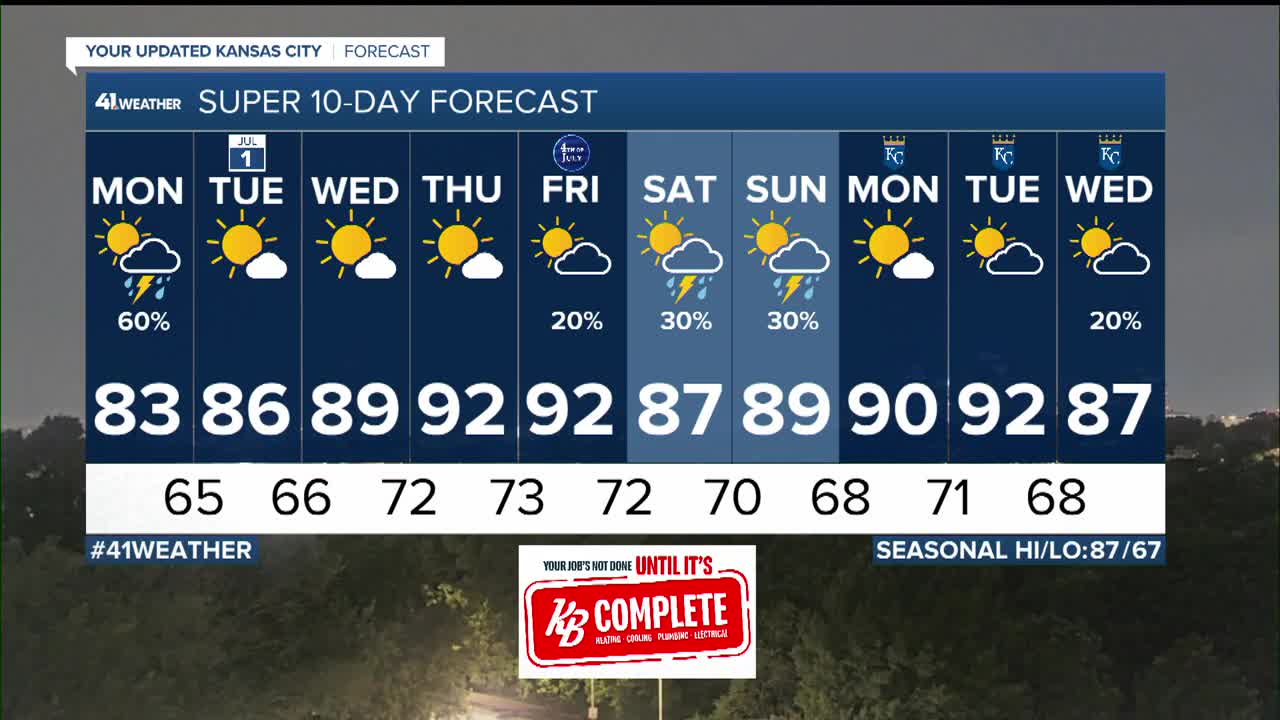
Monday: Morning showers and thunderstorms with a low chance of severe weather and flash flooding. The rest of the day will be partly cloudy with a chance for a few new thunderstorms.
Wind: N-NW 5-15 mph
High: 83º
Tuesday: A nice summer day. Mostly sunny, lower humidity and a light wind.
Wind: N 5-10 mph
Low: 65º High: 86º
Wednesday: A nice summer day. Mostly sunny with an increase in humidity.
Wind: S 5-15 mph
Low: 66º High: 89º
Get more updates from our weather team:
View our interactive radar
Read our Weather Blog
Check out the current conditions in our area
The KSHB 41 Weather Storm Shield is a life-saving app that acts like an NOAA Emergency Weather Radio on your iPhone or Android phone. You will receive critical alerts via voice and push notification regarding major, potentially life-threatening weather events.
