

WEATHER HEADLINES
- Highs warm to the 80s today ahead of a strong cold front
- The strong front will bring thunderstorms, some severe with hail & gusty winds the main threat
- Thursday will be nice ahead of a 2nd cold front Friday
- The weekend looks nice
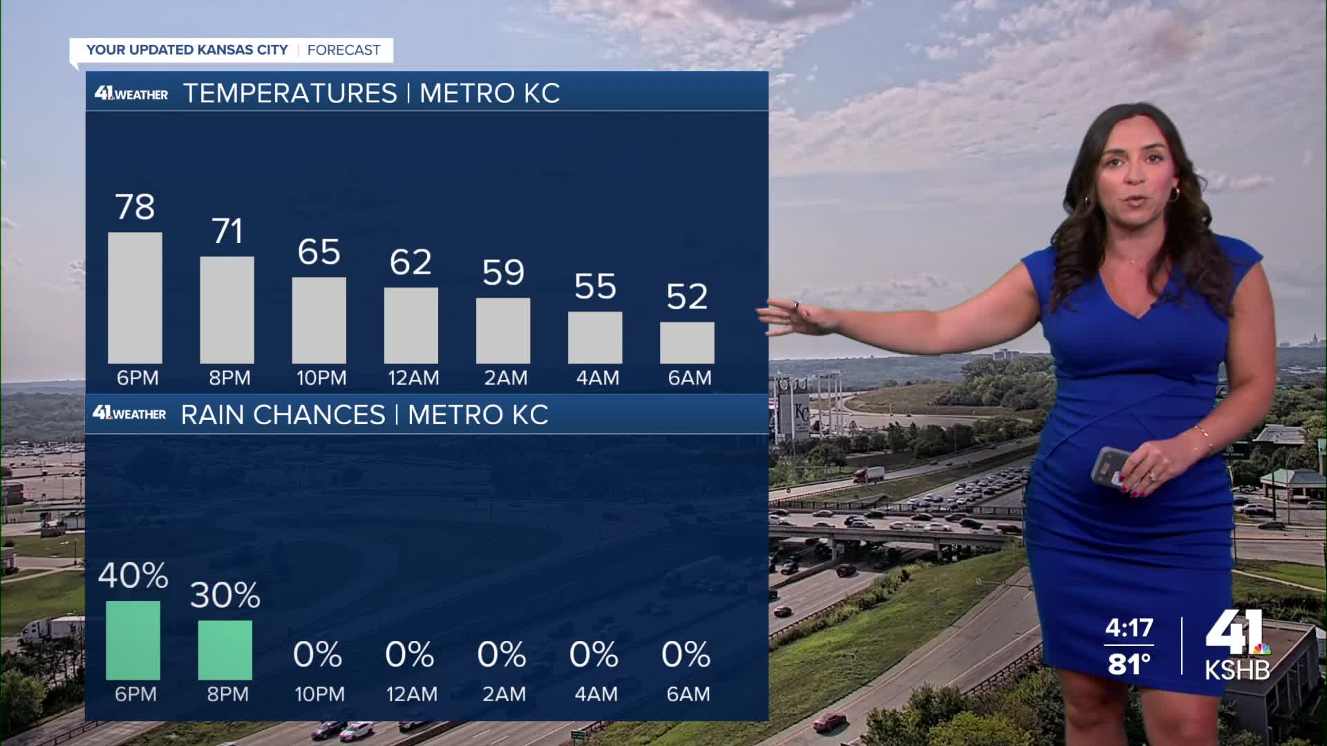
KANSAS CITY FORECAST
Wednesday: Partly cloudy and warming fast into the early afternoon. Then, a cold front arrives bringing scattered showers and thunderstorms, mainly between 4 PM and 10 PM. Some storms could have damaging wind and hail.
Wind: SW 5-15 mph shift to N 15-25 mph
High: 84º
Tonight: Much cooler as showers and thunderstorms end to the south between 10 PM and midnight.
Wind: N 10-20 to 5-15 mph
Low: 50º
Thursday: A nice day. Partly to mostly and cooler.
Wind: SW 5-15 mph
High: 76º
Friday: A 2nd cold front sweeps through bringing a mostly cloudy sky and a few rain showers.
Wind: N 10-15 mph
Low: 60º
High: 69º
Get more updates from our weather team:
View our interactive radar
Read our Weather Blog
Check out the current conditions in our area
—
