

WEATHER HEADLINES
- Near-record to record heat Wednesday and Thursday
- Strong cold front Thursday night with a good chance of showers and storms.
- Possible freeze Saturday morning
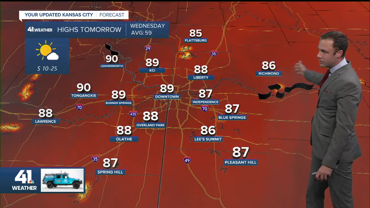
KANSAS CITY'S FORECAST
Tuesday night: Partly cloudy and not as cold.
Low: 48°
Wind: SE 5-15 mph
Wednesday: Abundant sunshine, hot and breezy.
High: 89° (Record: 90° in 1907)
Wind: SW 10-20 mph
Thursday: Mostly sunny and windy with a likely record high ahead of a strong evening cold front. Showers and thunderstorms are possible Thursday night. Some storms could have strong wind and hail.
High: 89° (Record: 85° in 1991)
Wind: SW 15-25 mph
Get more updates from our weather team:
View our interactive radar
